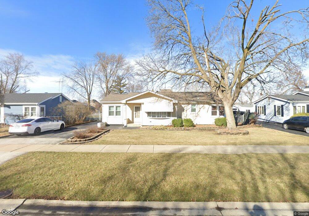
7924 Mobile Ave Burbank, IL 60459
Estimated Value: $229,000 - $312,000
2
Beds
1
Bath
960
Sq Ft
$277/Sq Ft
Est. Value
About This Home
This home is located at 7924 Mobile Ave, Burbank, IL 60459 and is currently estimated at $266,084, approximately $277 per square foot. 7924 Mobile Ave is a home located in Cook County with nearby schools including Edward J Tobin Elementary School, Reavis High School, and St Albert the Great Catholic School.
Ownership History
Date
Name
Owned For
Owner Type
Purchase Details
Closed on
Mar 1, 2018
Sold by
Jones Gregory H and Jones Michelle A
Bought by
Jones Michelle A and Jones Gregory H
Current Estimated Value
Purchase Details
Closed on
Jan 26, 1998
Sold by
Prairie Bank & Trust Company
Bought by
Jones Gregory H and Jones Michelle A
Home Financials for this Owner
Home Financials are based on the most recent Mortgage that was taken out on this home.
Original Mortgage
$131,580
Outstanding Balance
$23,625
Interest Rate
7.16%
Mortgage Type
VA
Estimated Equity
$242,459
Purchase Details
Closed on
Apr 2, 1997
Sold by
Quade Virginia M
Bought by
Prairie Bank & Trust Company and Trust #96-101
Create a Home Valuation Report for This Property
The Home Valuation Report is an in-depth analysis detailing your home's value as well as a comparison with similar homes in the area
Home Values in the Area
Average Home Value in this Area
Purchase History
| Date | Buyer | Sale Price | Title Company |
|---|---|---|---|
| Jones Michelle A | -- | None Available | |
| Jones Gregory H | $129,000 | -- | |
| Prairie Bank & Trust Company | -- | -- |
Source: Public Records
Mortgage History
| Date | Status | Borrower | Loan Amount |
|---|---|---|---|
| Open | Jones Gregory H | $131,580 |
Source: Public Records
Tax History Compared to Growth
Tax History
| Year | Tax Paid | Tax Assessment Tax Assessment Total Assessment is a certain percentage of the fair market value that is determined by local assessors to be the total taxable value of land and additions on the property. | Land | Improvement |
|---|---|---|---|---|
| 2024 | $4,556 | $18,001 | $6,318 | $11,683 |
| 2023 | $4,578 | $18,001 | $6,318 | $11,683 |
| 2022 | $4,578 | $15,291 | $5,559 | $9,732 |
| 2021 | $4,413 | $15,291 | $5,559 | $9,732 |
| 2020 | $4,339 | $15,291 | $5,559 | $9,732 |
| 2019 | $4,400 | $15,710 | $5,054 | $10,656 |
| 2018 | $4,273 | $15,710 | $5,054 | $10,656 |
| 2017 | $4,151 | $15,710 | $5,054 | $10,656 |
| 2016 | $3,887 | $13,530 | $4,295 | $9,235 |
| 2015 | $3,700 | $13,530 | $4,295 | $9,235 |
| 2014 | $3,607 | $13,530 | $4,295 | $9,235 |
| 2013 | $3,614 | $14,651 | $4,295 | $10,356 |
Source: Public Records
Map
Nearby Homes
- 7921 Mobile Ave
- 7948 Merrimac Ave
- 6241 W 80th St
- 6127 W 79th Place
- 7900 S Nagle Ave Unit 1S
- 7900 Nagle Ave Unit 3S
- 8019 Natchez Ave
- 8646 S Nagle Ave
- 7851 Moody Ave
- 7734 Melvina Ave
- 7707 Mobile Ave
- 7723 Melvina Ave
- 6139 W 81st Place
- 6040 W 79th St
- 7711 Melvina Ave
- 7712 Nagle Ave
- 7728 Natchez Ave
- 6437 W 82nd St
- 7943 Natoma Ave
- 8146 Austin Ave
- 7918 Mobile Ave
- 7932 Mobile Ave
- 7925 Mulligan Ave
- 7910 Mobile Ave
- 7933 Mulligan Ave
- 7919 Mulligan Ave
- 7938 Mobile Ave
- 7939 Mulligan Ave
- 7935 Mobile Ave
- 7911 Mulligan Ave
- 7915 Mobile Ave
- 7944 Mobile Ave
- 7945 Mulligan Ave
- 7945 Mobile Ave
- 7944 Mulligan Ave
- 6345 W 79th St
- 7924 Merrimac Ave
- 7932 Merrimac Ave
- 7918 Merrimac Ave
- 7922 Mulligan Ave