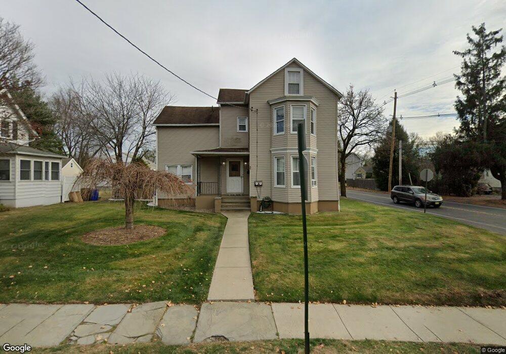
793 W Broad St Westfield, NJ 07090
Estimated Value: $919,458 - $1,199,000
3
Beds
1
Bath
2,314
Sq Ft
$440/Sq Ft
Est. Value
About This Home
This home is located at 793 W Broad St, Westfield, NJ 07090 and is currently estimated at $1,018,615, approximately $440 per square foot. 793 W Broad St is a home located in Union County with nearby schools including McKinley Elementary School, Westfield Senior High School, and Holy Trinity School.
Ownership History
Date
Name
Owned For
Owner Type
Purchase Details
Closed on
Oct 24, 2012
Sold by
Defreitas Michael and Defreitas Carolina
Bought by
Defreitas Michael and Defreitas Caroline
Current Estimated Value
Purchase Details
Closed on
Jul 19, 2005
Sold by
Tiedrich Deborah
Bought by
Defreitas Michael and Defreitas Carolina
Home Financials for this Owner
Home Financials are based on the most recent Mortgage that was taken out on this home.
Original Mortgage
$408,000
Interest Rate
5.67%
Mortgage Type
New Conventional
Purchase Details
Closed on
Jun 30, 1999
Sold by
Tarantino Robert and Tarantino Rose A
Bought by
Debal Llc
Purchase Details
Closed on
Mar 10, 1998
Sold by
Tarantino Joanne
Bought by
Tarantino Robert and Tarantino Rose A
Home Financials for this Owner
Home Financials are based on the most recent Mortgage that was taken out on this home.
Original Mortgage
$120,500
Interest Rate
6.92%
Create a Home Valuation Report for This Property
The Home Valuation Report is an in-depth analysis detailing your home's value as well as a comparison with similar homes in the area
Home Values in the Area
Average Home Value in this Area
Purchase History
| Date | Buyer | Sale Price | Title Company |
|---|---|---|---|
| Defreitas Michael | $10 | -- | |
| Defreitas Michael | $510,000 | -- | |
| Debal Llc | $320,000 | -- | |
| Tarantino Robert | -- | Principal Title Agency Inc |
Source: Public Records
Mortgage History
| Date | Status | Borrower | Loan Amount |
|---|---|---|---|
| Previous Owner | Defreitas Michael | $408,000 | |
| Previous Owner | Tarantino Robert | $120,500 |
Source: Public Records
Tax History Compared to Growth
Tax History
| Year | Tax Paid | Tax Assessment Tax Assessment Total Assessment is a certain percentage of the fair market value that is determined by local assessors to be the total taxable value of land and additions on the property. | Land | Improvement |
|---|---|---|---|---|
| 2025 | $12,510 | $555,500 | $326,300 | $229,200 |
| 2024 | $12,254 | $555,500 | $326,300 | $229,200 |
| 2023 | $12,254 | $555,500 | $326,300 | $229,200 |
| 2022 | $11,999 | $555,500 | $326,300 | $229,200 |
| 2021 | $12,015 | $555,500 | $326,300 | $229,200 |
| 2020 | $11,988 | $555,500 | $326,300 | $229,200 |
| 2019 | $11,943 | $555,500 | $326,300 | $229,200 |
| 2018 | $13,843 | $148,900 | $60,100 | $88,800 |
| 2017 | $13,767 | $148,900 | $60,100 | $88,800 |
| 2016 | $13,444 | $148,900 | $60,100 | $88,800 |
| 2015 | $13,176 | $148,900 | $60,100 | $88,800 |
| 2014 | $12,741 | $148,900 | $60,100 | $88,800 |
Source: Public Records
Map
Nearby Homes
- 119 Lamberts Mill Rd
- 2154 W Broad St
- 314 Highgate Ave
- 1466 Lamberts Mill Rd
- 2116 Newark Ave
- 2 Brookside Ct
- 524 Edgar Rd
- 525 Edgar Rd
- 1933 W Broad St
- 1933 Mary Ellen Ln
- 614 Dorian Rd
- 724 South Ave W Unit 724A
- 2212 Shady Ln
- 350 W Dudley Ave
- 2314 Longfellow Ave
- 538 Westfield Ave
- 2 Dutch Ln
- 2219 North Ave Unit 6
- 57 Rambling Dr
- 522 Boulevard
- 791 W Broad St
- 787 W Broad St Unit 2
- 787 W Broad St
- 2160 W Broad St
- 783 W Broad St
- 121 Lamberts Mill Rd
- 1348 Lamberts Mill Rd
- 798 W Broad St
- 2215 W Broad St
- 794 W Broad St
- 794 W Broad St Unit 2
- 125 Lamberts Mill Rd
- 108 Florence Ave
- 790 W Broad St
- 100 Florence Ave
- 110 Florence Ave
- 2211 W Broad St
- 786 W Broad St
- 1352 Lamberts Mill Rd
- 120 Florence Ave