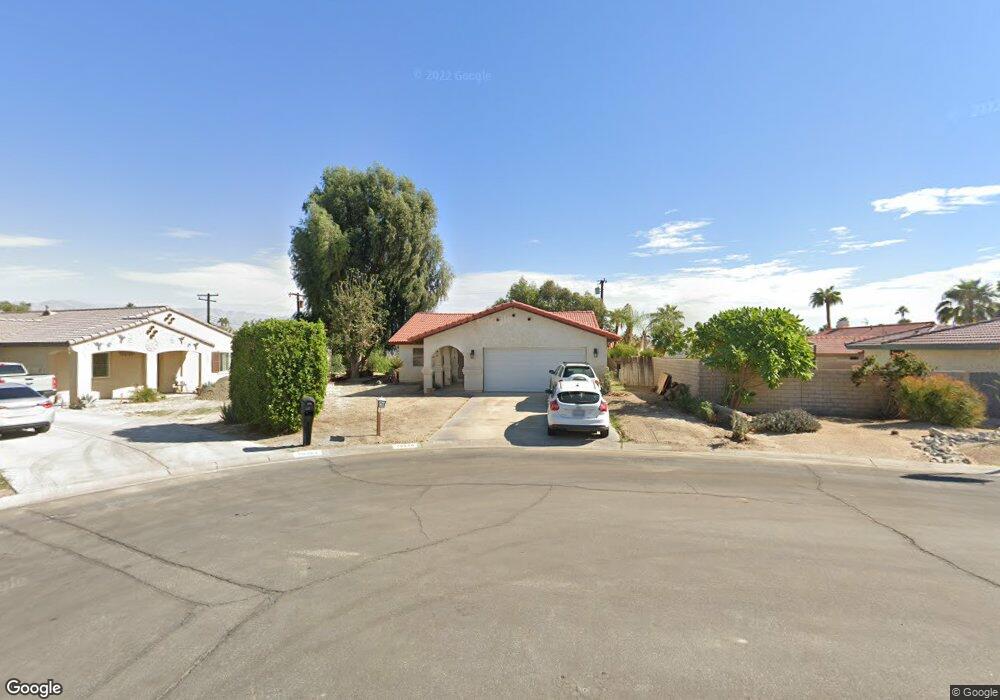
79370 Saint Lucia Ct Bermuda Dunes, CA 92203
Estimated Value: $417,000 - $731,000
4
Beds
3
Baths
1,987
Sq Ft
$291/Sq Ft
Est. Value
About This Home
This home is located at 79370 Saint Lucia Ct, Bermuda Dunes, CA 92203 and is currently estimated at $578,269, approximately $291 per square foot. 79370 Saint Lucia Ct is a home located in Riverside County with nearby schools including James Monroe Elementary School, Colonel Mitchell Paige Middle School, and Palm Desert High School.
Ownership History
Date
Name
Owned For
Owner Type
Purchase Details
Closed on
Feb 27, 1998
Sold by
Boedeker Judith A
Bought by
Pitchford Robert and Pitchford Judith Ann
Current Estimated Value
Home Financials for this Owner
Home Financials are based on the most recent Mortgage that was taken out on this home.
Original Mortgage
$96,000
Interest Rate
7.15%
Mortgage Type
Purchase Money Mortgage
Create a Home Valuation Report for This Property
The Home Valuation Report is an in-depth analysis detailing your home's value as well as a comparison with similar homes in the area
Home Values in the Area
Average Home Value in this Area
Purchase History
| Date | Buyer | Sale Price | Title Company |
|---|---|---|---|
| Pitchford Robert | -- | Chicago Title Co |
Source: Public Records
Mortgage History
| Date | Status | Borrower | Loan Amount |
|---|---|---|---|
| Closed | Pitchford Robert | $96,000 |
Source: Public Records
Tax History Compared to Growth
Tax History
| Year | Tax Paid | Tax Assessment Tax Assessment Total Assessment is a certain percentage of the fair market value that is determined by local assessors to be the total taxable value of land and additions on the property. | Land | Improvement |
|---|---|---|---|---|
| 2025 | $3,410 | $281,242 | $70,706 | $210,536 |
| 2023 | $3,410 | $210,714 | $67,961 | $142,753 |
| 2022 | $2,564 | $206,583 | $66,629 | $139,954 |
| 2021 | $2,514 | $202,533 | $65,323 | $137,210 |
| 2020 | $2,466 | $200,458 | $64,654 | $135,804 |
| 2019 | $2,418 | $196,529 | $63,387 | $133,142 |
| 2018 | $2,371 | $192,677 | $62,146 | $130,531 |
| 2017 | $2,321 | $188,900 | $60,928 | $127,972 |
| 2016 | $2,263 | $185,197 | $59,734 | $125,463 |
| 2015 | $2,270 | $182,418 | $58,838 | $123,580 |
| 2014 | $2,231 | $178,847 | $57,687 | $121,160 |
Source: Public Records
Map
Nearby Homes
- 79361 Port Royal Ave
- 41740 Cambridge Ave
- 79381 Avenue 42
- 41855 Volare Ct
- 41868 Volare Ct
- 41879 Volare Ct
- 41891 Volare Ct
- 41880 Volare Ct
- 41892 Volare Ct
- 79305 Bermuda Dunes Dr
- 79211 Bermuda Dunes Dr
- 41252 Gaslight Ave
- 42410 Adams St
- 42533 Capri Dr
- 42505 Adams St
- 79750 Gable Glen St
- 79760 Gable Glen St
- 0 Avenue 42 Unit OC25052084
- 0 Avenue 42 Unit 219102024DA
- 79040 Cliff St
- 79408 Tobago Ct
- 79364 Saint Lucia Ct
- 79390 Port Royal Ave
- 79364 St Lucia
- 79380 Port Royal Ave
- 79400 Port Royal Ave
- 79356 Saint Lucia Ct
- 0 Tobago Ct Unit 217008850
- 0 Tobago Ct Unit 217029484
- 0 Tobago Ct Unit 219010953
- 0 Tobago Ct
- 79371 Spalding Dr
- 79361 Spalding Dr
- 79381 Spalding Dr
- 79351 Spalding Dr
- 79340 Port Royal Ave
- 0 St Lucia Ct Unit 41431065
- 79391 Spalding Dr
- 79424 Tobago Ct
- 79341 Spalding Dr