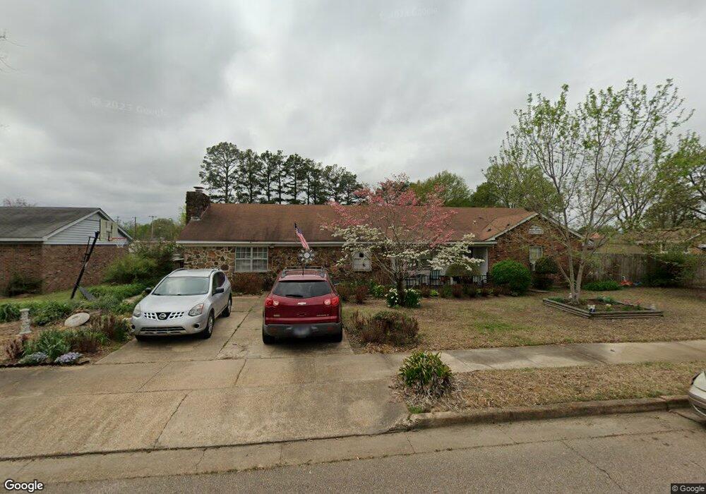
7939 Max Dr Millington, TN 38053
Estimated Value: $188,000 - $247,000
3
Beds
1
Bath
2,176
Sq Ft
$105/Sq Ft
Est. Value
About This Home
This home is located at 7939 Max Dr, Millington, TN 38053 and is currently estimated at $227,753, approximately $104 per square foot. 7939 Max Dr is a home located in Shelby County with nearby schools including Millington High School and Lighthouse Christian Academy.
Ownership History
Date
Name
Owned For
Owner Type
Purchase Details
Closed on
Sep 30, 1998
Sold by
Cole Bernard B and Cole Sarah A
Bought by
Parks James and Parks Jeannie
Current Estimated Value
Home Financials for this Owner
Home Financials are based on the most recent Mortgage that was taken out on this home.
Original Mortgage
$94,860
Outstanding Balance
$20,858
Interest Rate
6.95%
Mortgage Type
VA
Estimated Equity
$206,895
Create a Home Valuation Report for This Property
The Home Valuation Report is an in-depth analysis detailing your home's value as well as a comparison with similar homes in the area
Home Values in the Area
Average Home Value in this Area
Purchase History
| Date | Buyer | Sale Price | Title Company |
|---|---|---|---|
| Parks James | $93,000 | -- |
Source: Public Records
Mortgage History
| Date | Status | Borrower | Loan Amount |
|---|---|---|---|
| Open | Parks James | $94,860 |
Source: Public Records
Tax History Compared to Growth
Tax History
| Year | Tax Paid | Tax Assessment Tax Assessment Total Assessment is a certain percentage of the fair market value that is determined by local assessors to be the total taxable value of land and additions on the property. | Land | Improvement |
|---|---|---|---|---|
| 2025 | $1,268 | $57,775 | $5,550 | $52,225 |
| 2024 | $3,071 | $45,300 | $4,675 | $40,625 |
| 2023 | $2,170 | $45,300 | $4,675 | $40,625 |
| 2022 | $2,170 | $45,300 | $4,675 | $40,625 |
| 2021 | $2,197 | $45,300 | $4,675 | $40,625 |
| 2020 | $1,540 | $27,600 | $4,675 | $22,925 |
| 2019 | $1,118 | $27,600 | $4,675 | $22,925 |
| 2018 | $1,540 | $27,600 | $4,675 | $22,925 |
| 2017 | $1,557 | $27,600 | $4,675 | $22,925 |
| 2016 | $1,505 | $25,500 | $0 | $0 |
| 2014 | $1,114 | $25,500 | $0 | $0 |
Source: Public Records
Map
Nearby Homes
- 4721 Janie Ave
- 4741 Janie Ave
- 4752 Janie Cove
- 5852 U S Highway 51
- 4812 Janie Ave
- 4853 2nd Ave
- 4880 Easley Ave
- 4655 Doris Cir S
- 7988 Royster Creek Dr E
- 4915 1st Ave
- 7988 Royster Creek Dr
- 7932 Royster Creek Dr
- 7942 Royster Creek Dr
- 7980 Royster Creek Dr
- 7994 Royster Creek Dr
- 7963 Royster Creek Dr
- 7955 Royster Creek Dr
- 7943 Royster Creek Dr
- 7727 Tecumseh St
- 8852 U S 51
- 7929 Max Dr
- 4709 Janie Ave
- 4712 Janie Ave
- 4705 Janie Ave
- 7919 Max Dr
- 4716 Janie Ave
- 7930 Max Dr
- 4708 Janie Ave
- 4722 Janie Ave
- 4701 Janie Ave
- 7911 Newport Blvd
- 4729 Janie Ave
- 4700 Janie Ave
- 4728 Janie Ave
- 7913 Newport Blvd
- 4751 Janie Ave
- 7917 Newport Blvd
- 7910 Newport Blvd
- 4694 Navy Rd
- 4761 Janie Ave