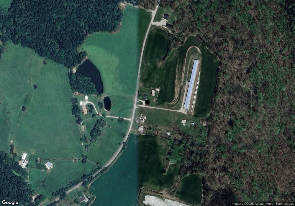
794 Park Boundary Rd Smiths Grove, KY 42171
Estimated Value: $131,000 - $161,917
2
Beds
1
Bath
1,572
Sq Ft
$91/Sq Ft
Est. Value
About This Home
This home is located at 794 Park Boundary Rd, Smiths Grove, KY 42171 and is currently estimated at $142,979, approximately $90 per square foot. 794 Park Boundary Rd is a home located in Edmonson County with nearby schools including Edmonson County Fifth/Sixth Grade Center and Edmonson County High School.
Ownership History
Date
Name
Owned For
Owner Type
Purchase Details
Closed on
Jan 31, 2025
Sold by
Ray Eugene and Ray Myra
Bought by
Ray Aaron and Ray Sarah
Current Estimated Value
Purchase Details
Closed on
Mar 2, 2021
Sold by
Dehnam Wade and Denham Debbie
Bought by
Jaggers Phil
Home Financials for this Owner
Home Financials are based on the most recent Mortgage that was taken out on this home.
Original Mortgage
$73,616
Interest Rate
2.7%
Mortgage Type
New Conventional
Purchase Details
Closed on
Feb 26, 2021
Sold by
Jaggers Jennifer and Estate Of Wade Dehnam
Bought by
Ray Aaron
Home Financials for this Owner
Home Financials are based on the most recent Mortgage that was taken out on this home.
Original Mortgage
$73,616
Interest Rate
2.7%
Mortgage Type
New Conventional
Create a Home Valuation Report for This Property
The Home Valuation Report is an in-depth analysis detailing your home's value as well as a comparison with similar homes in the area
Home Values in the Area
Average Home Value in this Area
Purchase History
| Date | Buyer | Sale Price | Title Company |
|---|---|---|---|
| Ray Aaron | $28,000 | None Listed On Document | |
| Ray Aaron | $28,000 | None Listed On Document | |
| Jaggers Phil | $132,145 | None Listed On Document | |
| Ray Aaron | $92,020 | None Available |
Source: Public Records
Mortgage History
| Date | Status | Borrower | Loan Amount |
|---|---|---|---|
| Previous Owner | Ray Aaron | $73,616 |
Source: Public Records
Tax History Compared to Growth
Tax History
| Year | Tax Paid | Tax Assessment Tax Assessment Total Assessment is a certain percentage of the fair market value that is determined by local assessors to be the total taxable value of land and additions on the property. | Land | Improvement |
|---|---|---|---|---|
| 2024 | $897 | $95,000 | $0 | $0 |
| 2023 | $852 | $92,020 | $0 | $0 |
| 2022 | $878 | $75,544 | $0 | $0 |
| 2021 | $731 | $75,544 | $0 | $0 |
| 2020 | $733 | $75,544 | $0 | $0 |
| 2019 | $685 | $70,544 | $0 | $0 |
| 2018 | $1,407 | $151,500 | $0 | $0 |
| 2017 | $1,512 | $166,200 | $0 | $0 |
| 2016 | $1,484 | $166,200 | $0 | $0 |
| 2015 | -- | $166,200 | $0 | $0 |
| 2013 | -- | $291,900 | $0 | $291,900 |
Source: Public Records
Map
Nearby Homes
- 630 Chaumont Rd
- 94 Carnation Ln
- 1390 Chaumont Rd
- 101 Villa Dr
- 166 Lewis Rd
- 425 Eagle Way
- 1431 New Grove Rd
- 417 Eagle Way
- 4642 Brownsville Rd
- 18996 Louisville Rd
- 60 Gateway Ct
- 250 Lauren Way
- Lot 12 Lauren Way
- 373 Woosley Dr
- 422 New Grove Rd
- 821 Rocky Hill Rd
- 15190 Louisville Rd
- 243 New Grove Rd
- 87 Middlebrook Ln
- 86 Olivia Ct
- 956 Park Boundary Rd
- 777 Park Boundary Rd
- 534 Park Boundary Rd
- 556 Park Boundary Rd
- 359 Park Boundary Rd Unit aka 359 National Par
- 229 C L Ray Rd
- 247 Park Rd
- 347 C L Ray Rd
- 163 Park Boundary Rd
- 178 Park Boundary Rd
- 7802 Brownsville Rd
- 7830 Brownsville Rd
- 7938 Brownsville Rd
- 7950 Brownsville Rd
- 7805 Brownsville Rd
- 105 Park Boundary Rd
- 7905 Brownsville Rd
- 7931 Brownsville Rd
- 1011 C L Ray Rd
- 8121 Brownsville Rd
