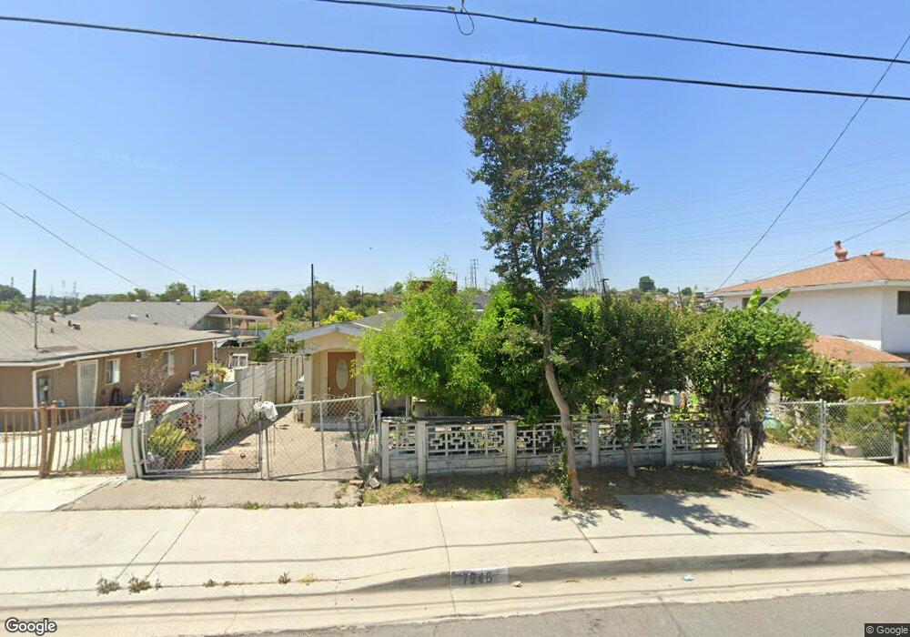
7948 La Merced Rd Rosemead, CA 91770
South San Gabriel NeighborhoodEstimated Value: $771,913 - $894,000
2
Beds
1
Bath
1,512
Sq Ft
$558/Sq Ft
Est. Value
About This Home
This home is located at 7948 La Merced Rd, Rosemead, CA 91770 and is currently estimated at $843,978, approximately $558 per square foot. 7948 La Merced Rd is a home located in Los Angeles County with nearby schools including Rice (Eldridge) Elementary School, Temple (Roger W.) Intermediate School, and San Gabriel High School.
Ownership History
Date
Name
Owned For
Owner Type
Purchase Details
Closed on
Oct 18, 2000
Sold by
Trust Colvin Mike G Trs Mike G Col and Armand Mia
Bought by
Lapeter
Current Estimated Value
Home Financials for this Owner
Home Financials are based on the most recent Mortgage that was taken out on this home.
Original Mortgage
$119,600
Outstanding Balance
$43,554
Interest Rate
7.9%
Estimated Equity
$800,424
Purchase Details
Closed on
Jun 19, 1996
Sold by
Colvin Mike
Bought by
Colvin Mike G
Create a Home Valuation Report for This Property
The Home Valuation Report is an in-depth analysis detailing your home's value as well as a comparison with similar homes in the area
Home Values in the Area
Average Home Value in this Area
Purchase History
| Date | Buyer | Sale Price | Title Company |
|---|---|---|---|
| Lapeter | $149,500 | United Title Company | |
| Colvin Mike G | -- | -- |
Source: Public Records
Mortgage History
| Date | Status | Borrower | Loan Amount |
|---|---|---|---|
| Open | Lapeter | $119,600 |
Source: Public Records
Tax History
| Year | Tax Paid | Tax Assessment Tax Assessment Total Assessment is a certain percentage of the fair market value that is determined by local assessors to be the total taxable value of land and additions on the property. | Land | Improvement |
|---|---|---|---|---|
| 2025 | $3,961 | $284,929 | $180,208 | $104,721 |
| 2024 | $3,961 | $279,343 | $176,675 | $102,668 |
| 2023 | $3,822 | $273,866 | $173,211 | $100,655 |
| 2022 | $3,651 | $268,497 | $169,815 | $98,682 |
| 2021 | $3,630 | $263,234 | $166,486 | $96,748 |
| 2020 | $3,597 | $260,535 | $164,779 | $95,756 |
| 2019 | $3,501 | $255,428 | $161,549 | $93,879 |
| 2018 | $3,423 | $250,421 | $158,382 | $92,039 |
| 2016 | $3,144 | $240,699 | $152,233 | $88,466 |
| 2015 | $3,095 | $237,085 | $149,947 | $87,138 |
| 2014 | $3,061 | $232,442 | $147,010 | $85,432 |
Source: Public Records
Map
Nearby Homes
- 2058 Redding Ave
- 8148 Loren Ln
- 7707 Young Ave
- 7727 Melrose Ave
- 2506 Strathmore Ave
- 7665 Graves Ave
- 7513 Marsh Ave
- 7944 Hill Dr
- 7642 Steddom Dr
- 1713 Redding Ave
- 1525 San Gabriel Blvd
- 2217 Angelus Ave
- 8361 Sierra Bonita Ave
- 7525 Graves Ave
- 2647 Pine St
- 2109 Cathryn Dr
- 7308 Mooney Dr
- 7319 Berne St
- 2555 Angelus Ave
- 1791 Neil Armstrong St Unit 103
- 7952 La Merced Rd
- 7942 La Merced Rd
- 7956 La Merced Rd
- 2053 Agnolo Dr
- 7936 La Merced Rd
- 2017 Agnolo Dr
- 2023 Agnolo Dr
- 7932 La Merced Rd
- 2011 Agnolo Dr
- 7953 La Merced Rd
- 2029 Agnolo Dr
- 7947 La Merced Rd
- 7943 La Merced Rd
- 2007 Agnolo Dr
- 7928 La Merced Rd
- 2058 Agnolo Dr
- 7937 La Merced Rd
- 2052 Agnolo Dr
- 7931 La Merced Rd
- 7961 La Merced Rd
Your Personal Tour Guide
Ask me questions while you tour the home.