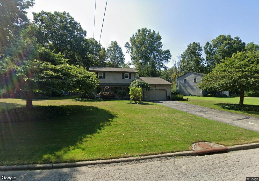
795 Glenbrook Rd Youngstown, OH 44512
Estimated Value: $250,000 - $285,000
3
Beds
2
Baths
1,988
Sq Ft
$134/Sq Ft
Est. Value
About This Home
This home is located at 795 Glenbrook Rd, Youngstown, OH 44512 and is currently estimated at $266,445, approximately $134 per square foot. 795 Glenbrook Rd is a home located in Mahoning County with nearby schools including West Boulevard Elementary School, Boardman Center Middle School, and Boardman High School.
Ownership History
Date
Name
Owned For
Owner Type
Purchase Details
Closed on
Nov 1, 2007
Sold by
Rohan William M
Bought by
Rohan William M and Kocak Karen B
Current Estimated Value
Purchase Details
Closed on
May 25, 2007
Sold by
Baharis Scott and Foster Andrea B
Bought by
Rohan William M
Home Financials for this Owner
Home Financials are based on the most recent Mortgage that was taken out on this home.
Original Mortgage
$37,000
Outstanding Balance
$22,543
Interest Rate
6.2%
Mortgage Type
Purchase Money Mortgage
Estimated Equity
$243,902
Purchase Details
Closed on
Oct 6, 1998
Sold by
Baharis James H and Baharis J A
Bought by
Baharis Scott and Foster Andrea B
Purchase Details
Closed on
Feb 23, 1966
Bought by
Baharis James H and A J
Create a Home Valuation Report for This Property
The Home Valuation Report is an in-depth analysis detailing your home's value as well as a comparison with similar homes in the area
Home Values in the Area
Average Home Value in this Area
Purchase History
| Date | Buyer | Sale Price | Title Company |
|---|---|---|---|
| Rohan William M | -- | Attorney | |
| Rohan William M | $152,000 | Attorney | |
| Baharis Scott | -- | -- | |
| Baharis James H | -- | -- |
Source: Public Records
Mortgage History
| Date | Status | Borrower | Loan Amount |
|---|---|---|---|
| Open | Rohan William M | $37,000 |
Source: Public Records
Tax History Compared to Growth
Tax History
| Year | Tax Paid | Tax Assessment Tax Assessment Total Assessment is a certain percentage of the fair market value that is determined by local assessors to be the total taxable value of land and additions on the property. | Land | Improvement |
|---|---|---|---|---|
| 2024 | $3,436 | $67,350 | $9,120 | $58,230 |
| 2023 | $3,391 | $67,350 | $9,120 | $58,230 |
| 2022 | $3,321 | $50,470 | $8,590 | $41,880 |
| 2021 | $3,323 | $50,470 | $8,590 | $41,880 |
| 2020 | $3,340 | $50,470 | $8,590 | $41,880 |
| 2019 | $3,277 | $43,880 | $7,470 | $36,410 |
| 2018 | $2,842 | $43,880 | $7,470 | $36,410 |
| 2017 | $2,808 | $43,880 | $7,470 | $36,410 |
| 2016 | $2,615 | $40,430 | $8,300 | $32,130 |
| 2015 | $2,564 | $40,430 | $8,300 | $32,130 |
| 2014 | $2,571 | $40,430 | $8,300 | $32,130 |
| 2013 | $2,539 | $40,430 | $8,300 | $32,130 |
Source: Public Records
Map
Nearby Homes
- 5200 West Blvd Unit 505
- 768 Crestview Dr
- 715 Crestview Dr
- 29 Gillian Ln
- 990 Westport Dr
- 21.19 acres Truesdale and Lockwood Rd
- 272 Shields Rd
- 5020 Friendship Ave
- 813 Brookfield Ave
- 396 Brookfield Ave
- 169 Wolcott Dr
- 6632 Harrington Ave
- 242 Oakley Ave
- 6938 Ron Park Place
- 5670 Tracy Dr
- 4225 Stratford Rd
- 103 Wildwood Dr
- 6511 Pembrooke Place
- 6892 Glenwood Ave
- 4250 Oak Knoll Dr
- 791 Glenbrook Rd
- 803 Glenbrook Rd
- 787 Glenbrook Rd
- 802 Glenbrook Rd
- 785 Glenbrook Rd
- 796 Kiwana Dr
- 796 Glenbrook Rd
- 804 Kiwana Dr
- 792 Glenbrook Rd
- 804 Glenbrook Rd
- 792 Kiwana Dr
- 786 Glenbrook Rd
- 788 Kiwana Dr
- 820 Kiwana Dr
- 783 Glenbrook Rd
- 810 Glenbrook Rd
- 782 Glenbrook Rd
- 816 Glenbrook Rd
- 778 Glenbrook Rd
- 781 Glenbrook Rd