Estimated Value: $157,000 - $656,000
--
Bed
--
Bath
1,260
Sq Ft
$256/Sq Ft
Est. Value
About This Home
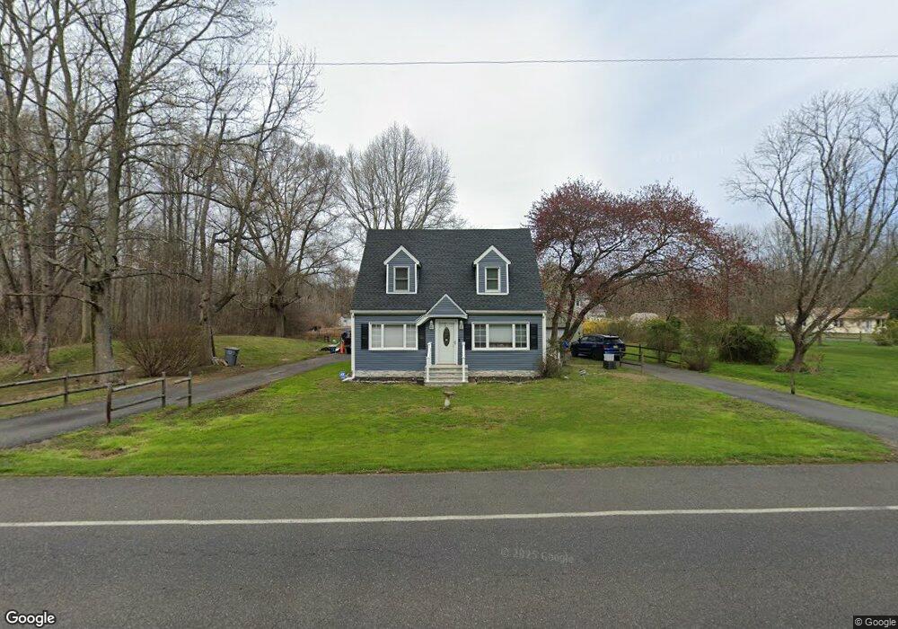
This home is located at 795 Hawks Bridge Rd, Salem, NJ 08079 and is currently estimated at $321,975, approximately $255 per square foot. 795 Hawks Bridge Rd is a home located in Salem County with nearby schools including Mannington Township School.
Ownership History
Date
Name
Owned For
Owner Type
Purchase Details
Closed on
Jun 13, 1997
Sold by
Willis Sue Jet and Byrd Johnnie Mae
Bought by
Dunn William A
Current Estimated Value
Home Financials for this Owner
Home Financials are based on the most recent Mortgage that was taken out on this home.
Original Mortgage
$64,300
Outstanding Balance
$9,067
Interest Rate
7.81%
Mortgage Type
FHA
Estimated Equity
$312,908
Create a Home Valuation Report for This Property
The Home Valuation Report is an in-depth analysis detailing your home's value as well as a comparison with similar homes in the area
Home Values in the Area
Average Home Value in this Area
Purchase History
| Date | Buyer | Sale Price | Title Company |
|---|---|---|---|
| Dunn William A | $64,500 | Intercoastal Title Agency In |
Source: Public Records
Mortgage History
| Date | Status | Borrower | Loan Amount |
|---|---|---|---|
| Open | Dunn William A | $64,300 |
Source: Public Records
Tax History Compared to Growth
Tax History
| Year | Tax Paid | Tax Assessment Tax Assessment Total Assessment is a certain percentage of the fair market value that is determined by local assessors to be the total taxable value of land and additions on the property. | Land | Improvement |
|---|---|---|---|---|
| 2025 | $4,551 | $130,900 | $38,400 | $92,500 |
| 2024 | $4,519 | $130,900 | $38,400 | $92,500 |
| 2023 | $4,519 | $130,900 | $38,400 | $92,500 |
| 2022 | $4,538 | $130,900 | $38,400 | $92,500 |
| 2021 | $4,427 | $130,900 | $38,400 | $92,500 |
| 2020 | $4,163 | $130,900 | $38,400 | $92,500 |
| 2019 | $4,053 | $130,900 | $38,400 | $92,500 |
| 2018 | $3,867 | $130,900 | $38,400 | $92,500 |
| 2017 | $3,692 | $128,400 | $38,400 | $90,000 |
| 2016 | $3,504 | $128,400 | $38,400 | $90,000 |
| 2015 | $3,240 | $128,400 | $38,400 | $90,000 |
| 2014 | $3,139 | $128,400 | $38,400 | $90,000 |
Source: Public Records
Map
Nearby Homes
- 12 Hawks Bridge Rd
- 824 Hawks Bridge Rd
- 17 Sportsman Rd
- 613 Hawks Bridge Rd
- 371 40 Route
- 609 Hawks Bridge Rd
- 371 Route 40
- 604 Hawks Bridge Rd
- 1 Victory Ave Unit 84
- 1 Victory Ave Unit 82
- 1 Victory Ave Unit 74
- 1 Victory Ave Unit 72
- 1 Victory Ave Unit 8
- 1 Victory Ave Unit 93
- 1 Victory Ave
- 1 Victory Ave Unit 56
- 1 Victory Ave Unit 22
- 298 N Hook Rd
- 6 Sunset Ave
- 613 Soders Rd
- 801 Hawks Bridge Rd
- 807 Hawks Bridge Rd
- 787 Hawks Bridge Rd
- 797 Hawks Bridge Rd
- 813 Hawks Bridge Rd
- 817 Hawks Bridge Rd
- 820 Hawks Bridge Rd
- 600 Hawks Bridge Rd
- 821 Hawks Bridge Rd
- 0 Hawks Bridge Rd
- 829 Hawks Bridge Rd
- 829 Hawks Bridge Rd
- 52 Haines Neck Rd
- 10 Haines Neck Rd
- 17 Haines Neck Rd
- 837 Hawks Bridge Rd
- 751 Hawks Bridge Rd
- 816 Hawks Bridge Rd
- 15 Haines Neck Rd
- 839 Hawks Bridge Rd