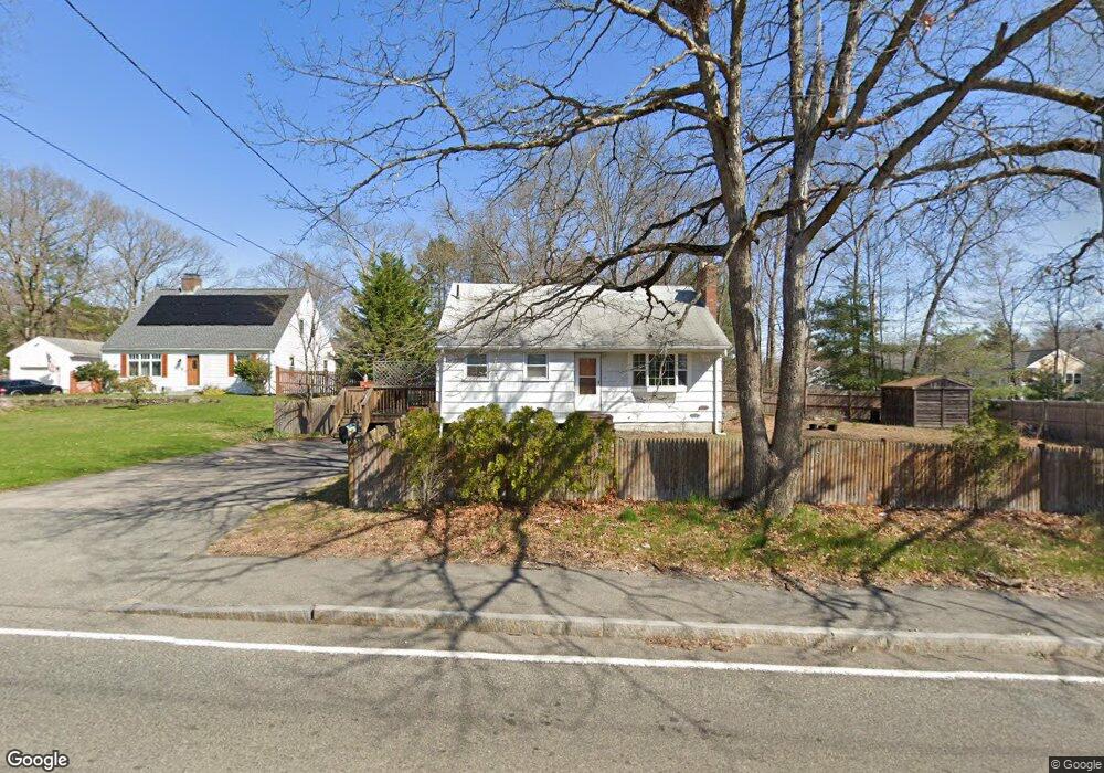
796 E Ashland St Brockton, MA 02302
Estimated Value: $436,000 - $515,000
3
Beds
1
Bath
1,044
Sq Ft
$465/Sq Ft
Est. Value
About This Home
This home is located at 796 E Ashland St, Brockton, MA 02302 and is currently estimated at $485,572, approximately $465 per square foot. 796 E Ashland St is a home located in Plymouth County with nearby schools including Brookfield Elementary School, Downey Elementary School, and Ashfield Middle School.
Ownership History
Date
Name
Owned For
Owner Type
Purchase Details
Closed on
Mar 31, 2022
Sold by
Chery Marlyne
Bought by
Wood Dreck
Current Estimated Value
Home Financials for this Owner
Home Financials are based on the most recent Mortgage that was taken out on this home.
Original Mortgage
$339,500
Outstanding Balance
$316,633
Interest Rate
3.92%
Mortgage Type
Purchase Money Mortgage
Estimated Equity
$168,939
Purchase Details
Closed on
Oct 15, 2020
Sold by
Wood Derek and Chery Marlyne
Bought by
Chery Marlyne
Purchase Details
Closed on
Sep 6, 2006
Sold by
Brodie Bruce A and Brodie Michelle A
Bought by
Wood Derek and Chery Marlyne
Home Financials for this Owner
Home Financials are based on the most recent Mortgage that was taken out on this home.
Original Mortgage
$216,000
Interest Rate
6.79%
Mortgage Type
Purchase Money Mortgage
Create a Home Valuation Report for This Property
The Home Valuation Report is an in-depth analysis detailing your home's value as well as a comparison with similar homes in the area
Home Values in the Area
Average Home Value in this Area
Purchase History
| Date | Buyer | Sale Price | Title Company |
|---|---|---|---|
| Wood Dreck | $350,000 | None Available | |
| Chery Marlyne | -- | None Available | |
| Wood Derek | $270,000 | -- |
Source: Public Records
Mortgage History
| Date | Status | Borrower | Loan Amount |
|---|---|---|---|
| Open | Wood Dreck | $339,500 | |
| Previous Owner | Wood Derek | $216,000 |
Source: Public Records
Tax History Compared to Growth
Tax History
| Year | Tax Paid | Tax Assessment Tax Assessment Total Assessment is a certain percentage of the fair market value that is determined by local assessors to be the total taxable value of land and additions on the property. | Land | Improvement |
|---|---|---|---|---|
| 2025 | $5,080 | $419,500 | $144,400 | $275,100 |
| 2024 | $4,928 | $410,000 | $144,400 | $265,600 |
| 2023 | $4,656 | $358,700 | $109,300 | $249,400 |
| 2022 | $4,571 | $327,200 | $99,300 | $227,900 |
| 2021 | $4,195 | $289,300 | $92,800 | $196,500 |
| 2020 | $4,269 | $281,800 | $89,100 | $192,700 |
| 2019 | $4,051 | $260,700 | $82,900 | $177,800 |
| 2018 | $4,375 | $212,500 | $82,900 | $129,600 |
| 2017 | $3,404 | $211,400 | $82,900 | $128,500 |
| 2016 | $3,590 | $206,800 | $79,100 | $127,700 |
| 2015 | $3,194 | $176,000 | $79,100 | $96,900 |
| 2014 | $3,131 | $172,700 | $79,100 | $93,600 |
Source: Public Records
Map
Nearby Homes
- 780 E Ashland St Unit 1507
- 780 E Ashland St Unit 1102
- 780 E Ashland St Unit 1602
- 780 E Ashland St Unit 901
- 780 E Ashland St Unit 902
- 780 E Ashland St Unit 1009
- 780 E Ashland St Unit 1004
- 780 E Ashland St Unit 903
- 786 E Ashland St
- 790 E Ashland St Unit 1404
- 790 E Ashland St Unit 1504
- 790 E Ashland St Unit 1010
- 797 E Ashland St
- 789 E Ashland St
- 810 E Ashland St
- 809 E Ashland St
- 11 Oberlin Rd
- 815 E Ashland St
- 4 Pomona Dr
- 821 E Ashland St