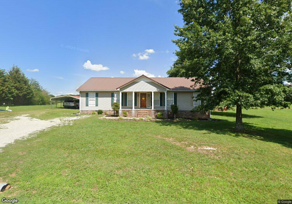
796 Michael Terrace Lawrenceburg, TN 38464
Estimated Value: $238,784 - $304,000
--
Bed
2
Baths
1,624
Sq Ft
$164/Sq Ft
Est. Value
About This Home
This home is located at 796 Michael Terrace, Lawrenceburg, TN 38464 and is currently estimated at $266,196, approximately $163 per square foot. 796 Michael Terrace is a home located in Lawrence County with nearby schools including Ingram Sowell Elementary School, Lawrenceburg Public Elementary School, and David Crockett Elementary School.
Ownership History
Date
Name
Owned For
Owner Type
Purchase Details
Closed on
Oct 22, 2009
Sold by
Garner Lisa
Bought by
Mashburn Heath
Current Estimated Value
Home Financials for this Owner
Home Financials are based on the most recent Mortgage that was taken out on this home.
Original Mortgage
$86,575
Interest Rate
5.01%
Purchase Details
Closed on
Jul 1, 2004
Bought by
Garner Lisa
Purchase Details
Closed on
Mar 22, 1996
Sold by
Jon Gobbell and Jonas Crews
Bought by
Cory Cowheard
Purchase Details
Closed on
Sep 5, 1995
Bought by
Jon Gobbell and Jonas Crews
Purchase Details
Closed on
Jun 24, 1987
Bought by
Bonner Glenn and Bonner Nettie
Purchase Details
Closed on
Jan 1, 1981
Create a Home Valuation Report for This Property
The Home Valuation Report is an in-depth analysis detailing your home's value as well as a comparison with similar homes in the area
Home Values in the Area
Average Home Value in this Area
Purchase History
| Date | Buyer | Sale Price | Title Company |
|---|---|---|---|
| Mashburn Heath | $95,000 | -- | |
| Garner Lisa | $91,000 | -- | |
| Cory Cowheard | $77,300 | -- | |
| Jon Gobbell | $5,000 | -- | |
| Bonner Glenn | -- | -- | |
| -- | $4,000 | -- |
Source: Public Records
Mortgage History
| Date | Status | Borrower | Loan Amount |
|---|---|---|---|
| Closed | Not Available | $86,575 | |
| Previous Owner | Not Available | $79,500 |
Source: Public Records
Tax History Compared to Growth
Tax History
| Year | Tax Paid | Tax Assessment Tax Assessment Total Assessment is a certain percentage of the fair market value that is determined by local assessors to be the total taxable value of land and additions on the property. | Land | Improvement |
|---|---|---|---|---|
| 2025 | $892 | $44,375 | $0 | $0 |
| 2024 | $892 | $44,375 | $5,000 | $39,375 |
| 2023 | $892 | $44,375 | $5,000 | $39,375 |
| 2022 | $892 | $44,375 | $5,000 | $39,375 |
| 2021 | $691 | $23,350 | $2,125 | $21,225 |
| 2020 | $691 | $23,350 | $2,125 | $21,225 |
| 2019 | $691 | $23,350 | $2,125 | $21,225 |
| 2018 | $691 | $23,350 | $2,125 | $21,225 |
| 2017 | $691 | $23,350 | $2,125 | $21,225 |
| 2016 | $691 | $23,350 | $2,125 | $21,225 |
| 2015 | $639 | $23,350 | $2,125 | $21,225 |
| 2014 | $603 | $22,025 | $2,125 | $19,900 |
Source: Public Records
Map
Nearby Homes
- 114 Hummingbird Ln
- 132 Sundance Dr
- 52 Beuerlein Cir
- 31 Community Rd
- 729 Weakley Creek Rd
- 14 Delana Ave
- 970 9th St
- 975 Weakley Creek Rd
- 4000 Weakley Creek Rd
- 4951 Weakley Creek Rd
- 1083 Mattox Town Rd
- 0 Woodland Cir Unit RTC3033314
- 48 Woodland Cir
- 1050 Baylee Cir
- 1088 Mattox Town Rd
- 801 Douglas Dr
- 111 Grandview Dr
- 1303 5th Ave
- 717 Toben Terrace
- 1280 E Gaines St
- 1619 Lance Dr
- 792 Michael Terrace
- 1550 Branch Dr
- 1621 Lance Dr
- 1560 Branch Dr
- 790 Michael Terrace
- 790 Michael Terrace
- 1620 Lance Dr
- 1658 Lance Dr
- 1565 Branch Dr
- 1656 Lance Dr
- 1575 Branch Dr
- 1580 Branch Dr
- 1585 Branch Dr
- 2136 Stacy Ln
- 2120 Stacy Ln
- 2140 Stacy Ln
- 1699 Lance Dr
- 1587 Branch Dr
- 2170 Stacy Ln