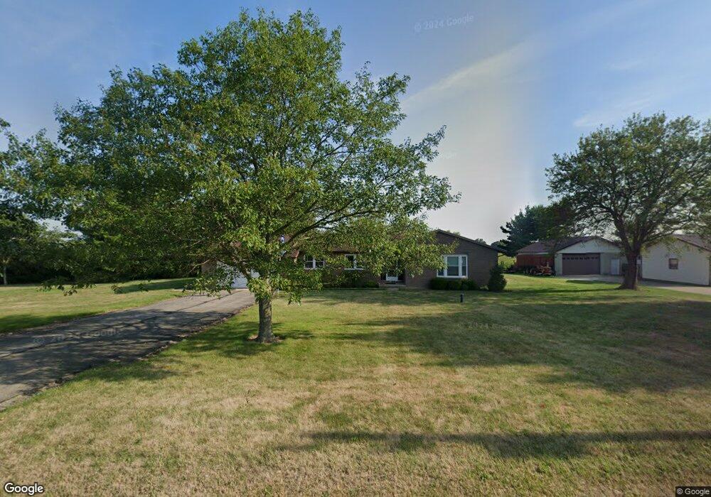
7960 Snyder Rd Orient, OH 43146
Estimated Value: $355,907 - $542,000
3
Beds
2
Baths
1,906
Sq Ft
$220/Sq Ft
Est. Value
About This Home
This home is located at 7960 Snyder Rd, Orient, OH 43146 and is currently estimated at $419,227, approximately $219 per square foot. 7960 Snyder Rd is a home located in Pickaway County.
Ownership History
Date
Name
Owned For
Owner Type
Purchase Details
Closed on
Aug 17, 2012
Sold by
Ruoff Ralph C and Ruoff Glenna L
Bought by
Ruoff Scott J
Current Estimated Value
Home Financials for this Owner
Home Financials are based on the most recent Mortgage that was taken out on this home.
Original Mortgage
$54,000
Outstanding Balance
$8,251
Interest Rate
2.85%
Mortgage Type
New Conventional
Estimated Equity
$410,976
Purchase Details
Closed on
Jun 17, 2010
Sold by
Ruoff Ralph C and Ruoff Glenna L
Bought by
Ruoff Ralph C and Ruoff Glenna L
Purchase Details
Closed on
Jan 7, 2009
Sold by
Caner Alison L
Bought by
Ruoff Ralph C and Ruoff Glenna L
Purchase Details
Closed on
Nov 7, 2005
Sold by
Harrington Peggy L
Bought by
Harrington Peggy L and Caner Alison L
Purchase Details
Closed on
Nov 10, 1993
Sold by
Marshall Harold
Bought by
Harrington Walter D
Create a Home Valuation Report for This Property
The Home Valuation Report is an in-depth analysis detailing your home's value as well as a comparison with similar homes in the area
Purchase History
| Date | Buyer | Sale Price | Title Company |
|---|---|---|---|
| Ruoff Scott J | $117,000 | None Available | |
| Ruoff Ralph C | -- | Attorney | |
| Ruoff Ralph C | $130,000 | None Available | |
| Harrington Peggy L | -- | None Available | |
| Harrington Walter D | $120,000 | -- |
Source: Public Records
Mortgage History
| Date | Status | Borrower | Loan Amount |
|---|---|---|---|
| Open | Ruoff Scott J | $54,000 |
Source: Public Records
Tax History
| Year | Tax Paid | Tax Assessment Tax Assessment Total Assessment is a certain percentage of the fair market value that is determined by local assessors to be the total taxable value of land and additions on the property. | Land | Improvement |
|---|---|---|---|---|
| 2024 | -- | $100,110 | $21,040 | $79,070 |
| 2023 | $3,768 | $100,110 | $21,040 | $79,070 |
| 2022 | $2,763 | $67,430 | $14,030 | $53,400 |
| 2021 | $2,772 | $65,370 | $14,030 | $51,340 |
| 2020 | $2,685 | $65,370 | $14,030 | $51,340 |
| 2019 | $2,255 | $56,870 | $13,330 | $43,540 |
| 2018 | $2,216 | $56,870 | $13,330 | $43,540 |
| 2017 | $2,989 | $56,870 | $13,330 | $43,540 |
| 2016 | $2,104 | $52,500 | $11,570 | $40,930 |
| 2015 | $2,106 | $52,500 | $11,570 | $40,930 |
| 2014 | $2,108 | $52,500 | $11,570 | $40,930 |
| 2013 | $2,192 | $52,500 | $11,570 | $40,930 |
Source: Public Records
Map
Nearby Homes
- 9148 Matville Rd
- 190 Rosewood Loop SW
- 161 Rosewood Loop SE
- 0 Burgett Rd
- 161 Chestnut Estates Dr
- 182 Honey Locust Ln
- 0 Ridpath Rd
- 38 Waterman Ave
- 66 Genoa Cir
- 315 Genoa Rd
- 305 Cherry Hills Rd
- 24 Erin Hills Rd
- 290 Olympic Loop
- 305 Olympic Loop
- 358 Oakmont Dr
- 359 Oakmont Dr
- 426 Bethpage Blvd
- 304 Cherry Hills Rd
- 277 Olympic Loop
- 284 Olympic Loop
- 7936 Snyder Rd
- 8078 Snyder Rd
- 8082 Snyder Rd
- 7825 Snyder Rd
- 8123 Snyder Rd
- 8086 Snyder Rd
- 7757 Snyder Rd
- 0 Snyder Rd
- 7727 Snyder Rd
- 9536 Matville Rd
- 9508 Matville Rd
- 7653 Snyder Rd
- 9410 Matville Rd
- 7572 Snyder Rd
- 7540 Snyder Rd
- 7561 Snyder Rd
- 9376 Matville Rd
- 9246 Matville Rd
- 7456 Snyder Rd
- 7870 Ridpath Rd
Your Personal Tour Guide
Ask me questions while you tour the home.