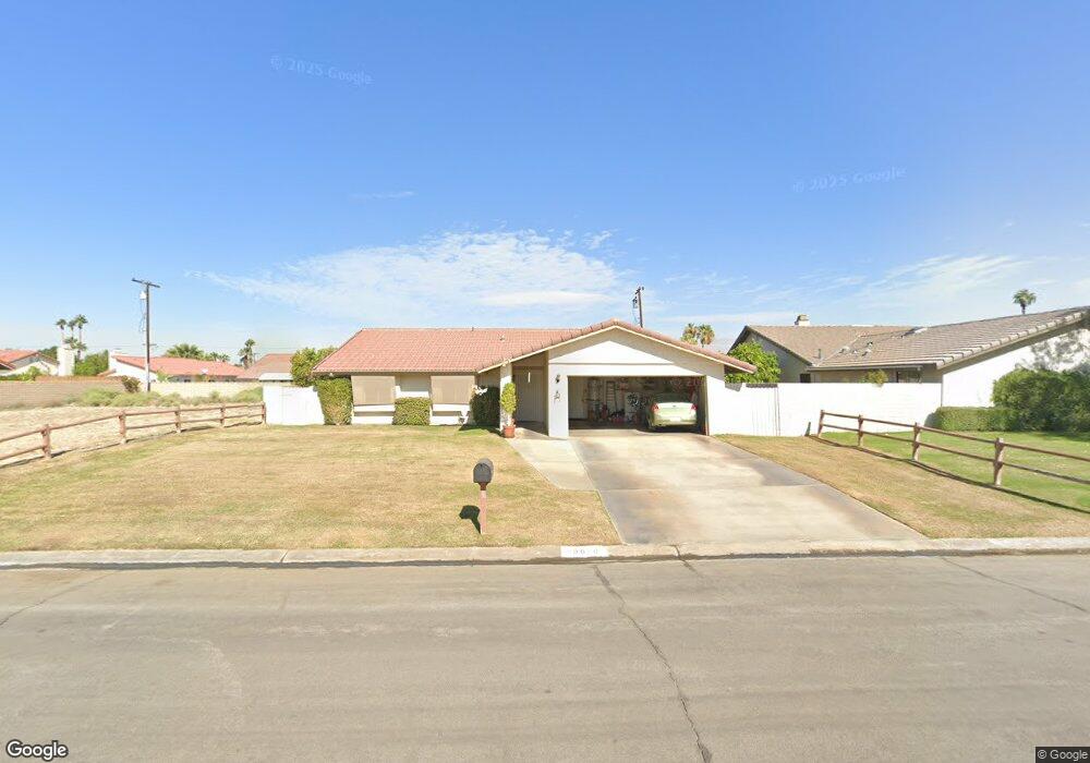
79610 Port Royal Ave Bermuda Dunes, CA 92203
Estimated Value: $429,000 - $531,000
3
Beds
2
Baths
1,413
Sq Ft
$343/Sq Ft
Est. Value
About This Home
This home is located at 79610 Port Royal Ave, Bermuda Dunes, CA 92203 and is currently estimated at $484,383, approximately $342 per square foot. 79610 Port Royal Ave is a home located in Riverside County with nearby schools including James Monroe Elementary School, Colonel Mitchell Paige Middle School, and Palm Desert High School.
Ownership History
Date
Name
Owned For
Owner Type
Purchase Details
Closed on
Aug 17, 2011
Sold by
Fannie Mae
Bought by
Kirsch Karl David
Current Estimated Value
Home Financials for this Owner
Home Financials are based on the most recent Mortgage that was taken out on this home.
Original Mortgage
$126,704
Outstanding Balance
$87,442
Interest Rate
4.5%
Mortgage Type
FHA
Estimated Equity
$396,941
Purchase Details
Closed on
Mar 9, 2011
Sold by
Diener John G and Diener Joylene K
Bought by
Federal National Mortgage Association
Purchase Details
Closed on
Nov 18, 2002
Sold by
Bandel Peter T and Bandel Debra L
Bought by
Diener John G and Diener Joylene K
Home Financials for this Owner
Home Financials are based on the most recent Mortgage that was taken out on this home.
Original Mortgage
$152,000
Interest Rate
6.03%
Create a Home Valuation Report for This Property
The Home Valuation Report is an in-depth analysis detailing your home's value as well as a comparison with similar homes in the area
Home Values in the Area
Average Home Value in this Area
Purchase History
| Date | Buyer | Sale Price | Title Company |
|---|---|---|---|
| Kirsch Karl David | $130,000 | Old Republic Title Company | |
| Federal National Mortgage Association | $115,000 | Landsafe Default Inc | |
| Diener John G | $190,000 | First American Title Co |
Source: Public Records
Mortgage History
| Date | Status | Borrower | Loan Amount |
|---|---|---|---|
| Open | Kirsch Karl David | $126,704 | |
| Previous Owner | Diener John G | $152,000 | |
| Closed | Diener John G | $38,000 |
Source: Public Records
Tax History Compared to Growth
Tax History
| Year | Tax Paid | Tax Assessment Tax Assessment Total Assessment is a certain percentage of the fair market value that is determined by local assessors to be the total taxable value of land and additions on the property. | Land | Improvement |
|---|---|---|---|---|
| 2025 | $1,908 | $163,273 | $40,815 | $122,458 |
| 2023 | $1,908 | $156,934 | $39,231 | $117,703 |
| 2022 | $1,832 | $153,858 | $38,462 | $115,396 |
| 2021 | $1,795 | $150,842 | $37,708 | $113,134 |
| 2020 | $1,761 | $149,296 | $37,322 | $111,974 |
| 2019 | $1,725 | $146,370 | $36,591 | $109,779 |
| 2018 | $1,689 | $143,501 | $35,874 | $107,627 |
| 2017 | $1,651 | $140,688 | $35,171 | $105,517 |
| 2016 | $1,608 | $137,931 | $34,482 | $103,449 |
| 2015 | $1,611 | $135,862 | $33,965 | $101,897 |
| 2014 | $1,582 | $133,201 | $33,300 | $99,901 |
Source: Public Records
Map
Nearby Homes
- 41740 Cambridge Ave
- 79416 Tobago Ct
- 0 Avenue 42 Unit OC25052084
- 0 Avenue 42 Unit 219102024DA
- 79540 Bermuda Dunes Dr
- 79380 Spalding Dr
- 79421 Avenue 42
- 79595 Bermuda Dunes Dr
- 79371 Bowden Dr
- 79361 Port Royal Ave
- 79760 Gable Glen St
- 79381 Avenue 42
- 79505 Saint Margarets Bay
- 41844 Volare Ct
- 41843 Volare Ct
- 41891 Volare Ct
- 41879 Volare Ct
- 41855 Volare Ct
- Residence 4 Plan at Volare
- Residence 3 Plan at Volare
- 41825 Trinity Cir
- 79601 Butler Bay Place
- 41785 Trinity Cir
- 79590 Port Royal Ave
- 0 Trinity Cir Unit 216034274
- 0 Trinity Cir Unit 217012534
- 0 Trinity Cir Unit 21447321
- 0 Trinity Cir
- 79591 Butler Bay Place
- 79611 Port Royal Ave
- 79621 Port Royal Ave
- 79601 Port Royal Ave
- 79650 Port Royal Ave
- 79580 Port Royal Ave
- 79641 Port Royal Ave
- 79591 Port Royal Ave
- 79581 Butler Bay Place
- 41780 Trinity Cir
- 41760 Trinity Cir
- 79581 Port Royal Ave
