Estimated Value: $194,829 - $272,000
4
Beds
1
Bath
1,857
Sq Ft
$129/Sq Ft
Est. Value
About This Home
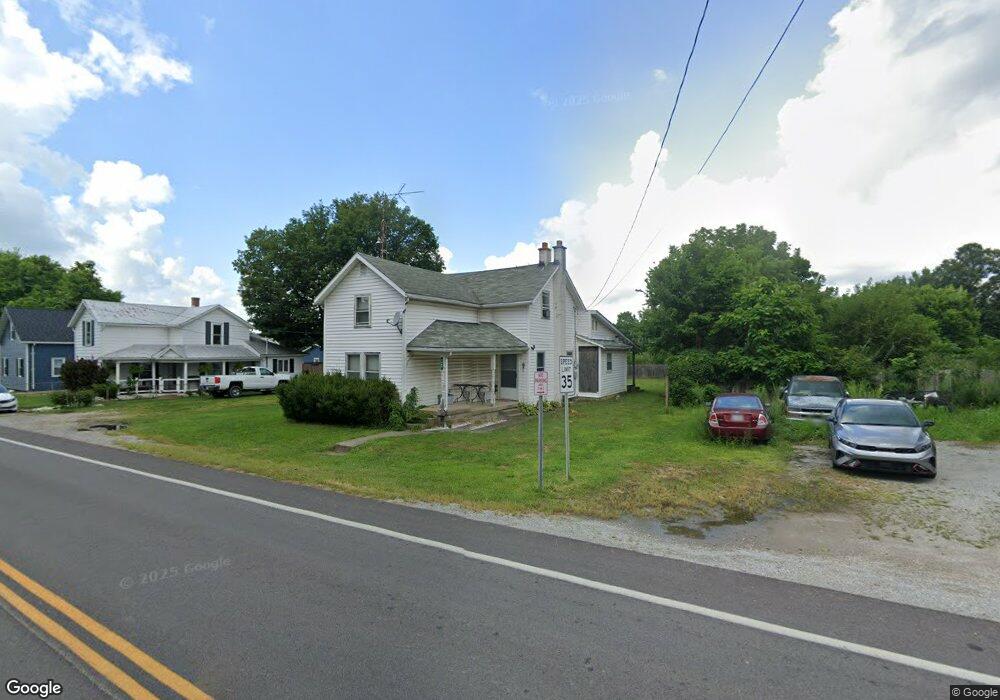
This home is located at 7965 E State Route 41, Troy, OH 45373 and is currently estimated at $238,707, approximately $128 per square foot. 7965 E State Route 41 is a home located in Miami County with nearby schools including Miami East Elementary School, Miami East Junior High School, and Miami East High School.
Ownership History
Date
Name
Owned For
Owner Type
Purchase Details
Closed on
Jan 19, 2018
Sold by
Woods Elsie G
Bought by
Stapleton Michael A
Current Estimated Value
Home Financials for this Owner
Home Financials are based on the most recent Mortgage that was taken out on this home.
Original Mortgage
$97,850
Outstanding Balance
$81,604
Interest Rate
3.94%
Mortgage Type
New Conventional
Estimated Equity
$157,103
Purchase Details
Closed on
Sep 20, 2010
Sold by
Woods Basil
Bought by
Woods Elsie G
Purchase Details
Closed on
Jul 1, 1978
Bought by
Woods Basil
Create a Home Valuation Report for This Property
The Home Valuation Report is an in-depth analysis detailing your home's value as well as a comparison with similar homes in the area
Purchase History
| Date | Buyer | Sale Price | Title Company |
|---|---|---|---|
| Stapleton Michael A | $103,000 | Hallmark Title | |
| Woods Elsie G | -- | -- | |
| Woods Basil | $19,500 | -- |
Source: Public Records
Mortgage History
| Date | Status | Borrower | Loan Amount |
|---|---|---|---|
| Open | Stapleton Michael A | $97,850 |
Source: Public Records
Tax History
| Year | Tax Paid | Tax Assessment Tax Assessment Total Assessment is a certain percentage of the fair market value that is determined by local assessors to be the total taxable value of land and additions on the property. | Land | Improvement |
|---|---|---|---|---|
| 2025 | $1,544 | $52,640 | $3,500 | $49,140 |
| 2024 | $1,544 | $46,410 | $3,780 | $42,630 |
| 2023 | $1,540 | $46,410 | $3,780 | $42,630 |
| 2022 | $1,513 | $46,410 | $3,780 | $42,630 |
| 2021 | $1,231 | $35,710 | $2,910 | $32,800 |
| 2020 | $1,237 | $35,710 | $2,910 | $32,800 |
| 2019 | $1,327 | $35,710 | $2,910 | $32,800 |
| 2018 | $1,087 | $29,060 | $2,840 | $26,220 |
| 2017 | $1,076 | $29,060 | $2,840 | $26,220 |
| 2016 | $1,008 | $29,060 | $2,840 | $26,220 |
| 2015 | $1,027 | $27,930 | $2,730 | $25,200 |
| 2014 | $1,027 | $27,930 | $2,730 | $25,200 |
| 2013 | $1,033 | $27,930 | $2,730 | $25,200 |
Source: Public Records
Map
Nearby Homes
- 8030 E State Route 41
- 3535 Ruby Dr
- 2656 Addison New Carlisle Rd
- 950 Rosenthal Dr
- 0 Gearhart Rd
- 3526 Dallas Dr
- 3410 Michael Dr
- 3406 Christina Dr
- 2691 County Highway 6a
- Tracts 4&5 (of 5) Elm Tree Rd
- 4930 State Route 201
- 8020 E New Carlisle Rd
- 907 White Pine St
- 3485 County Highway 6a
- 14 Ditmer
- 209 Meadow Dr
- 203 Monroe Way
- 208 Monroe Way
- 227 Fenwick Dr
- 6007 E State Route 571
- 7977 E State Route 41
- 7947 E State Route 41
- 7945 E State Route 41
- 7930 E State Route 41
- 7890 E State Route 41
- 7925 E State Route 41
- 7870 E State Route 41
- 7970 E State Route 41
- 7850 E State Route 41
- 7905 E State Route 41
- 7980 E State Route 41
- 7990 E State Route 41
- 7895 E State Route 41
- 8010 E State Route 41
- 7994 E State Route 41
- 950 S Alcony Conover Rd
- 930 S Alcony Conover Rd
- 8019 E State Route 41
- 8020 E State Route 41
- 7800 E State Route 41
Your Personal Tour Guide
Ask me questions while you tour the home.