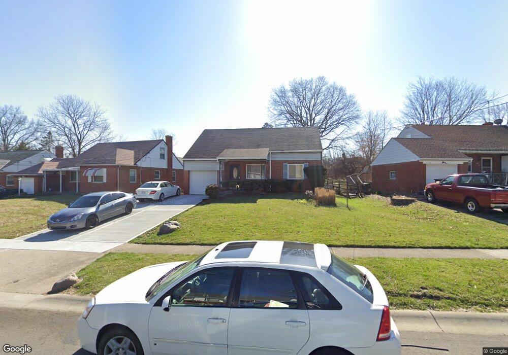
7968 Bobolink Dr Cincinnati, OH 45224
College Hill NeighborhoodEstimated Value: $143,000 - $240,000
2
Beds
1
Bath
924
Sq Ft
$206/Sq Ft
Est. Value
About This Home
This home is located at 7968 Bobolink Dr, Cincinnati, OH 45224 and is currently estimated at $190,409, approximately $206 per square foot. 7968 Bobolink Dr is a home located in Hamilton County with nearby schools including Pleasant Hill Elementary School, Western Hills High School, and Gilbert A. Dater High School.
Ownership History
Date
Name
Owned For
Owner Type
Purchase Details
Closed on
Mar 7, 1995
Sold by
Matson Samuel T and Matson Regina
Bought by
Edwards Sharon L and Edwards David
Current Estimated Value
Home Financials for this Owner
Home Financials are based on the most recent Mortgage that was taken out on this home.
Original Mortgage
$76,431
Interest Rate
9.13%
Mortgage Type
FHA
Create a Home Valuation Report for This Property
The Home Valuation Report is an in-depth analysis detailing your home's value as well as a comparison with similar homes in the area
Home Values in the Area
Average Home Value in this Area
Purchase History
| Date | Buyer | Sale Price | Title Company |
|---|---|---|---|
| Edwards Sharon L | -- | -- |
Source: Public Records
Mortgage History
| Date | Status | Borrower | Loan Amount |
|---|---|---|---|
| Closed | Edwards Sharon L | $76,431 |
Source: Public Records
Tax History Compared to Growth
Tax History
| Year | Tax Paid | Tax Assessment Tax Assessment Total Assessment is a certain percentage of the fair market value that is determined by local assessors to be the total taxable value of land and additions on the property. | Land | Improvement |
|---|---|---|---|---|
| 2024 | $2,549 | $42,431 | $11,739 | $30,692 |
| 2023 | $2,606 | $42,431 | $11,739 | $30,692 |
| 2022 | $1,883 | $27,416 | $9,559 | $17,857 |
| 2021 | $1,807 | $27,416 | $9,559 | $17,857 |
| 2020 | $1,860 | $27,416 | $9,559 | $17,857 |
| 2019 | $1,784 | $24,049 | $8,386 | $15,663 |
| 2018 | $1,787 | $24,049 | $8,386 | $15,663 |
| 2017 | $1,697 | $24,049 | $8,386 | $15,663 |
| 2016 | $2,043 | $28,578 | $8,946 | $19,632 |
| 2015 | $1,843 | $28,578 | $8,946 | $19,632 |
| 2014 | $1,856 | $28,578 | $8,946 | $19,632 |
| 2013 | $1,945 | $29,460 | $9,223 | $20,237 |
Source: Public Records
Map
Nearby Homes
- 7923 Bobolink Dr
- 1280 Brushwood Ave
- 7929 Cherrywood Ct
- 6765 Richard Ave
- 6596 S Oak Knoll Dr
- 6586 S Oak Knoll Dr
- 6785 Marvin Ave
- 6832 Tarawa Dr
- 6538 S Oak Knoll Dr
- 6642 Plantation Way
- 1544 W Galbraith Rd
- 1148 Hollywood Ave
- 1140 Hollywood Ave
- 8579 Daly Rd
- 1533 Corcoran Place
- 8543 Foxcroft Dr
- 1562 Oak Knoll Dr
- 8681 Desoto Dr
- 1025 Eastgate Dr
- 1575 W Galbraith Rd
- 8000 Bobolink Dr
- 7936 Bobolink Dr
- 7911 Knollwood Ln
- 7921 Knollwood Ln
- 7904 Bobolink Dr
- 8032 Bobolink Dr
- 7931 Knollwood Ln
- 7901 Knollwood Ln
- 8064 Bobolink Dr
- 8001 Bobolink Dr
- 7949 Knollwood Ln
- 8039 Bobolink Dr
- 7945 Bobolink Dr
- 7969 Bobolink Dr
- 7896 Bobolink Dr
- 7967 Knollwood Ln
- 7887 Knollwood Ln
- 8096 Bobolink Dr
- 7901 Bobolink Dr
- 8077 Bobolink Dr