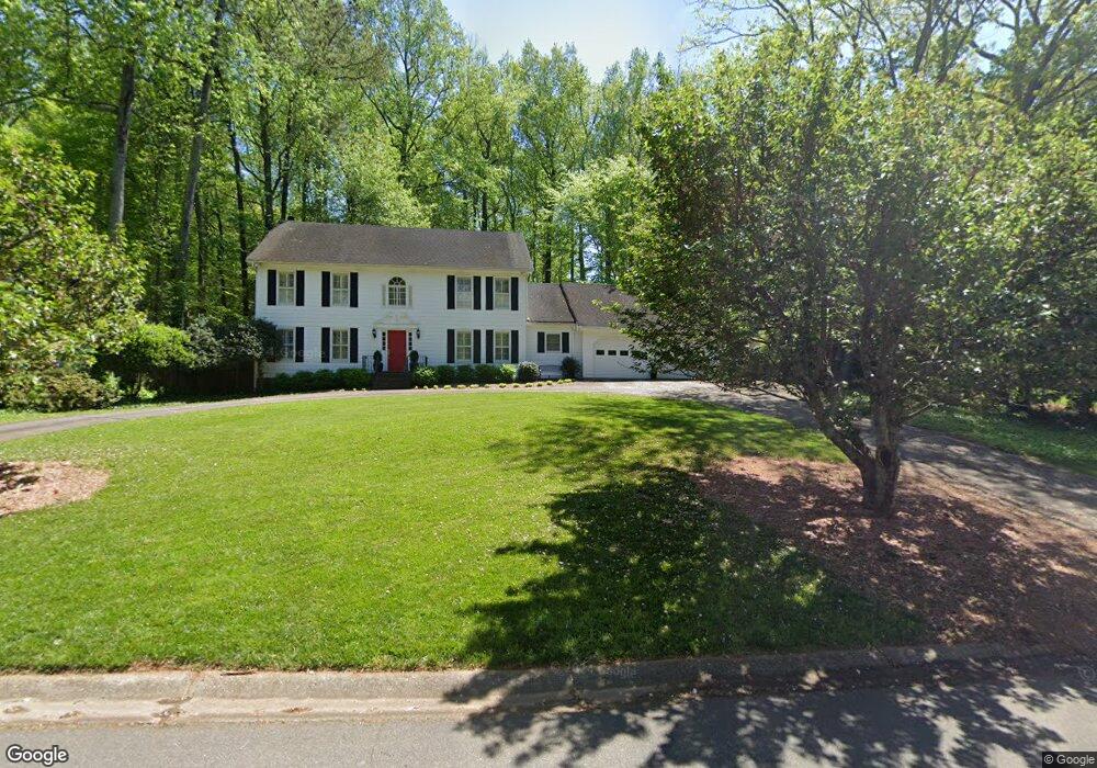
797 Colston Rd SW Marietta, GA 30064
Southwestern Marietta NeighborhoodEstimated Value: $522,000 - $742,000
3
Beds
3
Baths
3,030
Sq Ft
$213/Sq Ft
Est. Value
About This Home
This home is located at 797 Colston Rd SW, Marietta, GA 30064 and is currently estimated at $646,243, approximately $213 per square foot. 797 Colston Rd SW is a home located in Cobb County with nearby schools including Hickory Hills Elementary School, Marietta Sixth Grade Academy, and Marietta Middle School.
Ownership History
Date
Name
Owned For
Owner Type
Purchase Details
Closed on
Nov 24, 2003
Sold by
Lyle John B and Lyle Brenda M
Bought by
Smart Paul L and Smart Karen
Current Estimated Value
Home Financials for this Owner
Home Financials are based on the most recent Mortgage that was taken out on this home.
Original Mortgage
$235,000
Outstanding Balance
$99,415
Interest Rate
4.75%
Mortgage Type
New Conventional
Estimated Equity
$546,828
Purchase Details
Closed on
Jul 1, 1994
Sold by
Compton Barry M Bonnie S
Bought by
Lyle John B Brenda M
Home Financials for this Owner
Home Financials are based on the most recent Mortgage that was taken out on this home.
Original Mortgage
$141,600
Interest Rate
8.51%
Create a Home Valuation Report for This Property
The Home Valuation Report is an in-depth analysis detailing your home's value as well as a comparison with similar homes in the area
Home Values in the Area
Average Home Value in this Area
Purchase History
| Date | Buyer | Sale Price | Title Company |
|---|---|---|---|
| Smart Paul L | $284,000 | -- | |
| Lyle John B Brenda M | $177,000 | -- |
Source: Public Records
Mortgage History
| Date | Status | Borrower | Loan Amount |
|---|---|---|---|
| Open | Smart Paul L | $235,000 | |
| Previous Owner | Lyle John B Brenda M | $141,600 |
Source: Public Records
Tax History Compared to Growth
Tax History
| Year | Tax Paid | Tax Assessment Tax Assessment Total Assessment is a certain percentage of the fair market value that is determined by local assessors to be the total taxable value of land and additions on the property. | Land | Improvement |
|---|---|---|---|---|
| 2025 | $2,362 | $279,144 | $64,000 | $215,144 |
| 2024 | $2,362 | $279,144 | $64,000 | $215,144 |
| 2023 | $1,898 | $224,392 | $46,000 | $178,392 |
| 2022 | $1,422 | $168,140 | $46,000 | $122,140 |
| 2021 | $1,355 | $157,760 | $30,000 | $127,760 |
| 2020 | $1,156 | $134,592 | $30,000 | $104,592 |
| 2019 | $1,087 | $126,516 | $30,000 | $96,516 |
| 2018 | $1,087 | $126,516 | $30,000 | $96,516 |
| 2017 | $841 | $122,128 | $30,000 | $92,128 |
| 2016 | $841 | $122,128 | $30,000 | $92,128 |
| 2015 | $816 | $108,828 | $30,000 | $78,828 |
| 2014 | $691 | $89,196 | $0 | $0 |
Source: Public Records
Map
Nearby Homes
- The Bainbridge Plan at Highvale
- The Oxford Plan at Highvale
- The Thomson Plan at Highvale
- The Vinings Plan at Highvale
- The Brooks Plan at Highvale
- The Pinehurst Plan at Highvale
- The Evans Plan at Highvale
- The Rebecca Plan at Highvale
- The Ashburn Plan at Highvale
- The Dillard Plan at Highvale
- 988 Grantham Way SW
- 681 Hampton Place SW
- 1011 Cannongate Crossing SW
- 1017 Cannongate Crossing SW
- 1121 Cannongate Crossing SW
- 1161 Rockmann Terrace SW
- 916 Cannon Gate Crossing
- 916 Cannongate Crossing SW Unit 916
- 332 Rockmann Ln SW
- 1047 Chestnut Hill Cir SW
- 793 Colston Rd SW
- 801 Colston Rd SW
- 791 Colston Rd SW
- 603 Colston Ct SW
- 817 Colston Rd SW
- 798 Colston Rd SW
- 825 Colston Rd SW Unit 1
- 800 Colston Rd SW
- 807 Colston Rd SW Unit 2
- 813 Colston Rd SW
- 796 Colston Rd SW Unit 2
- 0 Colston Ct SW Unit 8402043
- 0 Colston Ct SW Unit 3185784
- 0 Colston Ct SW
- 789 Colston Rd SW
- 802 Colston Rd SW
- 604 Colston Ct SW Unit 2
- 829 Colston Rd SW
- 790 Colston Rd SW
- 615 Colston Ct SW