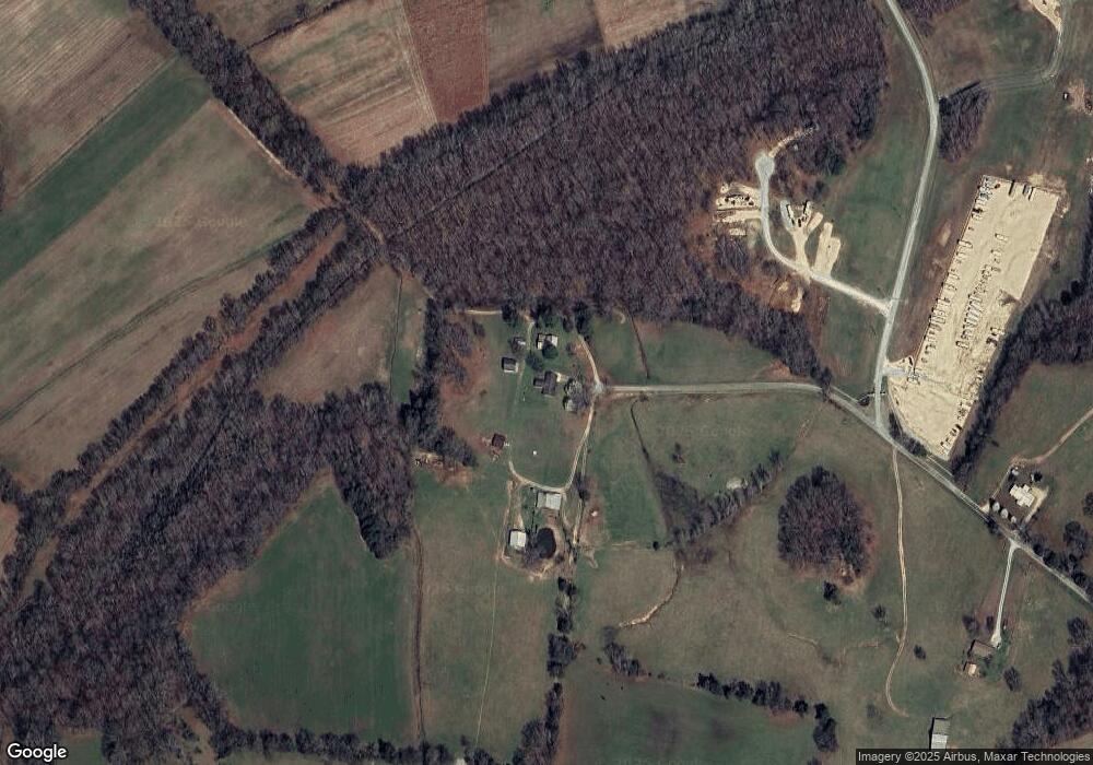
798 Middleton Rd Clifton, TN 38425
Estimated Value: $407,000 - $557,175
--
Bed
2
Baths
1,843
Sq Ft
$267/Sq Ft
Est. Value
About This Home
This home is located at 798 Middleton Rd, Clifton, TN 38425 and is currently estimated at $491,392, approximately $266 per square foot. 798 Middleton Rd is a home located in Perry County.
Ownership History
Date
Name
Owned For
Owner Type
Purchase Details
Closed on
Sep 2, 2009
Sold by
Holder Brandi Michelle
Bought by
Holder Jason Brent
Current Estimated Value
Purchase Details
Closed on
Aug 31, 2009
Sold by
Holder Wallace E
Bought by
Holder Jason Brent
Purchase Details
Closed on
Sep 4, 2007
Sold by
Holder Wallace E
Bought by
Ggp Llc
Purchase Details
Closed on
Jun 1, 1984
Purchase Details
Closed on
Mar 3, 1972
Bought by
Holder Wallace E & Villa Sue
Create a Home Valuation Report for This Property
The Home Valuation Report is an in-depth analysis detailing your home's value as well as a comparison with similar homes in the area
Home Values in the Area
Average Home Value in this Area
Purchase History
| Date | Buyer | Sale Price | Title Company |
|---|---|---|---|
| Holder Jason Brent | $180,000 | -- | |
| Holder Jason Brent | $180,000 | -- | |
| Ggp Llc | $250,000 | -- | |
| -- | -- | -- | |
| Holder Wallace E & Villa Sue | -- | -- |
Source: Public Records
Tax History Compared to Growth
Tax History
| Year | Tax Paid | Tax Assessment Tax Assessment Total Assessment is a certain percentage of the fair market value that is determined by local assessors to be the total taxable value of land and additions on the property. | Land | Improvement |
|---|---|---|---|---|
| 2025 | $1,684 | $73,350 | $0 | $0 |
| 2024 | $1,684 | $73,350 | $46,800 | $26,550 |
| 2023 | $1,684 | $73,350 | $46,800 | $26,550 |
| 2022 | $1,684 | $73,350 | $46,800 | $26,550 |
| 2021 | $1,684 | $73,350 | $46,800 | $26,550 |
| 2020 | $1,684 | $73,350 | $46,800 | $26,550 |
| 2019 | $1,531 | $61,725 | $36,225 | $25,500 |
| 2018 | $1,531 | $61,725 | $36,225 | $25,500 |
| 2017 | $1,512 | $61,725 | $36,225 | $25,500 |
| 2016 | $1,512 | $61,725 | $36,225 | $25,500 |
| 2015 | $1,483 | $61,725 | $36,225 | $25,500 |
| 2014 | $1,483 | $61,725 | $36,225 | $25,500 |
| 2013 | $1,259 | $52,403 | $0 | $0 |
Source: Public Records
Map
Nearby Homes
- 181 Mallard Dr
- 92 Pintail Ln
- 1434 S River Front Dr
- 1262 S River Front Dr
- 406 S River Front Dr
- 5 River Front Dr
- 188 S River Front Dr
- 328 Duck Blind Rd
- 380 Duck Blind Rd
- 705 River Front Dr
- 2857 Hardin Bottom River Rd
- 390 Duck Blind Rd
- 384 Duck Blind Rd
- 442 Duck Blind Rd
- 885 River Front Dr
- 1017 River Front Dr
- 637 River Front Dr
- 753 River Front Dr
- 992 River Front Dr
- 715 River Front Dr
- 275 Wood Duck Ln
- 0 Duck Blind Rd Unit 2139107
- 0 Duck Blind Rd Unit 2071168
- 541 Middleton Rd
- 1320 River Front Dr S
- 0 Middleton Lane Rd Unit 1639302
- 0 Middleton Lane Rd Unit RTC2306321
- 0 Middleton Lane Rd Unit Lot 74 10108115
- 0 Middleton Lane Rd Unit Lot 74 10107641
- 497 River Front Dr Unit Lots 73 & 73B
- 497 River Front Dr
- 1116 S River Front Dr Unit Lot 13 AB
- 88 Riverfront Dr S
- 496 River Front Dr S
- 1144 S River Front Dr
- 886 River Front Dr S
- 706 River Front Dr S
- 112 River Front Dr S
- 451 River Front Dr
- 1236 River Front Dr
