Estimated Value: $212,137 - $227,000
3
Beds
2
Baths
1,107
Sq Ft
$201/Sq Ft
Est. Value
About This Home
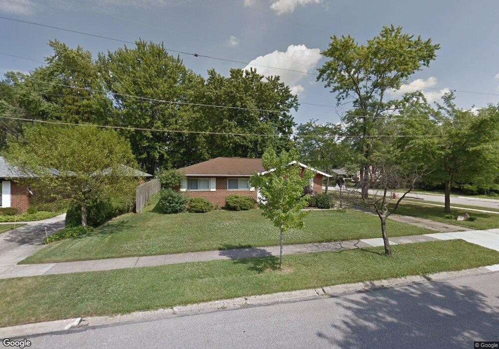
This home is located at 799 Edwards Dr, Berea, OH 44017 and is currently estimated at $222,284, approximately $200 per square foot. 799 Edwards Dr is a home located in Cuyahoga County with nearby schools including Grindstone Elementary School, Berea-Midpark Middle School, and Berea-Midpark High School.
Ownership History
Date
Name
Owned For
Owner Type
Purchase Details
Closed on
May 5, 2007
Sold by
Zacharias Paul F
Bought by
Dolan Sandra L
Current Estimated Value
Home Financials for this Owner
Home Financials are based on the most recent Mortgage that was taken out on this home.
Original Mortgage
$117,500
Outstanding Balance
$71,628
Interest Rate
6.21%
Mortgage Type
Purchase Money Mortgage
Estimated Equity
$150,656
Purchase Details
Closed on
Apr 30, 1991
Sold by
Zacharias Paul F
Bought by
Zacharias Paul F
Purchase Details
Closed on
Sep 17, 1985
Sold by
Gray David A
Bought by
Mcelhanon James David
Purchase Details
Closed on
Apr 13, 1984
Sold by
Olsafsky Max
Bought by
Gray David A
Purchase Details
Closed on
Nov 30, 1983
Sold by
Christopolis Ann T
Bought by
Olsafsky Max
Purchase Details
Closed on
Jan 1, 1975
Bought by
Christopolis Ann T
Create a Home Valuation Report for This Property
The Home Valuation Report is an in-depth analysis detailing your home's value as well as a comparison with similar homes in the area
Home Values in the Area
Average Home Value in this Area
Purchase History
| Date | Buyer | Sale Price | Title Company |
|---|---|---|---|
| Dolan Sandra L | $117,500 | Executive Title Agency Corp | |
| Zacharias Paul F | -- | -- | |
| Zacharias Paul F | $56,000 | -- | |
| Mcelhanon James David | $49,700 | -- | |
| Gray David A | $47,000 | -- | |
| Olsafsky Max | $46,500 | -- | |
| Christopolis Ann T | -- | -- |
Source: Public Records
Mortgage History
| Date | Status | Borrower | Loan Amount |
|---|---|---|---|
| Open | Dolan Sandra L | $117,500 |
Source: Public Records
Tax History
| Year | Tax Paid | Tax Assessment Tax Assessment Total Assessment is a certain percentage of the fair market value that is determined by local assessors to be the total taxable value of land and additions on the property. | Land | Improvement |
|---|---|---|---|---|
| 2024 | $2,939 | $60,340 | $10,325 | $50,015 |
| 2023 | $2,671 | $47,640 | $10,260 | $37,380 |
| 2022 | $2,682 | $47,640 | $10,260 | $37,380 |
| 2021 | $2,658 | $47,640 | $10,260 | $37,380 |
| 2020 | $2,438 | $40,360 | $8,680 | $31,680 |
| 2019 | $2,373 | $115,300 | $24,800 | $90,500 |
| 2018 | $2,582 | $40,360 | $8,680 | $31,680 |
| 2017 | $2,321 | $37,590 | $7,070 | $30,520 |
| 2016 | $3,378 | $37,590 | $7,070 | $30,520 |
| 2015 | $2,971 | $37,590 | $7,070 | $30,520 |
| 2014 | $2,971 | $39,590 | $7,460 | $32,130 |
Source: Public Records
Map
Nearby Homes
- 9003 Prospect Rd
- 21032 Breckenridge Ln
- 10020 Fair Rd
- 8902 Lincolnshire Blvd
- 275 Quarrystone Ln
- 20456 Scotch Pine Way
- 49 Monroe St
- 19890 Idlewood Trail
- 21586 Little Brook Way
- 20050 Idlewood Trail
- 458 Sprague Rd
- 647 Tampico Ct Unit 7
- 9384 N Marks Rd
- 18433 Whitney Rd
- 23004 Chandlers Ln Unit 4-344
- 47 Prospect St
- 23002 Chandlers Ln Unit 223
- 23002 Chandlers Ln Unit 221
- 11814 Craig Dr
- 388 Fairwood Cir
- 791 Edwards Dr
- 115 Maplelawn Dr
- 794 Edwards Dr
- 785 Edwards Dr
- 118 Maplelawn Dr
- 125 Maplelawn Dr
- 112 Milton St
- 777 Edwards Dr
- 92 Milton St
- 118 Milton St
- 86 Milton St
- 131 Maplelawn Dr
- 124 Milton St
- 128 Maplelawn Dr
- 74 Milton St
- 80 Milton St
- 130 Milton St
- 103 Milton St
- 139 Maplelawn Dr
- 138 Maplelawn Dr
Your Personal Tour Guide
Ask me questions while you tour the home.