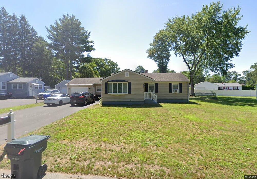
799 N Branch Pkwy Springfield, MA 01119
Sixteen Acres NeighborhoodEstimated Value: $322,000 - $333,000
3
Beds
2
Baths
1,222
Sq Ft
$269/Sq Ft
Est. Value
About This Home
This home is located at 799 N Branch Pkwy, Springfield, MA 01119 and is currently estimated at $328,449, approximately $268 per square foot. 799 N Branch Pkwy is a home located in Hampden County with nearby schools including Warner, M Marcus Kiley Middle, and Springfield Central High School.
Ownership History
Date
Name
Owned For
Owner Type
Purchase Details
Closed on
Sep 3, 2020
Sold by
Mccarthy Margaret C and Mccarthy Daniel J
Bought by
Alvardo-Colon Lisbeth M and Perez-Morales Edward J
Current Estimated Value
Home Financials for this Owner
Home Financials are based on the most recent Mortgage that was taken out on this home.
Original Mortgage
$184,594
Outstanding Balance
$163,511
Interest Rate
2.8%
Mortgage Type
FHA
Estimated Equity
$164,938
Purchase Details
Closed on
Jan 7, 2013
Sold by
Mccarthy Margaret C
Bought by
Mccarthy 3Rd Daniel J and Mullin Anne M
Create a Home Valuation Report for This Property
The Home Valuation Report is an in-depth analysis detailing your home's value as well as a comparison with similar homes in the area
Home Values in the Area
Average Home Value in this Area
Purchase History
| Date | Buyer | Sale Price | Title Company |
|---|---|---|---|
| Alvardo-Colon Lisbeth M | $188,000 | None Available | |
| Mccarthy 3Rd Daniel J | -- | -- |
Source: Public Records
Mortgage History
| Date | Status | Borrower | Loan Amount |
|---|---|---|---|
| Open | Alvardo-Colon Lisbeth M | $184,594 | |
| Previous Owner | Mccarthy 3Rd Daniel J | $30,000 | |
| Previous Owner | Mccarthy 3Rd Daniel J | $20,000 |
Source: Public Records
Tax History Compared to Growth
Tax History
| Year | Tax Paid | Tax Assessment Tax Assessment Total Assessment is a certain percentage of the fair market value that is determined by local assessors to be the total taxable value of land and additions on the property. | Land | Improvement |
|---|---|---|---|---|
| 2025 | $4,301 | $274,300 | $52,800 | $221,500 |
| 2024 | $3,850 | $239,700 | $52,800 | $186,900 |
| 2023 | $3,224 | $189,100 | $50,300 | $138,800 |
| 2022 | $3,510 | $186,500 | $50,300 | $136,200 |
| 2021 | $3,323 | $175,800 | $45,700 | $130,100 |
| 2020 | $3,246 | $166,200 | $45,700 | $120,500 |
| 2019 | $3,019 | $153,400 | $45,700 | $107,700 |
| 2018 | $3,060 | $155,500 | $45,700 | $109,800 |
| 2017 | $2,996 | $152,400 | $45,600 | $106,800 |
| 2016 | $2,713 | $138,000 | $45,600 | $92,400 |
| 2015 | $2,734 | $139,000 | $45,600 | $93,400 |
Source: Public Records
Map
Nearby Homes
- 665 Parker St
- 30 Jerilis Dr
- 135 Lucerne Rd
- 20 Wrenwood St
- 68 Hamilton St
- 44 Rest Way
- 25 Pioneer Way
- 32 Better Way
- 884 Parker St
- 135 Bulat Dr
- 161 Fernbank Rd
- 56 Contessa Ln
- 401 Grayson Dr
- 45 Nassau Dr
- 286 Nassau Dr Unit 286
- 34 Temby St
- 120 Lamplighter Ln Unit C
- 70 Shumway St Unit 29
- 70 Shumway St Unit A1
- 89 Pine Grove St
- 789 N Branch Pkwy
- 809 N Branch Pkwy
- 54 Overlea Dr
- 72 Overlea Dr
- 821 N Branch Pkwy
- 46 Overlea Dr
- 676 Parker St
- 668 Parker St
- 59 Overlea Dr
- 67 Overlea Dr
- 658 Parker St
- 49 Overlea Dr
- 688 Parker St
- 765 N Branch Pkwy
- 32 Overlea Dr
- 39 Overlea Dr
- 696 Parker St
- 679 Parker St
- 0 Lucerne Rd (Ws) L:70 Unit 70890929
- 671 Parker St