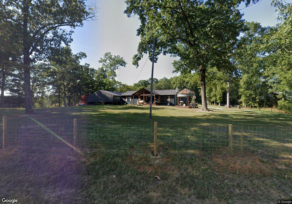
799 Simpson Rd Sparta, TN 38583
Estimated Value: $129,000 - $248,000
3
Beds
1
Bath
1,008
Sq Ft
$203/Sq Ft
Est. Value
About This Home
This home is located at 799 Simpson Rd, Sparta, TN 38583 and is currently estimated at $204,568, approximately $202 per square foot. 799 Simpson Rd is a home located in White County with nearby schools including Cassville Elementary School, White County Middle School, and White County High School.
Ownership History
Date
Name
Owned For
Owner Type
Purchase Details
Closed on
Jun 30, 2020
Sold by
Long Jackie C and Long Penny L
Bought by
Long Jacob
Current Estimated Value
Purchase Details
Closed on
Apr 9, 2010
Sold by
Unlimited Ventrues Llc
Bought by
Long Jackie C
Purchase Details
Closed on
Jun 18, 2009
Sold by
Nash Robynn
Bought by
Unlimited Ventrues Llc
Purchase Details
Closed on
Dec 29, 2000
Sold by
Citizens Bank
Bought by
Connie Webb
Purchase Details
Closed on
Oct 13, 2000
Sold by
Corona John W and Corona Jodi
Bought by
Citizens Bank
Purchase Details
Closed on
Oct 26, 1995
Bought by
John Corona
Purchase Details
Closed on
Dec 23, 1992
Bought by
Winchester Neilene and Winchester Gloria A
Purchase Details
Closed on
Jun 4, 1982
Bought by
Stewart William Hill and Stewart Lillian
Create a Home Valuation Report for This Property
The Home Valuation Report is an in-depth analysis detailing your home's value as well as a comparison with similar homes in the area
Purchase History
| Date | Buyer | Sale Price | Title Company |
|---|---|---|---|
| Long Jacob | $75,000 | None Available | |
| Long Jackie C | -- | -- | |
| Unlimited Ventrues Llc | $73,000 | -- | |
| Connie Webb | $44,000 | -- | |
| Citizens Bank | $37,500 | -- | |
| John Corona | $65,000 | -- | |
| Winchester Neilene | $52,500 | -- | |
| Stewart William Hill | -- | -- |
Source: Public Records
Tax History
| Year | Tax Paid | Tax Assessment Tax Assessment Total Assessment is a certain percentage of the fair market value that is determined by local assessors to be the total taxable value of land and additions on the property. | Land | Improvement |
|---|---|---|---|---|
| 2025 | $791 | $56,125 | $11,200 | $44,925 |
| 2024 | $660 | $32,200 | $7,600 | $24,600 |
| 2023 | $660 | $32,200 | $7,600 | $24,600 |
| 2022 | $660 | $32,200 | $7,600 | $24,600 |
| 2021 | $660 | $32,200 | $7,600 | $24,600 |
| 2020 | $579 | $32,200 | $7,600 | $24,600 |
| 2019 | $441 | $21,525 | $6,900 | $14,625 |
| 2018 | $441 | $21,525 | $6,900 | $14,625 |
| 2017 | $441 | $21,525 | $6,900 | $14,625 |
| 2016 | $441 | $21,525 | $6,900 | $14,625 |
| 2015 | $398 | $21,525 | $6,900 | $14,625 |
| 2014 | -- | $21,525 | $6,900 | $14,625 |
| 2013 | -- | $23,225 | $7,625 | $15,600 |
Source: Public Records
Map
Nearby Homes
- 6760 Smithville Hwy
- 304 Lucille St
- 8444 Old Kentucky Rd
- 6444 Old Smithville Hwy S
- 121 Hutchings College Rd
- 6311 Old Smithville Hwy S
- 0 Liberty Rd
- 409 Westwood Dr
- 288 Westwood Dr
- lot 16 Old Kentucky Rd
- Lot 17 Old Kentucky Rd
- 0 Jenkins Rd
- 268 Fairview Cir
- 365 Fairview Cir
- 478 Frank Anderson Rd
- 459 Frank Anderson Rd
- 1092 Frank Anderson Rd
- 1072 Frank Anderson Rd
- 1054 Frank Anderson Rd
- 13-B Petty Rd
- 895 Simpson Rd
- 785 Simpson Rd Unit 795
- 0 Simpson Rd Unit 126154
- 0 Simpson Rd Unit 213206
- 744 Simpson Rd
- 745 Simpson Rd
- 704 Simpson Rd
- 796 Simpson Rd
- 1367 Hutchings College Rd
- 1001 Simpson Rd
- 1010 Simpson Rd
- 676 Simpson Rd
- Par10.04 Simpson Rd
- LOT 1 B Simpson Rd
- LOT 1C Simpson Rd
- 2.68 ACR Simpson Rd
- 00 Simpson Rd
- 423 Simpson Rd
- 1153 Simpson Rd
Your Personal Tour Guide
Ask me questions while you tour the home.