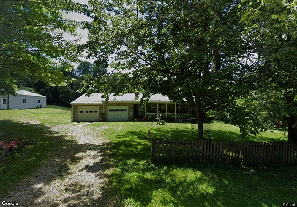
799 Township Road 2475 Loudonville, OH 44842
Estimated Value: $213,000 - $272,000
5
Beds
2
Baths
1,322
Sq Ft
$189/Sq Ft
Est. Value
About This Home
This home is located at 799 Township Road 2475, Loudonville, OH 44842 and is currently estimated at $250,000, approximately $189 per square foot. 799 Township Road 2475 is a home located in Ashland County with nearby schools including McMullen Elementary School, Budd Elementary School, and Loudonville High School.
Ownership History
Date
Name
Owned For
Owner Type
Purchase Details
Closed on
Sep 21, 2004
Bought by
Pyers Gerald D
Current Estimated Value
Purchase Details
Closed on
Jun 21, 2004
Sold by
Burgess Bret
Purchase Details
Closed on
Jul 28, 2000
Sold by
Loeber Louis G
Bought by
Burgess Bret
Purchase Details
Closed on
Jun 13, 1997
Sold by
Moore Jessee L
Bought by
Loeber Louis G
Purchase Details
Closed on
May 30, 1990
Bought by
Moore Jessee L
Create a Home Valuation Report for This Property
The Home Valuation Report is an in-depth analysis detailing your home's value as well as a comparison with similar homes in the area
Home Values in the Area
Average Home Value in this Area
Purchase History
| Date | Buyer | Sale Price | Title Company |
|---|---|---|---|
| Pyers Gerald D | $100,000 | -- | |
| -- | $82,700 | -- | |
| Burgess Bret | $119,900 | -- | |
| Loeber Louis G | $96,000 | -- | |
| Moore Jessee L | $49,000 | -- |
Source: Public Records
Tax History Compared to Growth
Tax History
| Year | Tax Paid | Tax Assessment Tax Assessment Total Assessment is a certain percentage of the fair market value that is determined by local assessors to be the total taxable value of land and additions on the property. | Land | Improvement |
|---|---|---|---|---|
| 2024 | $2,132 | $64,710 | $11,000 | $53,710 |
| 2023 | $2,132 | $64,710 | $11,000 | $53,710 |
| 2022 | $1,604 | $44,630 | $7,590 | $37,040 |
| 2021 | $1,590 | $44,630 | $7,590 | $37,040 |
| 2020 | $1,496 | $44,630 | $7,590 | $37,040 |
| 2019 | $1,423 | $42,430 | $7,290 | $35,140 |
| 2018 | $1,432 | $42,430 | $7,290 | $35,140 |
| 2017 | $1,234 | $42,430 | $7,290 | $35,140 |
| 2016 | $1,175 | $36,900 | $6,340 | $30,560 |
| 2015 | $1,167 | $36,900 | $6,340 | $30,560 |
| 2013 | $1,350 | $40,900 | $6,810 | $34,090 |
Source: Public Records
Map
Nearby Homes
- 609 Ohio 95
- 968 Township Road 2506
- 0 Township Road 925
- 560 Township Road 2402
- 136 Bridge St
- 0 County Road 917
- 1406 Pearl Dr
- 2818 Township Road 2812
- 723 Pearl Dr
- 0 Ashland County Road 2175
- 0 Ashland County Road 2175
- 513 N Mount Vernon Ave
- 68.40 Acres Trumpower Rd
- 0 Trumpower Rd
- 500 Stone Meadow Cir
- 1048 Township Road 2156
- 3386 Trumpower Rd
- 78 Forest Hill Rd
- 524 N Union St
- 2503 Township Road 827
- 2515 Township Road 827
- 2481 County Road 775
- 2477 County Road 775
- 732 State Route 95
- 2487 County Road 775
- 2497 County Road 775
- 723 Ohio 95
- 742 State Route 95
- 2501 Cr 775
- 721 State Route 95
- 2501 County Road 775
- 733 Ohio 95
- 2464 County Road 775
- 733 State Route 95
- 2448 County Road 775
- 827 Twp Rd
- 819 Township Road 2414 Unit 2414
- 819 Township Road 2414
- 2434 County Road 775