7999 Davidson Rd Delphos, OH 45833
Estimated Value: $248,000 - $310,000
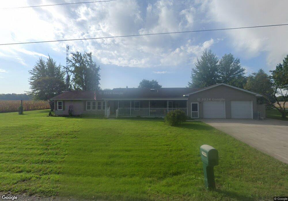
About This Home
This home is located at 7999 Davidson Rd, Delphos, OH 45833 and is currently estimated at $288,704, approximately $133 per square foot. 7999 Davidson Rd is a home located in Allen County with nearby schools including Elida Elementary School, Elida Middle School, and Elida High School.
Ownership History
We collect this data history from publicly available records. To have your information removed, we recommend requesting removal directly through your county’s website.
Purchase Details
Purchase Details
Purchase Details
Purchase History
We collect this data history from publicly available records. To have your information removed, we recommend requesting removal directly through your county’s website.
| Date | Buyer | Sale Price | Title Company |
|---|---|---|---|
| -- | None Available | ||
| -- | None Available | ||
| -- | -- |
Tax History
We collect this data history from publicly available records. To have your information removed, we recommend requesting removal directly through your county’s website.
| Year | Tax Paid | Tax Assessment Tax Assessment Total Assessment is a certain percentage of the fair market value that is determined by local assessors to be the total taxable value of land and additions on the property. | Land | Improvement |
|---|---|---|---|---|
| 2025 | $2,623 | $78,270 | $14,390 | $63,880 |
| 2024 | $2,645 | $78,270 | $14,390 | $63,880 |
| 2023 | $2,171 | $60,200 | $11,060 | $49,140 |
| 2022 | $2,240 | $60,200 | $11,060 | $49,140 |
| 2021 | $2,253 | $60,200 | $11,060 | $49,140 |
| 2020 | $2,096 | $53,770 | $10,680 | $43,090 |
| 2019 | $2,096 | $53,770 | $10,680 | $43,090 |
| 2018 | $1,968 | $53,770 | $10,680 | $43,090 |
| 2017 | $1,823 | $49,850 | $10,680 | $39,170 |
| 2016 | $1,822 | $49,850 | $10,680 | $39,170 |
| 2015 | $2,003 | $49,850 | $10,680 | $39,170 |
| 2014 | $2,003 | $51,950 | $10,260 | $41,690 |
| 2013 | $1,940 | $51,950 | $10,260 | $41,690 |
Map
- 3755 Grubb Rd N
- 2299 N Wapakoneta Rd
- 1774 Woodberry Creek Dr
- 8228 Elida Rd
- 105 W North St
- 8448 Elida Rd
- 5117 Willow St
- 5014 Lobo St
- 5724 Clover Ridge Dr
- 3075 Hummingbird St
- 4864 Hummingbird St
- 4848 Marciel Dr
- 4839 Sycamore St
- 402 E Main St
- 5654 Clover Ridge Dr
- 5643 Clover Ridge Dr
- 4795 Sycamore St
- 1064 S Grubb Rd
- 2148 Larkspur Dr
- 2581 Susan Ann Dr
- XXXX Mcbride Rd
- 7998 Davidson Rd
- 2550 Mcbride Rd
- 2610 Mcbride Rd
- 2400 Mcbride Rd
- 2581 Mcbride Rd
- 7900 Davidson Rd
- 2626 Mcbride Rd
- 2637 Mcbride Rd
- 2332 Mcbride Rd
- 2665 Mcbride Rd
- 2654 Mcbride Rd
- 7810 Davidson Rd
- 7805 Davidson Rd
- 2255 Mcbride Rd
- 7790 Davidson Rd
- 2190 Mcbride Rd
- 2854 Mcbride Rd
- 2910 Mcbride Rd
- 7557 Davidson Rd
Ask me questions while you tour the home.