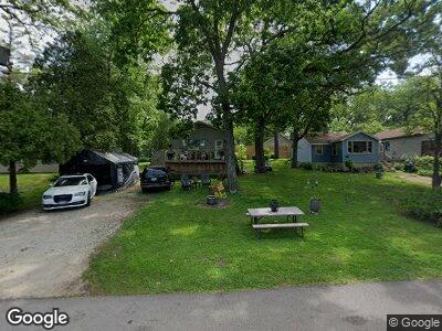
7N047 Riverside Dr Saint Charles, IL 60174
Fox River Heights NeighborhoodEstimated Value: $213,000 - $271,000
2
Beds
1
Bath
800
Sq Ft
$288/Sq Ft
Est. Value
About This Home
This home is located at 7N047 Riverside Dr, Saint Charles, IL 60174 and is currently estimated at $230,212, approximately $287 per square foot. 7N047 Riverside Dr is a home located in Kane County with nearby schools including Anderson Elementary School, Wredling Middle School, and St Charles North High School.
Ownership History
Date
Name
Owned For
Owner Type
Purchase Details
Closed on
Sep 14, 2020
Sold by
Thomas M Bradley M and Thomas Denise M
Bought by
7N047 Riverside Drive Llc
Current Estimated Value
Purchase Details
Closed on
Feb 22, 1999
Sold by
Zuk Kathryn J
Bought by
Thomas M Bradley and Thomas Denise M
Home Financials for this Owner
Home Financials are based on the most recent Mortgage that was taken out on this home.
Original Mortgage
$81,000
Interest Rate
6.92%
Create a Home Valuation Report for This Property
The Home Valuation Report is an in-depth analysis detailing your home's value as well as a comparison with similar homes in the area
Home Values in the Area
Average Home Value in this Area
Purchase History
| Date | Buyer | Sale Price | Title Company |
|---|---|---|---|
| 7N047 Riverside Drive Llc | -- | None Available | |
| Thomas M Bradley | $90,000 | Fox Title Company |
Source: Public Records
Mortgage History
| Date | Status | Borrower | Loan Amount |
|---|---|---|---|
| Previous Owner | Thomas M Bradley M | $67,500 | |
| Previous Owner | Thomas M Bradley | $76,000 | |
| Previous Owner | Thomas Bradley | $84,400 | |
| Previous Owner | Thomas M Bradley | $81,000 |
Source: Public Records
Tax History Compared to Growth
Tax History
| Year | Tax Paid | Tax Assessment Tax Assessment Total Assessment is a certain percentage of the fair market value that is determined by local assessors to be the total taxable value of land and additions on the property. | Land | Improvement |
|---|---|---|---|---|
| 2023 | $3,896 | $51,409 | $24,998 | $26,411 |
| 2022 | $4,066 | $53,158 | $26,286 | $26,872 |
| 2021 | $3,842 | $50,670 | $25,056 | $25,614 |
| 2020 | $3,492 | $45,472 | $24,589 | $20,883 |
| 2019 | $3,433 | $44,572 | $24,102 | $20,470 |
| 2018 | $3,097 | $40,118 | $24,405 | $15,713 |
| 2017 | $3,022 | $38,747 | $23,571 | $15,176 |
| 2016 | $3,004 | $35,240 | $22,743 | $12,497 |
| 2015 | -- | $27,711 | $22,498 | $5,213 |
| 2014 | -- | $28,480 | $22,498 | $5,982 |
| 2013 | -- | $33,914 | $22,723 | $11,191 |
Source: Public Records
Map
Nearby Homes
- 36W172 Silver Glen Ct
- 6N691 State Route 31
- 7N042 Smith St
- 35W343 Riverside Dr
- Lot 103 Oak Pointe Dr
- Lot 112 Whispering Trail
- 633 Endicott Rd
- 637 Endicott Rd
- 4009 Faith Ln
- 4032 Faith Ln
- 4016 Faith Ln
- 6N362 Riverside Dr
- 552 Endicott Rd
- 1000 Bristol Ct
- 1002 Bristol Ct
- 35W768 Wood Ln
- 525 Endicott Rd
- 520 Endicott Rd
- 513 Endicott Rd
- 36W703 Whispering Trail
- 7N047 Riverside Dr
- 7N037 Riverside Dr
- 7N061 Riverside Dr
- 7N042 Jackson Ave
- 7N029 Riverside Dr
- 7N054 Jackson Ave
- 7N081 Riverside Dr
- 7N005 Riverside Dr
- 7N085 Riverside Dr
- 7N039 Jackson Ave
- 7N025 Jackson Ave
- 35W825 Oak Dr
- 7N011 Jackson Ave
- 6N997 Jackson Ave
- 7N018 Irving Ave
- 7N018 Irving Ave
- 6N971 Riverside Dr
- 35W837 Oak Dr
- 6N977 Jackson Ave
- 6N977 Jackson Ave