8 Anthony Ave Cromwell, CT 06416
Estimated Value: $488,000 - $540,000
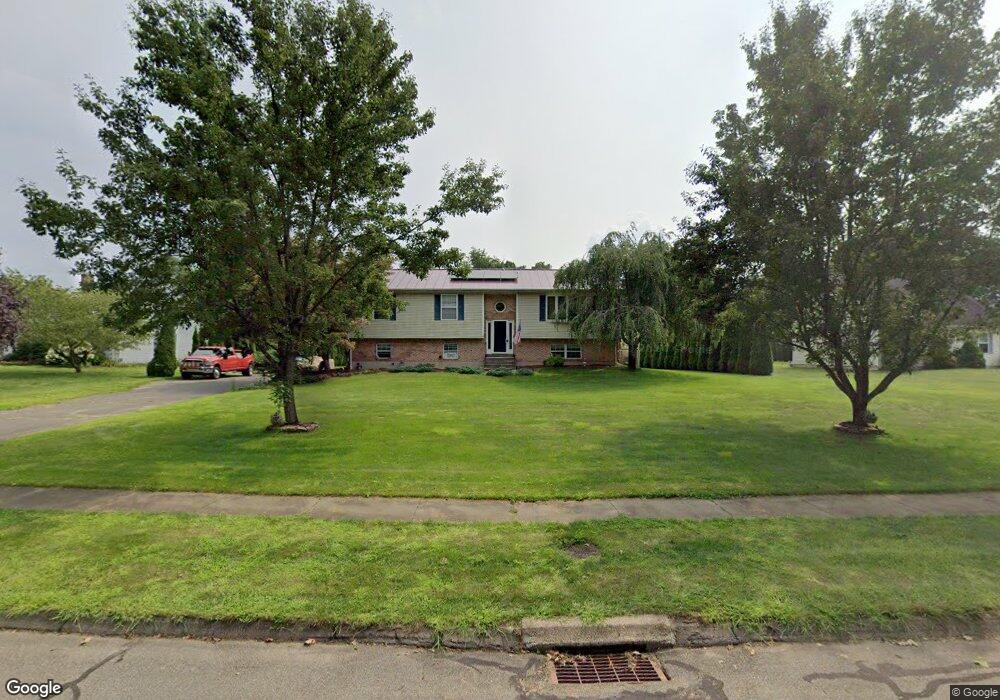
About This Home
This home is located at 8 Anthony Ave, Cromwell, CT 06416 and is currently estimated at $510,113, approximately $394 per square foot. 8 Anthony Ave is a home located in Middlesex County with nearby schools including Edna C. Stevens School, Woodside Intermediate School, and Cromwell Middle School.
Ownership History
We collect this data history from publicly available records. To have your information removed, we recommend requesting removal directly through your county’s website.
Purchase Details
Purchase Details
Purchase Details
Home Values in the Area
Average Home Value in this Area
Purchase History
We collect this data history from publicly available records. To have your information removed, we recommend requesting removal directly through your county’s website.
| Date | Buyer | Sale Price | Title Company |
|---|---|---|---|
| $335,000 | -- | ||
| $225,000 | -- | ||
| $139,900 | -- | ||
| $335,000 | -- | ||
| $225,000 | -- | ||
| $139,900 | -- |
Mortgage History
We collect this data history from publicly available records. To have your information removed, we recommend requesting removal directly through your county’s website.
| Date | Status | Borrower | Loan Amount |
|---|---|---|---|
| Open | $12,000 | ||
| Closed | $180,000 |
Tax History
We collect this data history from publicly available records. To have your information removed, we recommend requesting removal directly through your county’s website.
| Year | Tax Paid | Tax Assessment Tax Assessment Total Assessment is a certain percentage of the fair market value that is determined by local assessors to be the total taxable value of land and additions on the property. | Land | Improvement |
|---|---|---|---|---|
| 2025 | $7,977 | $259,070 | $95,690 | $163,380 |
| 2024 | $7,790 | $259,070 | $95,690 | $163,380 |
| 2023 | $7,619 | $259,070 | $95,690 | $163,380 |
| 2022 | $6,327 | $189,840 | $69,580 | $120,260 |
| 2021 | $6,327 | $189,840 | $69,580 | $120,260 |
| 2020 | $6,232 | $189,840 | $69,580 | $120,260 |
| 2019 | $6,232 | $189,840 | $69,580 | $120,260 |
| 2018 | $6,232 | $189,840 | $69,580 | $120,260 |
| 2017 | $6,327 | $186,470 | $72,900 | $113,570 |
| 2016 | $6,271 | $186,470 | $72,900 | $113,570 |
| 2015 | $5,851 | $186,470 | $72,900 | $113,570 |
| 2014 | $6,206 | $186,470 | $72,900 | $113,570 |
Map
- 170 Coles Rd
- 142 Woodland Dr
- 7 Capilos Dr
- 104 North Rd
- 13 Copper Knoll Ln
- 2217 Cromwell Hills Dr
- 1 Hunters Run
- 61 Greenview Dr
- 2324 Cromwell Hills Dr Unit 2324
- 1218 Cromwell Hills Dr Unit 1218
- 1219 Cromwell Hills Dr Unit 1219
- 11 Watch Hill Cir
- 7 Great Oak Ct
- 15 Cherokee Ct Unit 15
- 29 Midway Dr Unit 29
- 26 Glenview Dr Unit 26
- 22 Linda Ct Unit 22
- 9 Bayberry Ct
- 102 Country Club Ct
- 6 Congress Dr
Ask me questions while you tour the home.