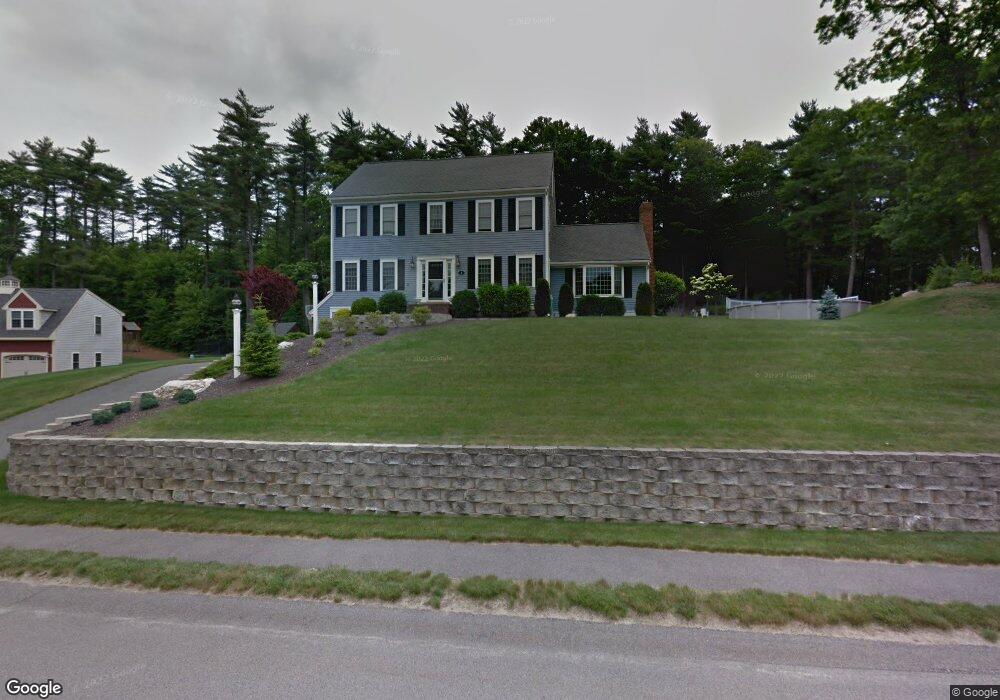
8 Audubon Ln Hanson, MA 02341
Estimated Value: $734,743 - $811,000
4
Beds
3
Baths
2,206
Sq Ft
$351/Sq Ft
Est. Value
About This Home
This home is located at 8 Audubon Ln, Hanson, MA 02341 and is currently estimated at $774,686, approximately $351 per square foot. 8 Audubon Ln is a home located in Plymouth County.
Ownership History
Date
Name
Owned For
Owner Type
Purchase Details
Closed on
Dec 14, 2023
Sold by
Wood David S and Wood Mary E
Bought by
Wood Ft and Wood
Current Estimated Value
Purchase Details
Closed on
Feb 21, 2002
Sold by
Hudson Park Assoc Nt and Burns
Bought by
Wood David S and Wood Mary E
Home Financials for this Owner
Home Financials are based on the most recent Mortgage that was taken out on this home.
Original Mortgage
$200,000
Interest Rate
7.08%
Mortgage Type
Purchase Money Mortgage
Create a Home Valuation Report for This Property
The Home Valuation Report is an in-depth analysis detailing your home's value as well as a comparison with similar homes in the area
Home Values in the Area
Average Home Value in this Area
Purchase History
| Date | Buyer | Sale Price | Title Company |
|---|---|---|---|
| Wood Ft | -- | None Available | |
| Wood David S | $140,000 | -- |
Source: Public Records
Mortgage History
| Date | Status | Borrower | Loan Amount |
|---|---|---|---|
| Previous Owner | Wood David S | $25,000 | |
| Previous Owner | Wood David S | $34,000 | |
| Previous Owner | Wood David S | $200,000 |
Source: Public Records
Tax History Compared to Growth
Tax History
| Year | Tax Paid | Tax Assessment Tax Assessment Total Assessment is a certain percentage of the fair market value that is determined by local assessors to be the total taxable value of land and additions on the property. | Land | Improvement |
|---|---|---|---|---|
| 2025 | $8,383 | $626,500 | $180,600 | $445,900 |
| 2024 | $8,213 | $613,800 | $175,300 | $438,500 |
| 2023 | $7,891 | $556,500 | $175,300 | $381,200 |
| 2022 | $7,703 | $510,500 | $159,400 | $351,100 |
| 2021 | $6,931 | $459,000 | $153,300 | $305,700 |
| 2020 | $6,829 | $447,200 | $148,100 | $299,100 |
| 2019 | $6,749 | $434,600 | $159,000 | $275,600 |
| 2018 | $6,668 | $421,200 | $152,900 | $268,300 |
| 2017 | $6,462 | $404,400 | $145,700 | $258,700 |
| 2016 | $6,557 | $396,200 | $145,700 | $250,500 |
| 2015 | $6,201 | $389,500 | $145,700 | $243,800 |
Source: Public Records
Map
Nearby Homes
- 37 Brook St
- 842 E Washington St
- 456 Gorwin Dr
- 15 Elm Place
- Lot 22 Adams Cir
- 418 E Washington St
- 1251 Broadway
- 248 E Washington St
- 269 Lakeside Rd
- 134 Crescent St
- 41 Gail Rd
- 57 Liberty St
- 553 Center St
- Lot 5 Princeton Way
- 456 Maquan St
- 114 Graham Hill Dr
- Lot 2 Harvard Rd
- Lot 6 Way
- 436 Center St
- 136 W Elm St