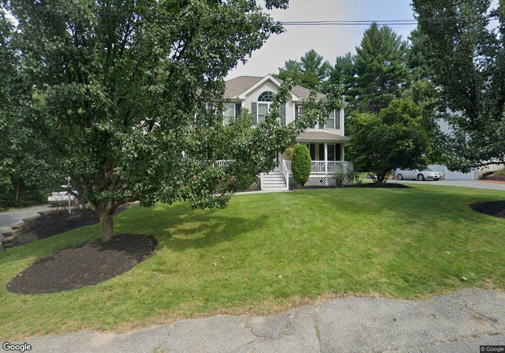
8 Bartlett Rd Methuen, MA 01844
The West End NeighborhoodEstimated Value: $761,064 - $857,000
4
Beds
3
Baths
2,608
Sq Ft
$313/Sq Ft
Est. Value
About This Home
This home is located at 8 Bartlett Rd, Methuen, MA 01844 and is currently estimated at $816,266, approximately $312 per square foot. 8 Bartlett Rd is a home located in Essex County with nearby schools including Tenney Grammar School, Methuen High School, and The Birches Academy of Academics and Art.
Ownership History
Date
Name
Owned For
Owner Type
Purchase Details
Closed on
Jun 22, 2005
Sold by
Century Bldrs Inc
Bought by
Mccormick Allyson
Current Estimated Value
Home Financials for this Owner
Home Financials are based on the most recent Mortgage that was taken out on this home.
Original Mortgage
$419,920
Interest Rate
5.82%
Mortgage Type
Purchase Money Mortgage
Create a Home Valuation Report for This Property
The Home Valuation Report is an in-depth analysis detailing your home's value as well as a comparison with similar homes in the area
Home Values in the Area
Average Home Value in this Area
Purchase History
| Date | Buyer | Sale Price | Title Company |
|---|---|---|---|
| Mccormick Allyson | $524,900 | -- | |
| Mccormick Allyson | $524,900 | -- |
Source: Public Records
Mortgage History
| Date | Status | Borrower | Loan Amount |
|---|---|---|---|
| Open | Mccormick Allyson | $415,000 | |
| Closed | Mccormick Allyson | $419,920 |
Source: Public Records
Tax History
| Year | Tax Paid | Tax Assessment Tax Assessment Total Assessment is a certain percentage of the fair market value that is determined by local assessors to be the total taxable value of land and additions on the property. | Land | Improvement |
|---|---|---|---|---|
| 2025 | $7,151 | $675,900 | $236,800 | $439,100 |
| 2024 | $7,043 | $648,500 | $208,000 | $440,500 |
| 2023 | $6,758 | $577,600 | $184,000 | $393,600 |
| 2022 | $6,491 | $497,400 | $160,000 | $337,400 |
| 2021 | $6,099 | $462,400 | $152,000 | $310,400 |
| 2020 | $6,033 | $448,900 | $152,000 | $296,900 |
| 2019 | $5,948 | $419,200 | $144,000 | $275,200 |
| 2018 | $5,784 | $405,300 | $144,000 | $261,300 |
| 2017 | $5,599 | $382,200 | $144,000 | $238,200 |
| 2016 | $5,591 | $377,500 | $144,000 | $233,500 |
| 2015 | $5,377 | $368,300 | $144,000 | $224,300 |
Source: Public Records
Map
Nearby Homes
- 255 Hampshire St
- 25 Carol Ave
- 8 Ridgeview Ave
- 19 Hampshire Rd Unit 304
- 21 Hampshire Rd Unit 111
- 28 Eagle Dr
- 0 Hampshire Rd
- 281 Broadway
- 23 Bentley Cir
- 17 Maguire St
- Lot 108 Garden City Rd
- 83 Arnold St
- 28 Currier Ave
- 7 Field Ave
- 123 Lawrence St
- 6 Huse Rd
- 64-66 Howe St
- 20 Ruskin Ave
- 24 Railroad St
- 115-117 Oakland Ave
- 10 Bartlett Rd
- 6 Bartlett Rd
- 4 Bartlett Rd
- 11 Melissa Cir
- 9 Bartlett Rd
- 7 Melissa Cir
- 15 Bartlett Rd
- 14 Bartlett Rd
- 5 Bartlett Rd
- 8 Melissa Cir
- 3 Bartlett Rd
- 18 Bartlett Rd
- 223 Hampshire St
- 221 Hampshire St
- 219 Hampshire St
- 39 Gaywood Cir
- 35 Gaywood Cir
- 251 Hampshire St
- 25 Gaywood Cir
- 215 Hampshire St
Your Personal Tour Guide
Ask me questions while you tour the home.