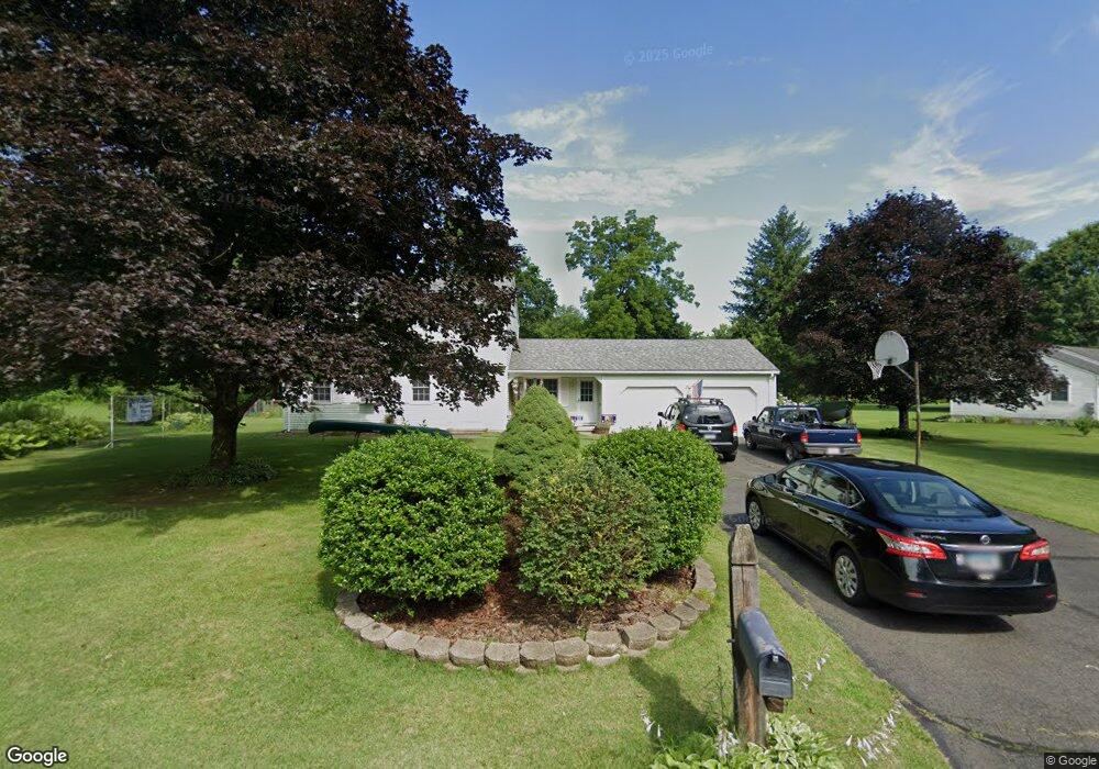
8 Chrismis Tree Ln East Granby, CT 06026
Estimated Value: $428,000 - $480,000
3
Beds
2
Baths
1,850
Sq Ft
$241/Sq Ft
Est. Value
About This Home
This home is located at 8 Chrismis Tree Ln, East Granby, CT 06026 and is currently estimated at $445,360, approximately $240 per square foot. 8 Chrismis Tree Ln is a home located in Hartford County with nearby schools including Carl Allgrove Elementary School, R. Dudley Seymour Elementary School, and East Granby Middle School.
Ownership History
Date
Name
Owned For
Owner Type
Purchase Details
Closed on
Nov 2, 2000
Sold by
Brogan Robert and Brogan Joan
Bought by
Moore James and Moore Jessica
Current Estimated Value
Home Financials for this Owner
Home Financials are based on the most recent Mortgage that was taken out on this home.
Original Mortgage
$193,800
Interest Rate
7.83%
Mortgage Type
Purchase Money Mortgage
Purchase Details
Closed on
Aug 31, 2000
Sold by
Southington Sb
Bought by
Fasulo Michael J and Defeo Michael T
Create a Home Valuation Report for This Property
The Home Valuation Report is an in-depth analysis detailing your home's value as well as a comparison with similar homes in the area
Home Values in the Area
Average Home Value in this Area
Purchase History
| Date | Buyer | Sale Price | Title Company |
|---|---|---|---|
| Moore James | $204,000 | -- | |
| Fasulo Michael J | $65,000 | -- |
Source: Public Records
Mortgage History
| Date | Status | Borrower | Loan Amount |
|---|---|---|---|
| Open | Fasulo Michael J | $175,900 | |
| Closed | Fasulo Michael J | $196,000 | |
| Closed | Fasulo Michael J | $193,800 |
Source: Public Records
Tax History Compared to Growth
Tax History
| Year | Tax Paid | Tax Assessment Tax Assessment Total Assessment is a certain percentage of the fair market value that is determined by local assessors to be the total taxable value of land and additions on the property. | Land | Improvement |
|---|---|---|---|---|
| 2025 | $7,027 | $230,400 | $58,700 | $171,700 |
| 2024 | $6,866 | $230,400 | $58,700 | $171,700 |
| 2023 | $6,215 | $171,200 | $56,000 | $115,200 |
| 2022 | $5,838 | $171,200 | $56,000 | $115,200 |
| 2021 | $5,752 | $171,200 | $56,000 | $115,200 |
| 2020 | $5,684 | $171,200 | $56,000 | $115,200 |
| 2019 | $5,615 | $171,200 | $56,000 | $115,200 |
| 2018 | $5,567 | $168,700 | $54,900 | $113,800 |
| 2017 | $5,466 | $168,700 | $54,900 | $113,800 |
| 2016 | $5,247 | $168,700 | $54,900 | $113,800 |
| 2015 | $5,128 | $168,700 | $54,900 | $113,800 |
| 2014 | $5,027 | $168,700 | $54,900 | $113,800 |
Source: Public Records
Map
Nearby Homes
- 7 Peppercorn Ln
- 4 Sage Ln
- 68 Tariffville Rd
- 9 Tunxis Place
- 5 Tunxis Place Unit C
- 6 Spoonville Rd
- 16 Hilltop Rd
- 23 Maple St
- 14 Loren Cir
- 39 Loren Cir
- 14 Main Street Extension
- 49 Seymour Rd
- 46 Hatchet Hill Rd
- 158 Tariffville Rd
- 14 Teal Cir Unit 14
- 552 Stone Rd
- 11 Mallard Cir
- 2 Quail Dr Unit 2
- 999 Stone Rd
- 220 Castlewood
- 6 Chrismis Tree Ln
- 141 Spoonville Rd
- 137 Spoonville Rd
- 143 Spoonville Rd
- 4 Chrismis Tree Ln
- 135 Spoonville Rd
- 7 Chrismis Tree Ln
- 3 Chrismis Tree Ln
- 5 Chrismis Tree Ln
- 145 Spoonville Rd
- 129 Spoonville Rd
- 127 Spoonville Rd
- 123 Spoonville Rd
- 118 Spoonville Rd
- 149 Spoonville Rd
- 153 Spoonville Rd
- 124 Spoonville Rd
- 126 Spoonville Rd
- 121 Spoonville Rd
- 150 Spoonville Rd