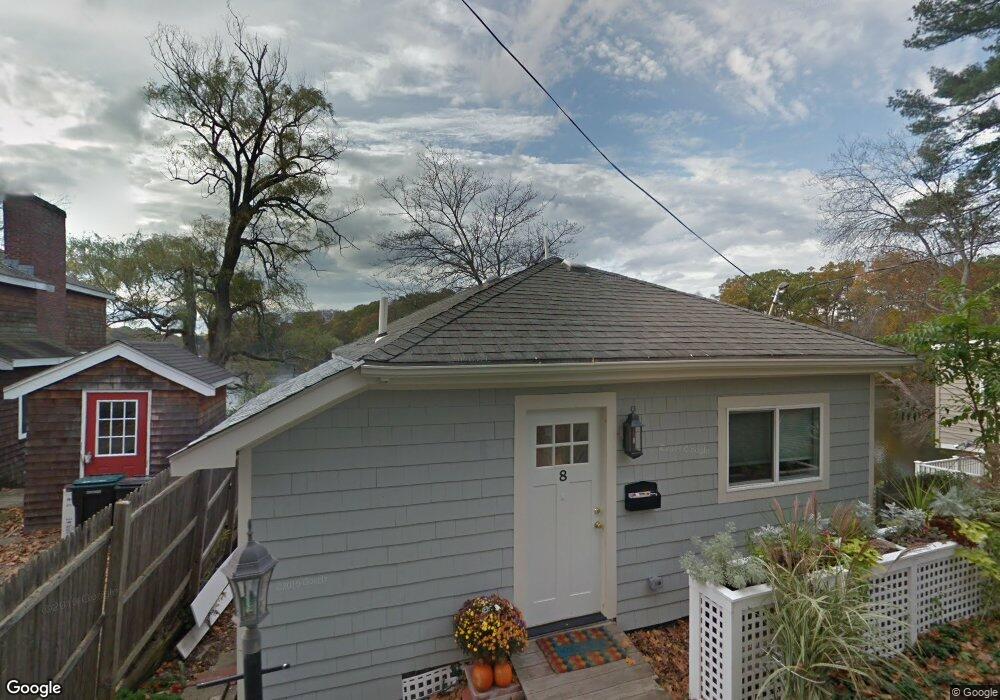
8 Crest Rd Wayland, MA 01778
Estimated Value: $583,000 - $720,000
1
Bed
1
Bath
730
Sq Ft
$912/Sq Ft
Est. Value
About This Home
This home is located at 8 Crest Rd, Wayland, MA 01778 and is currently estimated at $666,084, approximately $912 per square foot. 8 Crest Rd is a home located in Middlesex County with nearby schools including Wayland High School and Veritas Christian Academy.
Ownership History
Date
Name
Owned For
Owner Type
Purchase Details
Closed on
Apr 28, 2021
Sold by
Wells Victoria P
Bought by
Mahlowitz David and Wells Victoria P
Current Estimated Value
Home Financials for this Owner
Home Financials are based on the most recent Mortgage that was taken out on this home.
Original Mortgage
$407,250
Outstanding Balance
$369,070
Interest Rate
3.1%
Mortgage Type
New Conventional
Estimated Equity
$297,014
Purchase Details
Closed on
May 8, 2015
Sold by
Young Barbara J Est
Bought by
Wells Victoria P
Create a Home Valuation Report for This Property
The Home Valuation Report is an in-depth analysis detailing your home's value as well as a comparison with similar homes in the area
Home Values in the Area
Average Home Value in this Area
Purchase History
| Date | Buyer | Sale Price | Title Company |
|---|---|---|---|
| Mahlowitz David | -- | None Available | |
| Mahlowitz David | -- | None Available | |
| Wells Victoria P | $125,000 | -- | |
| Wells Victoria P | $125,000 | -- |
Source: Public Records
Mortgage History
| Date | Status | Borrower | Loan Amount |
|---|---|---|---|
| Open | Mahlowitz David | $407,250 | |
| Closed | Mahlowitz David | $407,250 |
Source: Public Records
Tax History
| Year | Tax Paid | Tax Assessment Tax Assessment Total Assessment is a certain percentage of the fair market value that is determined by local assessors to be the total taxable value of land and additions on the property. | Land | Improvement |
|---|---|---|---|---|
| 2025 | $10,533 | $673,900 | $537,000 | $136,900 |
| 2024 | $9,968 | $642,300 | $511,400 | $130,900 |
| 2023 | $9,692 | $582,100 | $464,900 | $117,200 |
| 2022 | $8,081 | $440,400 | $320,900 | $119,500 |
| 2021 | $7,349 | $396,800 | $291,700 | $105,100 |
| 2020 | $6,967 | $392,300 | $291,700 | $100,600 |
| 2019 | $12,083 | $359,000 | $269,900 | $89,100 |
| 2018 | $6,379 | $353,800 | $269,900 | $83,900 |
| 2017 | $5,952 | $328,100 | $257,000 | $71,100 |
| 2016 | $4,925 | $284,000 | $252,000 | $32,000 |
Source: Public Records
Map
Nearby Homes
- 108 Dudley Rd
- 123 Dudley Rd
- 22 Lake Shore Dr
- 186 Main St
- 26 Pine Ridge Rd
- 22 Pine Ridge Rd
- 45 W Plain St Unit 1
- 225 W Plain St
- 136 Commonwealth Rd
- 37 Davelin Rd
- 1 Cole Rd
- 5 Griffin Cir
- 218 Old Connecticut Path
- 35 Snake Brook Rd
- 1 Foley Dr
- 2 Darby Ct
- 18 Jay Dr
- 83 Felch Rd
- 67 Meadow St
- 689 Old Connecticut Path
Your Personal Tour Guide
Ask me questions while you tour the home.