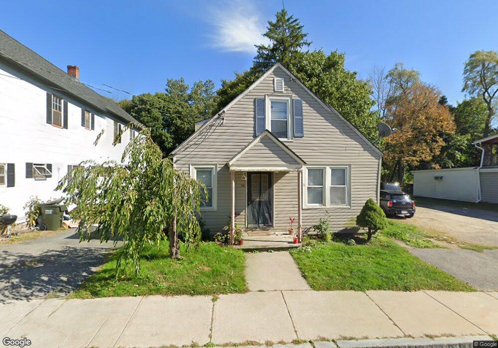
8 Crystal St Lenox Dale, MA 01242
Estimated Value: $332,000 - $491,000
3
Beds
--
Bath
2,300
Sq Ft
$180/Sq Ft
Est. Value
About This Home
This home is located at 8 Crystal St, Lenox Dale, MA 01242 and is currently estimated at $414,905, approximately $180 per square foot. 8 Crystal St is a home located in Berkshire County with nearby schools including Morris Elementary School, Lenox Memorial High School, and The Montessori School of the Berkshires.
Ownership History
Date
Name
Owned For
Owner Type
Purchase Details
Closed on
Apr 16, 2020
Sold by
Shove Kathleen E and Us Bank Na
Bought by
Us Bank Na Tr
Current Estimated Value
Purchase Details
Closed on
Jul 7, 2000
Sold by
Tanner Brain L and Tanner Dale E
Bought by
Crawford William H and Crawford Donna J
Home Financials for this Owner
Home Financials are based on the most recent Mortgage that was taken out on this home.
Original Mortgage
$210,000
Interest Rate
8.55%
Mortgage Type
Purchase Money Mortgage
Purchase Details
Closed on
Jun 20, 1997
Sold by
Liston Robert W
Bought by
Shove Richard M and Shove Kathleen E
Home Financials for this Owner
Home Financials are based on the most recent Mortgage that was taken out on this home.
Original Mortgage
$22,000
Interest Rate
7.87%
Mortgage Type
Purchase Money Mortgage
Create a Home Valuation Report for This Property
The Home Valuation Report is an in-depth analysis detailing your home's value as well as a comparison with similar homes in the area
Home Values in the Area
Average Home Value in this Area
Purchase History
| Date | Buyer | Sale Price | Title Company |
|---|---|---|---|
| Us Bank Na Tr | $129,709 | None Available | |
| Crawford William H | $15,000 | -- | |
| Shove Richard M | $72,000 | -- |
Source: Public Records
Mortgage History
| Date | Status | Borrower | Loan Amount |
|---|---|---|---|
| Previous Owner | Shove Richard M | $210,000 | |
| Previous Owner | Shove Richard M | $22,000 |
Source: Public Records
Tax History Compared to Growth
Tax History
| Year | Tax Paid | Tax Assessment Tax Assessment Total Assessment is a certain percentage of the fair market value that is determined by local assessors to be the total taxable value of land and additions on the property. | Land | Improvement |
|---|---|---|---|---|
| 2025 | $3,189 | $352,400 | $55,600 | $296,800 |
| 2024 | $2,746 | $302,800 | $52,400 | $250,400 |
| 2023 | $2,849 | $311,000 | $49,400 | $261,600 |
| 2022 | $2,533 | $233,700 | $41,200 | $192,500 |
| 2021 | $2,472 | $212,200 | $37,800 | $174,400 |
| 2020 | $2,608 | $215,500 | $36,700 | $178,800 |
| 2019 | $2,513 | $210,300 | $36,700 | $173,600 |
| 2018 | $2,608 | $212,100 | $36,000 | $176,100 |
| 2017 | $2,559 | $209,600 | $35,300 | $174,300 |
| 2016 | $2,534 | $208,400 | $35,300 | $173,100 |
| 2015 | $2,457 | $199,300 | $32,800 | $166,500 |
Source: Public Records
Map
Nearby Homes
- 528 Walker St
- 524 Walker St
- 55 Crystal St
- 15 Golden Hill Rd
- 8 Catherine St
- 16 Sedgwick Ln Unit 40
- 615 Laurel St
- 286 Lee Rd
- 46 Galway Ct
- 355 Laurel St
- 46 Pease Terrace
- 30 Pease Terrace
- 155 Laurel St
- 0 East St Unit 235893
- 175 Center St Unit 3
- 180 Center St
- 205 High St
- 20 Bentrup Ct
- 208 Main St
- 0 East St