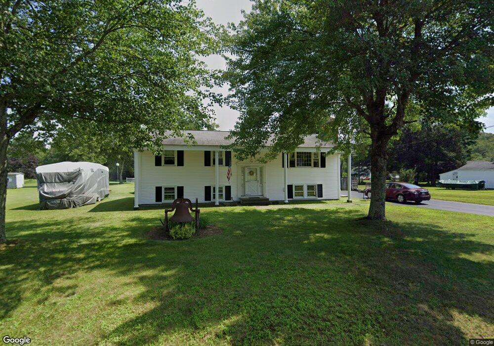
8 Darling Ln Sutton, MA 01590
Estimated Value: $406,077 - $536,000
3
Beds
1
Bath
1,222
Sq Ft
$366/Sq Ft
Est. Value
About This Home
This home is located at 8 Darling Ln, Sutton, MA 01590 and is currently estimated at $447,769, approximately $366 per square foot. 8 Darling Ln is a home located in Worcester County with nearby schools including Sutton Elementary School, Sutton Middle School, and Sutton High School.
Create a Home Valuation Report for This Property
The Home Valuation Report is an in-depth analysis detailing your home's value as well as a comparison with similar homes in the area
Home Values in the Area
Average Home Value in this Area
Tax History
| Year | Tax Paid | Tax Assessment Tax Assessment Total Assessment is a certain percentage of the fair market value that is determined by local assessors to be the total taxable value of land and additions on the property. | Land | Improvement |
|---|---|---|---|---|
| 2025 | $5,425 | $407,900 | $148,500 | $259,400 |
| 2024 | $5,709 | $413,100 | $142,200 | $270,900 |
| 2023 | $5,338 | $354,200 | $128,600 | $225,600 |
| 2022 | $5,004 | $302,200 | $102,900 | $199,300 |
| 2021 | $4,695 | $267,800 | $102,900 | $164,900 |
| 2020 | $4,501 | $260,900 | $102,900 | $158,000 |
| 2019 | $4,234 | $239,900 | $99,300 | $140,600 |
| 2018 | $10,525 | $216,300 | $84,400 | $131,900 |
| 2017 | $3,723 | $209,500 | $74,100 | $135,400 |
| 2016 | $9,981 | $204,300 | $74,100 | $130,200 |
| 2015 | $3,545 | $197,400 | $74,100 | $123,300 |
| 2014 | $3,376 | $185,500 | $72,000 | $113,500 |
Source: Public Records
Map
Nearby Homes
- 108 Mumford St
- 4 1st St
- 36 Compass Point Dr Unit 36
- 19 Birch St
- 33 Nautical Way Unit 107
- 26 Compass Point Dr Unit 26
- 8 Hough Rd
- 22 Gilboa St
- 5 B St
- 80 Barnett Rd
- 408 NE Main St
- 266 Putnam Hill Rd
- 2 White Ct
- 8 Wallis St
- 18 Lakeshore Dr
- 3 S East Main St
- 198 Uxbridge Rd
- 28 Johnson Rd
- 201 Prescott Rd
- Lot 27 Cedar St
Your Personal Tour Guide
Ask me questions while you tour the home.