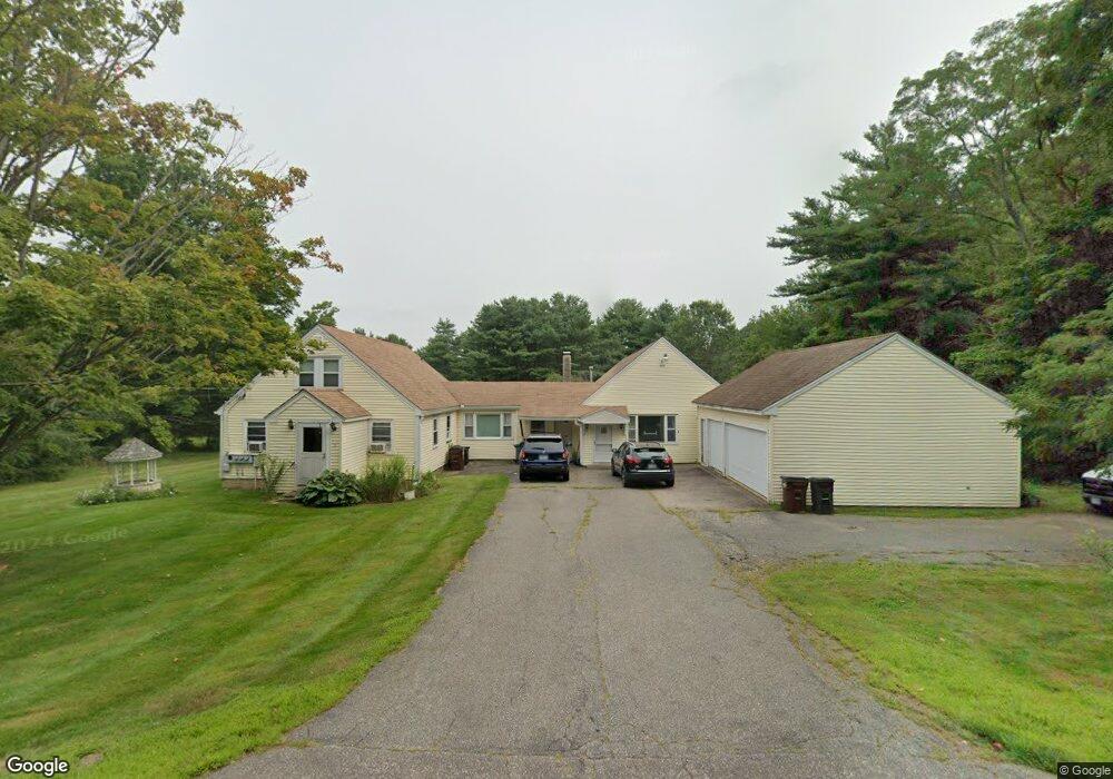
8 Fox Point Rd Newington, NH 03801
Estimated Value: $1,080,281 - $1,456,000
4
Beds
3
Baths
2,450
Sq Ft
$491/Sq Ft
Est. Value
About This Home
This home is located at 8 Fox Point Rd, Newington, NH 03801 and is currently estimated at $1,203,820, approximately $491 per square foot. 8 Fox Point Rd is a home located in Rockingham County with nearby schools including Newington Public School.
Ownership History
Date
Name
Owned For
Owner Type
Purchase Details
Closed on
Nov 7, 2012
Sold by
Packard Beverly N and Lord Annette L
Bought by
Lord Annette L and Packard Beverly N
Current Estimated Value
Home Financials for this Owner
Home Financials are based on the most recent Mortgage that was taken out on this home.
Original Mortgage
$114,000
Outstanding Balance
$78,888
Interest Rate
3.42%
Mortgage Type
Purchase Money Mortgage
Estimated Equity
$1,124,932
Create a Home Valuation Report for This Property
The Home Valuation Report is an in-depth analysis detailing your home's value as well as a comparison with similar homes in the area
Home Values in the Area
Average Home Value in this Area
Purchase History
| Date | Buyer | Sale Price | Title Company |
|---|---|---|---|
| Lord Annette L | -- | -- |
Source: Public Records
Mortgage History
| Date | Status | Borrower | Loan Amount |
|---|---|---|---|
| Open | Lord Annette L | $114,000 |
Source: Public Records
Tax History Compared to Growth
Tax History
| Year | Tax Paid | Tax Assessment Tax Assessment Total Assessment is a certain percentage of the fair market value that is determined by local assessors to be the total taxable value of land and additions on the property. | Land | Improvement |
|---|---|---|---|---|
| 2024 | $6,337 | $804,200 | $449,900 | $354,300 |
| 2023 | $8,632 | $512,600 | $228,000 | $284,600 |
| 2022 | $5,064 | $512,600 | $228,000 | $284,600 |
| 2021 | $5,116 | $512,600 | $228,000 | $284,600 |
| 2020 | $5,070 | $512,600 | $228,000 | $284,600 |
| 2018 | $4,599 | $496,100 | $214,200 | $281,900 |
| 2017 | $59 | $486,300 | $214,200 | $272,100 |
| 2016 | $4,539 | $496,100 | $214,200 | $281,900 |
| 2015 | $4,225 | $444,700 | $171,400 | $273,300 |
| 2014 | $4,322 | $444,700 | $253,390 | $191,310 |
| 2011 | $3,567 | $398,500 | $135,800 | $262,700 |
Source: Public Records
Map
Nearby Homes
- 10 Shipwright Way
- 36 Shipwright Way
- 71 Shipwright Way
- 0 Franks Fort Island Unit 1631886
- SLIP 15 Little Bay Marina
- 18 Little Bay Dr
- 33 Little Bay Dr
- 28 Little Bay Dr
- 27 Wentworth Terrace
- 348 Dover Point Rd
- 354 Dover Point Rd
- 0 Cote Dr
- 10 Shipping Ln
- 15 Shipping Ln
- 59 Clearwater Dr
- 1338 Woodbury Ave Unit 10
- 171 Echo Ave
- 5 Blue Heron Dr
- 25 Rogers Point Dr
- 51 Granite St
- 16 Fox Point Rd
- 7 Fox Point Rd
- 11 Fox Point Rd
- 1 Fox Point Rd
- 19 Fox Point Rd
- 28 Fox Point Rd
- 27 Fox Point Rd
- 37 Fox Point Rd
- 50 Fox Point Rd
- 47 Fox Point Rd
- 52 Fox Point Rd
- 40 Hannah Ln
- 24 Fox Point Rd
- 10 Lydia Ln
- 10 Nimble Hill Rd
- 58 Fox Point Rd
- 30 Hannah Ln
- 105 Nimble Hill Rd
- 41 Hannah Ln
- 12 Lydia Ln