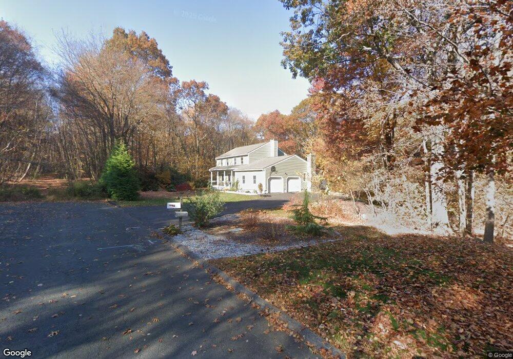
8 Harvest Hill Unit ROAD Wolcott, CT 06716
Estimated Value: $474,000 - $570,000
4
Beds
7
Baths
2,192
Sq Ft
$236/Sq Ft
Est. Value
About This Home
This home is located at 8 Harvest Hill Unit ROAD, Wolcott, CT 06716 and is currently estimated at $516,435, approximately $235 per square foot. 8 Harvest Hill Unit ROAD is a home located in New Haven County with nearby schools including Tyrrell Middle School and Wolcott High School.
Ownership History
Date
Name
Owned For
Owner Type
Purchase Details
Closed on
Oct 19, 2009
Sold by
Bassett Mark A and Bassett Stacey E
Bought by
Ehmer Cathleen D and Ehmer Eric J
Current Estimated Value
Home Financials for this Owner
Home Financials are based on the most recent Mortgage that was taken out on this home.
Original Mortgage
$224,000
Interest Rate
5.14%
Purchase Details
Closed on
Sep 29, 1994
Sold by
Schirmer Robert G and Arnold James J
Bought by
Bassett Mark A and Bassett Stacey E
Create a Home Valuation Report for This Property
The Home Valuation Report is an in-depth analysis detailing your home's value as well as a comparison with similar homes in the area
Home Values in the Area
Average Home Value in this Area
Purchase History
| Date | Buyer | Sale Price | Title Company |
|---|---|---|---|
| Ehmer Cathleen D | $280,000 | -- | |
| Bassett Mark A | $164,000 | -- |
Source: Public Records
Mortgage History
| Date | Status | Borrower | Loan Amount |
|---|---|---|---|
| Open | Bassett Mark A | $236,000 | |
| Closed | Bassett Mark A | $25,000 | |
| Closed | Bassett Mark A | $224,000 |
Source: Public Records
Tax History Compared to Growth
Tax History
| Year | Tax Paid | Tax Assessment Tax Assessment Total Assessment is a certain percentage of the fair market value that is determined by local assessors to be the total taxable value of land and additions on the property. | Land | Improvement |
|---|---|---|---|---|
| 2025 | $8,466 | $235,630 | $70,370 | $165,260 |
| 2024 | $7,792 | $235,630 | $70,370 | $165,260 |
| 2023 | $7,510 | $235,630 | $70,370 | $165,260 |
| 2022 | $7,257 | $235,630 | $70,370 | $165,260 |
| 2021 | $7,165 | $216,210 | $69,550 | $146,660 |
| 2020 | $7,165 | $216,210 | $69,550 | $146,660 |
| 2019 | $7,165 | $216,210 | $69,550 | $146,660 |
| 2018 | $6,962 | $216,210 | $69,550 | $146,660 |
| 2017 | $6,752 | $215,920 | $69,550 | $146,370 |
| 2016 | $6,800 | $235,200 | $68,730 | $166,470 |
| 2015 | $6,593 | $234,780 | $68,730 | $166,050 |
| 2014 | $6,379 | $234,780 | $68,730 | $166,050 |
Source: Public Records
Map
Nearby Homes
- 81 Allentown Rd
- 195 Andrews Rd
- Lots 70B and 71B Spindle Hill Rd
- 10 Country Garden Ct
- 33 Jacqueline Dr
- 353 Allentown Rd
- 5 Evas Terrace
- 275 Allentown Rd
- 13 Williams Ct
- 65 Meyers Rd
- 55 Colby Ln
- 49 Forestview Dr
- 1166 Spindle Hill Rd
- 141 Chicory Dr
- 16 Oakengate Rd
- 4 Park Ave Unit 1
- 981 Wolcott Rd
- 81 Hidden Pond Dr
- 75 Kingswood Ln
- 866 Wolcott Rd
- 8 Harvest Hill
- 2 Harvest Hill
- 7 Harvest Hill
- 14 Diamond Rock Rd
- 26 Diamond Rock Rd
- 20 Diamond Rock Rd
- 13 Diamond Rock Rd
- 32 Diamond Rock Rd
- 113 Allentown Rd
- 8 Diamond Rock Rd
- 7 Diamond Rock Rd
- 19 Diamond Rock Rd
- 1 Diamond Rock Rd
- 2 Diamond Rock Rd
- 109 Allentown Rd
- 73 Todd Hollow Rd
- 79 Todd Hollow Rd
- 75 Allentown Rd
- 75 Allentown Rd Unit B
- 105 Allentown Rd