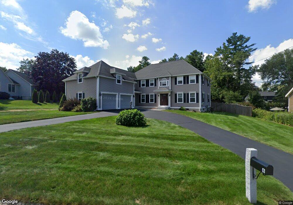
8 Lansing Dr Nashua, NH 03062
Southwest Nashua NeighborhoodEstimated Value: $848,419 - $963,000
5
Beds
3
Baths
3,497
Sq Ft
$262/Sq Ft
Est. Value
About This Home
This home is located at 8 Lansing Dr, Nashua, NH 03062 and is currently estimated at $914,855, approximately $261 per square foot. 8 Lansing Dr is a home located in Hillsborough County with nearby schools including Bicentennial Elementary School, Fairgrounds Middle School, and Nashua High School South.
Ownership History
Date
Name
Owned For
Owner Type
Purchase Details
Closed on
Sep 3, 2019
Sold by
Mazzapica Carol J
Bought by
Carol J Mazzapica Ret
Current Estimated Value
Purchase Details
Closed on
Sep 1, 1987
Bought by
Mazzapica John and Mazzapica Carol
Create a Home Valuation Report for This Property
The Home Valuation Report is an in-depth analysis detailing your home's value as well as a comparison with similar homes in the area
Home Values in the Area
Average Home Value in this Area
Purchase History
| Date | Buyer | Sale Price | Title Company |
|---|---|---|---|
| Carol J Mazzapica Ret | -- | -- | |
| Mazzapica John | $345,600 | -- |
Source: Public Records
Mortgage History
| Date | Status | Borrower | Loan Amount |
|---|---|---|---|
| Previous Owner | Mazzapica John | $250,000 | |
| Previous Owner | Mazzapica John | $50,000 |
Source: Public Records
Tax History Compared to Growth
Tax History
| Year | Tax Paid | Tax Assessment Tax Assessment Total Assessment is a certain percentage of the fair market value that is determined by local assessors to be the total taxable value of land and additions on the property. | Land | Improvement |
|---|---|---|---|---|
| 2024 | $13,168 | $828,200 | $181,700 | $646,500 |
| 2023 | $12,546 | $688,200 | $145,300 | $542,900 |
| 2022 | $12,436 | $688,200 | $145,300 | $542,900 |
| 2021 | $11,798 | $508,100 | $106,600 | $401,500 |
| 2020 | $11,488 | $508,100 | $106,600 | $401,500 |
| 2019 | $10,954 | $503,400 | $106,600 | $396,800 |
| 2018 | $10,677 | $503,400 | $106,600 | $396,800 |
| 2017 | $11,239 | $435,800 | $90,400 | $345,400 |
| 2016 | $10,910 | $435,200 | $90,400 | $344,800 |
| 2015 | $10,675 | $435,200 | $90,400 | $344,800 |
| 2014 | $10,467 | $435,200 | $90,400 | $344,800 |
Source: Public Records
Map
Nearby Homes
- 285 E Dunstable Rd
- 10 Lamb Rd
- 84 Hawthorne Village Rd Unit U414
- 29 Dickens St
- 16 Mountain Laurels Dr Unit 402
- 51 Legacy Dr
- 5 Appaloosa Place
- 125 Lille Rd
- 10 Mountain Laurels Dr Unit 606
- 19 Georgetown Dr
- 57 Wethersfield Rd
- 32 Cadogan Way Unit UZ257
- 31 Tenby Dr
- 8 Hikers Ln
- 7 Doucet Ave
- 4 Hikers Ln
- 65 Wilderness Dr
- 58 Wilderness Dr
- 50 Wilderness Dr
- 4 Wilderness Dr
- 6 Lansing Dr
- 10 Lansing Dr
- 282 E Dunstable Rd
- 7 Lansing Dr
- 12 Lansing Dr
- 5 Lansing Dr
- 6 Bicentennial Dr
- 9 Lansing Dr
- 278 E Dunstable Rd
- 278 E Dunstable Rd
- 4 Bicentennial Dr
- 14 Lansing Dr
- 11 Lansing Dr
- 14 Bicentennial Dr
- 1 Rosecliff Dr
- 280 E Dunstable Rd
- 2 Rosecliff Dr
- 15 Lansing Dr
- 0 E Dunstable Rd
- 16 Bicentennial Dr