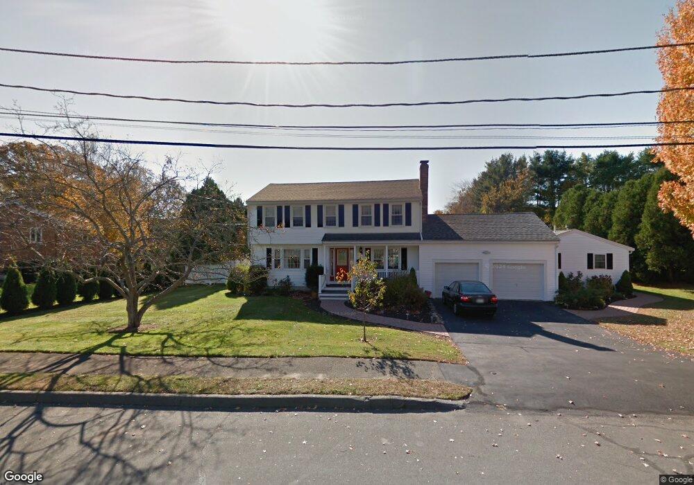
8 Locksley Rd Danvers, MA 01923
Estimated Value: $844,000 - $1,148,000
5
Beds
4
Baths
2,657
Sq Ft
$374/Sq Ft
Est. Value
About This Home
This home is located at 8 Locksley Rd, Danvers, MA 01923 and is currently estimated at $992,439, approximately $373 per square foot. 8 Locksley Rd is a home located in Essex County with nearby schools including Danvers High School, St. Mary of the Annunciation School, and St. John's Prep.
Ownership History
Date
Name
Owned For
Owner Type
Purchase Details
Closed on
Oct 30, 2000
Sold by
Garron Scott B and Garron Annmarie
Bought by
Okeefe Cathleen
Current Estimated Value
Purchase Details
Closed on
Jun 30, 1998
Sold by
Falkowski Edward J and Falkowski Doreen A
Bought by
Garron Scott B and Garron Annmarie
Purchase Details
Closed on
Dec 15, 1993
Sold by
Bisgrove Stella M
Bought by
Falkowski Edward J and Falkowski Doreen A
Create a Home Valuation Report for This Property
The Home Valuation Report is an in-depth analysis detailing your home's value as well as a comparison with similar homes in the area
Home Values in the Area
Average Home Value in this Area
Purchase History
| Date | Buyer | Sale Price | Title Company |
|---|---|---|---|
| Okeefe Cathleen | $381,900 | -- | |
| Garron Scott B | $290,000 | -- | |
| Falkowski Edward J | $255,000 | -- |
Source: Public Records
Mortgage History
| Date | Status | Borrower | Loan Amount |
|---|---|---|---|
| Open | Falkowski Edward J | $339,000 | |
| Closed | Falkowski Edward J | $352,000 |
Source: Public Records
Tax History
| Year | Tax Paid | Tax Assessment Tax Assessment Total Assessment is a certain percentage of the fair market value that is determined by local assessors to be the total taxable value of land and additions on the property. | Land | Improvement |
|---|---|---|---|---|
| 2025 | $9,510 | $865,300 | $405,400 | $459,900 |
| 2024 | $9,354 | $841,900 | $398,700 | $443,200 |
| 2023 | $8,972 | $763,600 | $364,900 | $398,700 |
| 2022 | $8,830 | $697,500 | $324,400 | $373,100 |
| 2021 | $8,718 | $653,000 | $320,400 | $332,600 |
| 2020 | $8,834 | $676,400 | $320,400 | $356,000 |
| 2019 | $8,427 | $634,600 | $290,700 | $343,900 |
| 2018 | $8,263 | $610,300 | $290,700 | $319,600 |
| 2017 | $7,829 | $551,700 | $250,200 | $301,500 |
| 2016 | $7,546 | $531,400 | $236,700 | $294,700 |
| 2015 | $7,379 | $494,900 | $216,400 | $278,500 |
Source: Public Records
Map
Nearby Homes
Your Personal Tour Guide
Ask me questions while you tour the home.