Estimated Value: $480,499 - $544,000
3
Beds
1
Bath
1,209
Sq Ft
$424/Sq Ft
Est. Value
About This Home
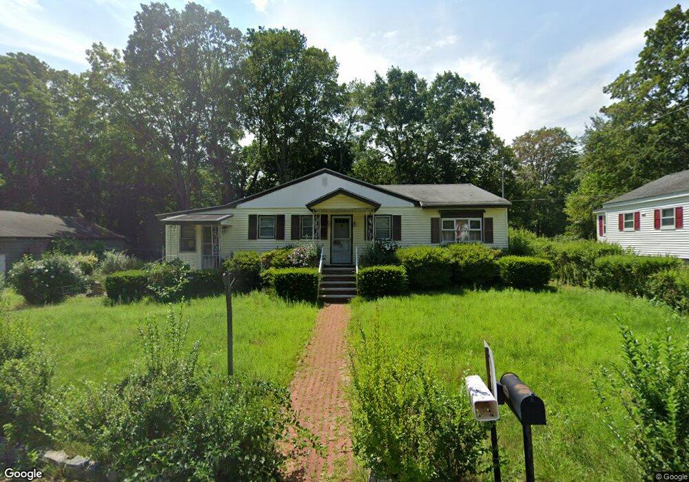
This home is located at 8 Mcmann Ct, Salem, NH 03079 and is currently estimated at $512,875, approximately $424 per square foot. 8 Mcmann Ct is a home located in Rockingham County with nearby schools including William T. Barron Elementary School, Woodbury School, and Salem High School.
Ownership History
Date
Name
Owned For
Owner Type
Purchase Details
Closed on
Aug 25, 2021
Sold by
Pierog John J
Bought by
Pierog 2021 T
Current Estimated Value
Purchase Details
Closed on
Dec 23, 2015
Sold by
Pierog John J and Pierog Joseph J
Bought by
Pierog John J
Home Financials for this Owner
Home Financials are based on the most recent Mortgage that was taken out on this home.
Original Mortgage
$164,000
Interest Rate
3.99%
Create a Home Valuation Report for This Property
The Home Valuation Report is an in-depth analysis detailing your home's value as well as a comparison with similar homes in the area
Purchase History
| Date | Buyer | Sale Price | Title Company |
|---|---|---|---|
| Pierog 2021 T | -- | None Available | |
| Pierog John J | $102,533 | -- |
Source: Public Records
Mortgage History
| Date | Status | Borrower | Loan Amount |
|---|---|---|---|
| Previous Owner | Pierog John J | $164,000 |
Source: Public Records
Tax History
| Year | Tax Paid | Tax Assessment Tax Assessment Total Assessment is a certain percentage of the fair market value that is determined by local assessors to be the total taxable value of land and additions on the property. | Land | Improvement |
|---|---|---|---|---|
| 2024 | $5,882 | $334,200 | $157,000 | $177,200 |
| 2023 | $5,668 | $334,200 | $157,000 | $177,200 |
| 2022 | $5,364 | $334,200 | $157,000 | $177,200 |
| 2021 | $5,341 | $334,200 | $157,000 | $177,200 |
| 2020 | $5,102 | $231,700 | $112,400 | $119,300 |
| 2019 | $5,093 | $231,700 | $112,400 | $119,300 |
| 2018 | $4,877 | $231,700 | $112,400 | $119,300 |
| 2017 | $4,734 | $231,700 | $112,400 | $119,300 |
| 2016 | $4,734 | $231,700 | $112,400 | $119,300 |
| 2015 | $4,366 | $204,100 | $111,300 | $92,800 |
| 2014 | $4,243 | $204,100 | $111,300 | $92,800 |
| 2013 | $4,460 | $218,000 | $117,300 | $100,700 |
Source: Public Records
Map
Nearby Homes
- 7 Douglas Dr
- 5 Highland Ave
- 5 Canterbury Ct
- 17 Canterbury Ct
- 10 Town Village Dr
- 40 Stanwood Rd Unit 9
- 5 Sally Sweets Way Unit 128
- 384 Main St Unit 203
- 384 Main St Unit 102
- 384 Main St Unit 107
- 8 Alta Ave
- 15 Briar Ave
- 4 Therriault Ave
- 12 Field Ave
- 14 Loren Rd
- 18 Shepard Ave
- 139 North St
- 20 Williams St
- 47 Millville St
- 66 Brookwood Dr
- 6 Mcmann Ct
- 6 Bridge St
- 4 Mcmann Ct
- 4 Bridge St
- 9 Brown St
- 7 Brown St
- 298 Main St
- 5 Brown St
- 12 Bridge St
- 292 Main St
- 12 Brown St
- 10 Brown St
- 290 Main St
- 0 Confidential Street C 008a Unit 71420312
- 0 Confidential Unit 72111672
- 0 Confidential Unit 71508324
- 0 Confidential Unit 4615353
- 14 Bridge St
- 14 Bridge St Unit 84/1591
- 14 Bridge St Divide Unit 84/1591
Your Personal Tour Guide
Ask me questions while you tour the home.