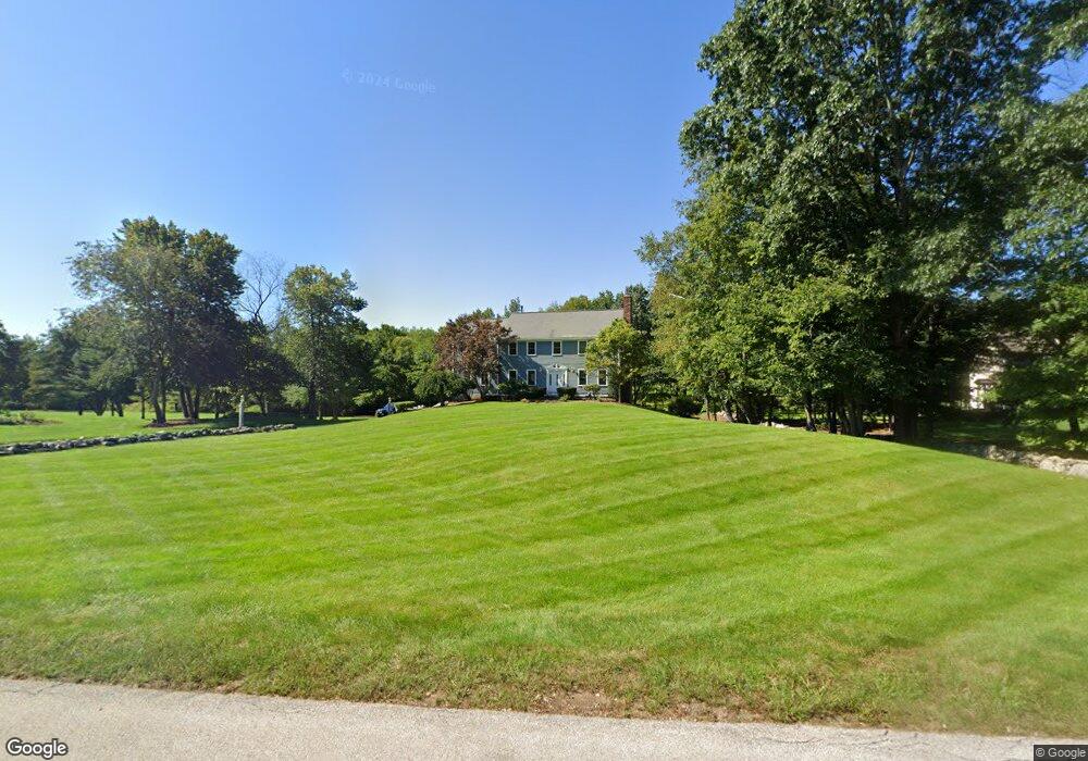
8 Mendelssohn Dr Hollis, NH 03049
Hollis NeighborhoodEstimated Value: $1,031,153 - $1,200,000
4
Beds
3
Baths
3,262
Sq Ft
$341/Sq Ft
Est. Value
About This Home
This home is located at 8 Mendelssohn Dr, Hollis, NH 03049 and is currently estimated at $1,113,038, approximately $341 per square foot. 8 Mendelssohn Dr is a home with nearby schools including Hollis Primary School, Hollis Upper Elementary School, and Hollis-Brookline Middle School.
Ownership History
Date
Name
Owned For
Owner Type
Purchase Details
Closed on
Feb 28, 2022
Sold by
Movafaghi Shahriar and Movafaghi Mona T
Bought by
Shahriar Movafaghi Ret
Current Estimated Value
Purchase Details
Closed on
Oct 3, 2012
Sold by
Movafaghi Shahriar and Movafaghi Mona T
Bought by
Shahriar Movafaghi Ret
Purchase Details
Closed on
Aug 18, 1989
Bought by
Shahriar Movafaghi Ret
Create a Home Valuation Report for This Property
The Home Valuation Report is an in-depth analysis detailing your home's value as well as a comparison with similar homes in the area
Home Values in the Area
Average Home Value in this Area
Purchase History
| Date | Buyer | Sale Price | Title Company |
|---|---|---|---|
| Shahriar Movafaghi Ret | -- | None Available | |
| Shahriar Movafaghi Ret | -- | -- | |
| Shahriar Movafaghi Ret | -- | -- |
Source: Public Records
Mortgage History
| Date | Status | Borrower | Loan Amount |
|---|---|---|---|
| Previous Owner | Shahriar Movafaghi Ret | $390,000 | |
| Previous Owner | Shahriar Movafaghi Ret | $404,000 | |
| Previous Owner | Shahriar Movafaghi Ret | $417,000 | |
| Previous Owner | Shahriar Movafaghi Ret | $250,000 |
Source: Public Records
Tax History Compared to Growth
Tax History
| Year | Tax Paid | Tax Assessment Tax Assessment Total Assessment is a certain percentage of the fair market value that is determined by local assessors to be the total taxable value of land and additions on the property. | Land | Improvement |
|---|---|---|---|---|
| 2024 | $15,115 | $852,500 | $300,800 | $551,700 |
| 2023 | $14,203 | $852,500 | $300,800 | $551,700 |
| 2022 | $19,241 | $852,500 | $300,800 | $551,700 |
| 2021 | $13,055 | $575,100 | $225,400 | $349,700 |
| 2020 | $5,095 | $575,100 | $225,400 | $349,700 |
| 2019 | $5,025 | $575,100 | $225,400 | $349,700 |
| 2018 | $12,462 | $575,100 | $225,400 | $349,700 |
| 2017 | $11,763 | $508,100 | $169,200 | $338,900 |
| 2016 | $4,781 | $504,300 | $169,200 | $335,100 |
| 2015 | $11,609 | $504,300 | $169,200 | $335,100 |
| 2014 | $11,664 | $504,300 | $169,200 | $335,100 |
| 2013 | $11,508 | $504,300 | $169,200 | $335,100 |
Source: Public Records
Map
Nearby Homes
- 22 Cathedral Cir
- 14 Parrish Hill Dr
- 6 Cornwall Ln Unit 7
- 4 Brick Manor Dr
- 4 Jared Cir Unit U21
- 199 Pine Hill Rd
- 5 Chatfield Dr Unit U18
- 334 Broad St
- 17 Dunbarton Dr
- 1 Dunbarton Dr
- 3 Richmond St
- 4 Nelson St
- 8 Pilgrim Cir
- 10 Pilgrim Cir
- 28 Bartemus Trail Unit U210
- 2 Sycamore Ln
- 27 Country Hill Rd Unit U90
- 80 Bartemus Trail Unit U229
- 11 Bartemus Trail Unit 204
- 38 Dianne St
- 6 Mendelssohn Dr
- 12 Mendelssohn Dr
- 4 Mendelssohn Dr
- 13 Mendelssohn Dr
- 9 Mendelssohn Dr
- 7 Mendelssohn Dr
- 15 Mendelssohn Dr
- 5 Mendelssohn Dr
- 2 Mendelssohn Dr
- 11 Mendelssohn Dr
- 17 Mendelssohn Dr
- 68 Howe Ln
- 1 Mendelssohn Dr
- 72 Howe Ln
- 82 Howe Ln
- 19 Mendelssohn Dr
- 71 Howe Ln
- 65 Howe Ln
- 21 Mendelssohn Dr
- 60 Howe Ln