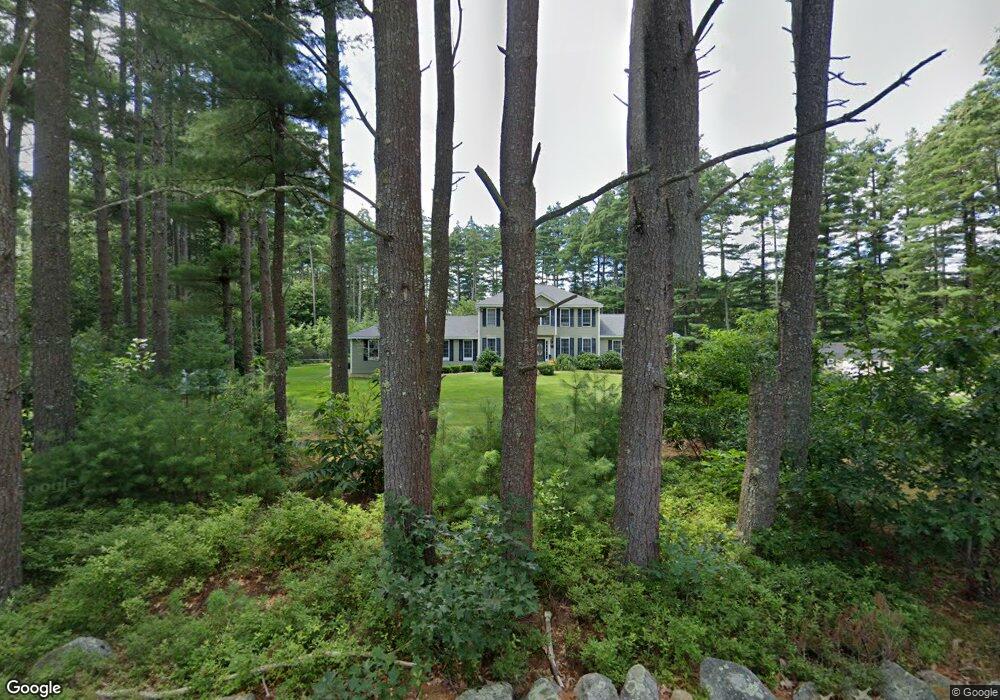
8 Moeckel Rd Windham, NH 03087
Estimated Value: $837,000 - $1,110,000
4
Beds
3
Baths
3,132
Sq Ft
$318/Sq Ft
Est. Value
About This Home
This home is located at 8 Moeckel Rd, Windham, NH 03087 and is currently estimated at $995,088, approximately $317 per square foot. 8 Moeckel Rd is a home located in Rockingham County with nearby schools including Golden Brook Elementary School, Windham Middle School, and Windham High School.
Ownership History
Date
Name
Owned For
Owner Type
Purchase Details
Closed on
Sep 2, 2020
Sold by
Mayo Stephanie A
Bought by
Stephanie A Mayo Ret
Current Estimated Value
Purchase Details
Closed on
Jun 15, 2005
Sold by
Desimone John R and Desimone Janice M
Bought by
Mayo Robert S and Mayo Stephanie A
Home Financials for this Owner
Home Financials are based on the most recent Mortgage that was taken out on this home.
Original Mortgage
$250,000
Interest Rate
5.78%
Purchase Details
Closed on
Sep 7, 2001
Sold by
D& S Custom Bldrs Inc
Bought by
Jacobs John M
Home Financials for this Owner
Home Financials are based on the most recent Mortgage that was taken out on this home.
Original Mortgage
$322,000
Interest Rate
7.05%
Purchase Details
Closed on
Sep 3, 1999
Sold by
Rvkb Gertrude M Linton
Bought by
D&S Custom Bldrs Inc
Create a Home Valuation Report for This Property
The Home Valuation Report is an in-depth analysis detailing your home's value as well as a comparison with similar homes in the area
Home Values in the Area
Average Home Value in this Area
Purchase History
| Date | Buyer | Sale Price | Title Company |
|---|---|---|---|
| Stephanie A Mayo Ret | -- | None Available | |
| Mayo Robert S | $515,000 | -- | |
| Jacobs John M | $115,000 | -- | |
| D&S Custom Bldrs Inc | $165,000 | -- |
Source: Public Records
Mortgage History
| Date | Status | Borrower | Loan Amount |
|---|---|---|---|
| Previous Owner | Mayo Robert S | $250,000 | |
| Previous Owner | D&S Custom Bldrs Inc | $322,000 |
Source: Public Records
Tax History
| Year | Tax Paid | Tax Assessment Tax Assessment Total Assessment is a certain percentage of the fair market value that is determined by local assessors to be the total taxable value of land and additions on the property. | Land | Improvement |
|---|---|---|---|---|
| 2024 | $15,778 | $696,900 | $240,200 | $456,700 |
| 2023 | $14,914 | $696,900 | $240,200 | $456,700 |
| 2022 | $13,771 | $696,900 | $240,200 | $456,700 |
| 2021 | $10,891 | $584,900 | $240,200 | $344,700 |
| 2020 | $11,189 | $584,900 | $240,200 | $344,700 |
| 2019 | $9,940 | $440,800 | $177,200 | $263,600 |
| 2018 | $10,266 | $440,800 | $177,200 | $263,600 |
| 2017 | $8,904 | $440,800 | $177,200 | $263,600 |
| 2016 | $9,618 | $440,800 | $177,200 | $263,600 |
| 2015 | $9,778 | $450,200 | $177,200 | $273,000 |
| 2014 | $9,926 | $413,600 | $173,000 | $240,600 |
| 2013 | $10,094 | $427,700 | $173,000 | $254,700 |
Source: Public Records
Map
Nearby Homes
- 3 Harmony Ln
- 15 Kens Way
- 210 Range Rd
- 12 Shelly Dr
- 50 Cobbetts Pond Rd
- 47 Cobbetts Pond Rd
- 23 Ryan Farm Rd
- 22 Ryan Farm Rd
- 6 Hemlock Dr
- 2 Cypress Ln
- 7 Cypress Ln Unit 5
- 4 Cypress Ln Unit 10
- 11 Venus Way
- 7 Venus Way Unit 22
- 6 Westchester Rd
- 28 West St
- 9A Winter St
- 84, 86, 88 Ryan Farm Rd Unit 1, 2, 3
- 47 Campbell St
- 94 Tanager Cir Unit 94
Your Personal Tour Guide
Ask me questions while you tour the home.