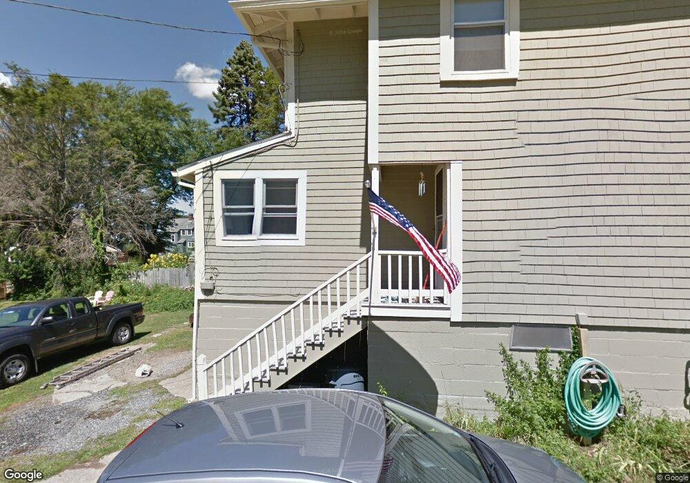
8 Orchard Way Gloucester, MA 01930
Riverview NeighborhoodEstimated Value: $746,053 - $917,000
4
Beds
2
Baths
1,880
Sq Ft
$441/Sq Ft
Est. Value
About This Home
This home is located at 8 Orchard Way, Gloucester, MA 01930 and is currently estimated at $829,263, approximately $441 per square foot. 8 Orchard Way is a home located in Essex County with nearby schools including Beeman Memorial, Ralph B O'maley Middle School, and Gloucester High School.
Ownership History
Date
Name
Owned For
Owner Type
Purchase Details
Closed on
Dec 8, 2020
Sold by
Carrancho Michelle
Bought by
Carrancho Michelle and Ricci-Munn Janda
Current Estimated Value
Home Financials for this Owner
Home Financials are based on the most recent Mortgage that was taken out on this home.
Original Mortgage
$130,000
Outstanding Balance
$76,800
Interest Rate
2.8%
Mortgage Type
New Conventional
Estimated Equity
$752,463
Purchase Details
Closed on
Mar 20, 2009
Sold by
Cecilio Sylvia T
Bought by
Carrancho Michelle and Carrancho Michelle A
Home Financials for this Owner
Home Financials are based on the most recent Mortgage that was taken out on this home.
Original Mortgage
$218,000
Interest Rate
5.25%
Mortgage Type
Purchase Money Mortgage
Create a Home Valuation Report for This Property
The Home Valuation Report is an in-depth analysis detailing your home's value as well as a comparison with similar homes in the area
Home Values in the Area
Average Home Value in this Area
Purchase History
| Date | Buyer | Sale Price | Title Company |
|---|---|---|---|
| Carrancho Michelle | -- | None Available | |
| Carrancho Michelle | $285,000 | -- |
Source: Public Records
Mortgage History
| Date | Status | Borrower | Loan Amount |
|---|---|---|---|
| Open | Carrancho Michelle | $130,000 | |
| Previous Owner | Carrancho Michelle | $218,000 | |
| Previous Owner | Carrancho Michelle | $57,000 |
Source: Public Records
Tax History Compared to Growth
Tax History
| Year | Tax Paid | Tax Assessment Tax Assessment Total Assessment is a certain percentage of the fair market value that is determined by local assessors to be the total taxable value of land and additions on the property. | Land | Improvement |
|---|---|---|---|---|
| 2025 | $6,248 | $642,800 | $231,500 | $411,300 |
| 2024 | $6,147 | $631,800 | $220,500 | $411,300 |
| 2023 | $5,893 | $556,500 | $196,800 | $359,700 |
| 2022 | $5,662 | $482,700 | $167,300 | $315,400 |
| 2021 | $5,467 | $439,500 | $152,100 | $287,400 |
| 2020 | $5,418 | $439,400 | $152,100 | $287,300 |
| 2019 | $5,199 | $409,700 | $152,100 | $257,600 |
| 2018 | $5,031 | $389,100 | $152,100 | $237,000 |
| 2017 | $4,883 | $370,200 | $144,900 | $225,300 |
| 2016 | $4,736 | $348,000 | $145,400 | $202,600 |
| 2015 | $4,541 | $332,700 | $145,400 | $187,300 |
Source: Public Records
Map
Nearby Homes
- 672 Washington St
- 109 Riverview Rd
- 188 Atlantic St
- 226 Atlantic St
- 65 Poplar St
- 19 Mystic Ave
- 78 Grove St
- 196 Washington St
- 16 Cleveland Place Unit 11
- 40 Sargent St
- 15 Harvard St
- 119 Pleasant St
- 33 Maplewood Ave Unit 21
- 8 Summer St Unit 103
- 4 Mount Vernon St
- 22 Taylor St Unit 1
- 5 Washington Square
- 29 Harrison Ave
- 90 Middle St Unit L
- 160 Prospect St Unit 3
- 9 Orchard Way
- 7 Orchard Way
- 6 Orchard Way
- 5 Wheelers Point Rd
- 20 Shore Hill Rd
- 7 Wheelers Point Rd
- 11 Orchard Way
- 8 Shore Hill Rd
- 3 Orchard Way
- 4 Orchard Way
- 6 Shore Hill Rd
- 22 Shore Hill Rd
- 9 Wheelers Point Rd
- 6 Wheelers Point Rd
- 2 Orchard Way
- 125 Wheeler St
- 127 Wheeler St
- 14 Shore Hill Rd
- 131A Wheeler St
- 24 Shore Hill Rd