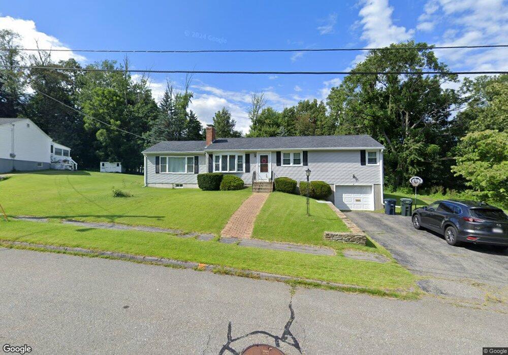
8 Osgood Ave Holden, MA 01520
Estimated Value: $454,000 - $530,000
3
Beds
1
Bath
1,056
Sq Ft
$475/Sq Ft
Est. Value
About This Home
This home is located at 8 Osgood Ave, Holden, MA 01520 and is currently estimated at $501,941, approximately $475 per square foot. 8 Osgood Ave is a home located in Worcester County with nearby schools including Wachusett Regional High School, Abby Kelley Foster Charter Public School, and Bancroft School.
Ownership History
Date
Name
Owned For
Owner Type
Purchase Details
Closed on
Aug 18, 2010
Sold by
Barbour Christopher
Bought by
Barbour Christopher M and Barbour Katharine S
Current Estimated Value
Home Financials for this Owner
Home Financials are based on the most recent Mortgage that was taken out on this home.
Original Mortgage
$85,000
Outstanding Balance
$56,448
Interest Rate
4.63%
Mortgage Type
Purchase Money Mortgage
Estimated Equity
$445,493
Purchase Details
Closed on
Jan 22, 1999
Sold by
Rackauskas Donald A
Bought by
Barbour Christopher
Home Financials for this Owner
Home Financials are based on the most recent Mortgage that was taken out on this home.
Original Mortgage
$116,900
Interest Rate
6.7%
Mortgage Type
Purchase Money Mortgage
Create a Home Valuation Report for This Property
The Home Valuation Report is an in-depth analysis detailing your home's value as well as a comparison with similar homes in the area
Home Values in the Area
Average Home Value in this Area
Purchase History
| Date | Buyer | Sale Price | Title Company |
|---|---|---|---|
| Barbour Christopher M | -- | -- | |
| Barbour Christopher | $129,900 | -- |
Source: Public Records
Mortgage History
| Date | Status | Borrower | Loan Amount |
|---|---|---|---|
| Open | Barbour Christopher M | $85,000 | |
| Previous Owner | Barbour Christopher | $89,000 | |
| Previous Owner | Barbour Christopher | $116,900 |
Source: Public Records
Tax History Compared to Growth
Tax History
| Year | Tax Paid | Tax Assessment Tax Assessment Total Assessment is a certain percentage of the fair market value that is determined by local assessors to be the total taxable value of land and additions on the property. | Land | Improvement |
|---|---|---|---|---|
| 2025 | $5,897 | $425,500 | $161,900 | $263,600 |
| 2024 | $5,514 | $389,700 | $157,100 | $232,600 |
| 2023 | $5,324 | $355,200 | $136,600 | $218,600 |
| 2022 | $5,153 | $311,200 | $106,700 | $204,500 |
| 2021 | $4,983 | $286,400 | $101,600 | $184,800 |
| 2020 | $4,597 | $270,400 | $96,800 | $173,600 |
| 2019 | $4,504 | $258,100 | $96,800 | $161,300 |
| 2018 | $4,204 | $238,700 | $92,100 | $146,600 |
| 2017 | $4,100 | $233,100 | $92,100 | $141,000 |
| 2016 | $4,005 | $232,200 | $87,700 | $144,500 |
| 2015 | $3,992 | $220,300 | $87,700 | $132,600 |
| 2014 | $3,910 | $220,300 | $87,700 | $132,600 |
Source: Public Records
Map
Nearby Homes
- 535 Prospect St
- 93 Winfield Rd
- 83 Stoneleigh Rd
- 22 Danielles Way
- 26 Danielles Way
- 31 Danielles Way
- 21 Wyoming Dr
- 23 Orono St
- 9 Idalla Ave
- 29 Glenwood St
- 87 Malden St
- 15 Cumberland St
- 29 Isleboro St
- 33 Isleboro St
- 12 Dixfield Rd
- 15 Lowell Ave
- 1110 W Boylston St Unit A
- 10 Beale St
- 12 Birchbrush Ln
- 1 Juneberry Ln Unit 82
- 6 Osgood Ave
- 47 Osgood Ave
- 9 Osgood Ave
- 2 Osgood Ave
- 27 Sheffield Way
- 3 Osgood Ave
- 30 Osgood Ave
- 29 Osgood Ave
- 33 Sheffield Way
- Lot B Sheffield Rd
- Lot D Sheffield Way
- 11 Sheffield Way
- 66 Pinecroft Ave
- 20 Pinecroft Ave
- 42 Sheffield Way
- 20 Sheffield Way
- 24 Sheffield Way
- 58 Pinecroft Ave
- 16 Sheffield Way
- 28 Sheffield Way