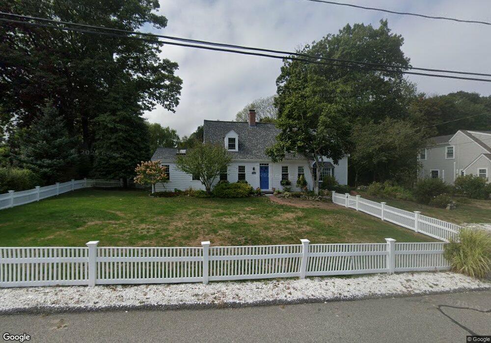
8 Red Gate Ln Cohasset, MA 02025
Estimated Value: $1,244,794 - $1,607,000
3
Beds
5
Baths
2,278
Sq Ft
$591/Sq Ft
Est. Value
About This Home
This home is located at 8 Red Gate Ln, Cohasset, MA 02025 and is currently estimated at $1,346,199, approximately $590 per square foot. 8 Red Gate Ln is a home located in Norfolk County with nearby schools including Joseph Osgood School, Deer Hill School, and Cohasset Middle School.
Ownership History
Date
Name
Owned For
Owner Type
Purchase Details
Closed on
Sep 25, 1998
Sold by
Leonard Anthony P and Leonard Sharon J
Bought by
Kimla Brian J
Current Estimated Value
Home Financials for this Owner
Home Financials are based on the most recent Mortgage that was taken out on this home.
Original Mortgage
$274,500
Outstanding Balance
$59,944
Interest Rate
6.87%
Mortgage Type
Purchase Money Mortgage
Estimated Equity
$1,286,255
Purchase Details
Closed on
Jul 31, 1996
Sold by
Leisher Kenneth and Leisher Patricia
Bought by
Leonard Anthony P and Leonard Sharon J
Home Financials for this Owner
Home Financials are based on the most recent Mortgage that was taken out on this home.
Original Mortgage
$203,000
Interest Rate
8.27%
Mortgage Type
Purchase Money Mortgage
Create a Home Valuation Report for This Property
The Home Valuation Report is an in-depth analysis detailing your home's value as well as a comparison with similar homes in the area
Home Values in the Area
Average Home Value in this Area
Purchase History
| Date | Buyer | Sale Price | Title Company |
|---|---|---|---|
| Kimla Brian J | $305,000 | -- | |
| Kimla Brian J | $305,000 | -- | |
| Leonard Anthony P | $225,900 | -- | |
| Leonard Anthony P | $225,900 | -- |
Source: Public Records
Mortgage History
| Date | Status | Borrower | Loan Amount |
|---|---|---|---|
| Open | Leonard Anthony P | $274,500 | |
| Closed | Leonard Anthony P | $274,500 | |
| Previous Owner | Leonard Anthony P | $203,000 |
Source: Public Records
Tax History Compared to Growth
Tax History
| Year | Tax Paid | Tax Assessment Tax Assessment Total Assessment is a certain percentage of the fair market value that is determined by local assessors to be the total taxable value of land and additions on the property. | Land | Improvement |
|---|---|---|---|---|
| 2025 | $12,012 | $1,037,300 | $624,600 | $412,700 |
| 2024 | $10,197 | $837,900 | $520,500 | $317,400 |
| 2023 | $8,172 | $692,500 | $375,900 | $316,600 |
| 2022 | $8,405 | $669,200 | $375,900 | $293,300 |
| 2021 | $8,305 | $636,900 | $375,900 | $261,000 |
| 2020 | $7,759 | $598,200 | $341,000 | $257,200 |
| 2019 | $7,717 | $598,200 | $341,000 | $257,200 |
| 2018 | $7,651 | $598,200 | $341,000 | $257,200 |
| 2017 | $6,493 | $497,200 | $310,000 | $187,200 |
| 2016 | $6,404 | $497,200 | $310,000 | $187,200 |
| 2015 | $6,319 | $497,200 | $310,000 | $187,200 |
| 2014 | $6,235 | $497,200 | $310,000 | $187,200 |
Source: Public Records
Map
Nearby Homes
- 25 Ripley Rd
- 506-512 N Main St
- 31 Bow St
- 11 Beach St
- 29 Heather Dr
- 137 Fairoaks Ln
- 128 Elm St Unit 211
- 135 Beach St
- 46 Pond St
- 40 Pond St
- 25 Mohawk Way
- 21-23 Elm Ct
- 17 Mohawk Way
- 124 Elm St Unit 308
- 152 Forest Ave
- 100 Pond St Unit 10
- 247 Forest Ave
- 356 Atlantic Ave
- 98 Black Horse Ln
- 104 Howard Gleason Rd