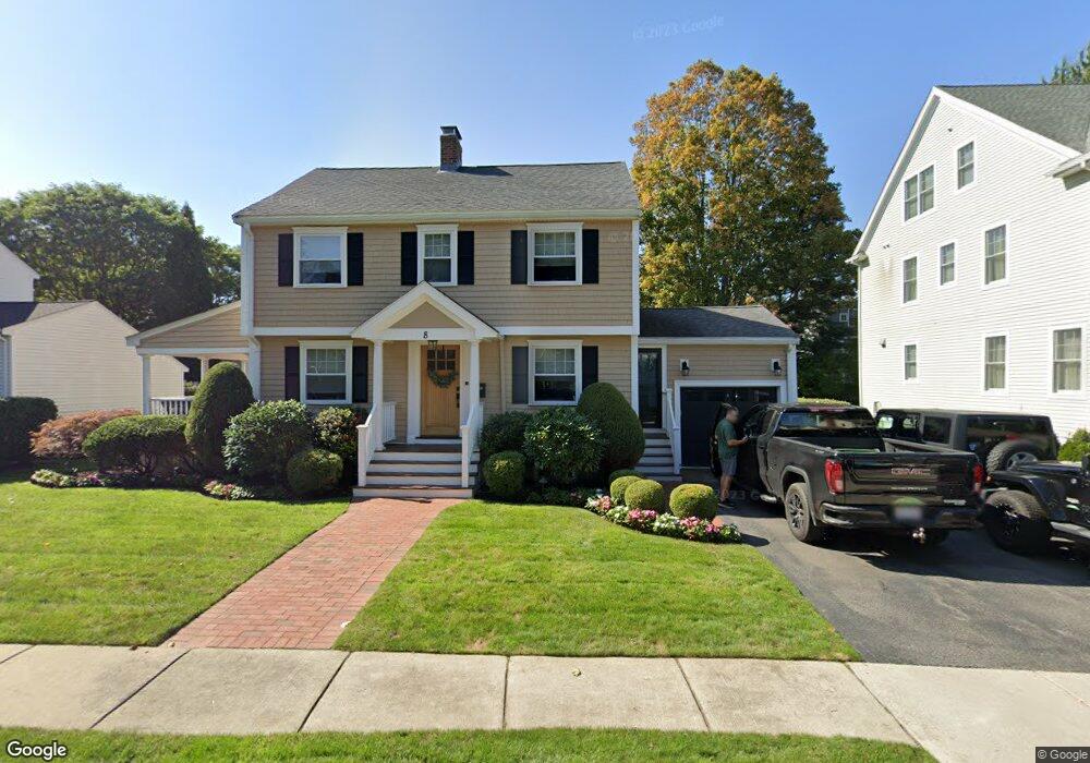
8 Sargent Rd Belmont, MA 02478
Cushing Square NeighborhoodEstimated Value: $1,365,000 - $1,757,978
3
Beds
2
Baths
1,376
Sq Ft
$1,136/Sq Ft
Est. Value
About This Home
This home is located at 8 Sargent Rd, Belmont, MA 02478 and is currently estimated at $1,563,745, approximately $1,136 per square foot. 8 Sargent Rd is a home located in Middlesex County with nearby schools including Mary Lee Burbank Elementary School, Winthrop L Chenery Middle School, and Belmont High School.
Ownership History
Date
Name
Owned For
Owner Type
Purchase Details
Closed on
Jun 24, 2009
Sold by
Est Servello James V and Servello Stephen J
Bought by
Varsamis Peter J and Varsamis Haroula T
Current Estimated Value
Home Financials for this Owner
Home Financials are based on the most recent Mortgage that was taken out on this home.
Original Mortgage
$412,500
Outstanding Balance
$262,725
Interest Rate
4.92%
Mortgage Type
Purchase Money Mortgage
Estimated Equity
$1,301,020
Create a Home Valuation Report for This Property
The Home Valuation Report is an in-depth analysis detailing your home's value as well as a comparison with similar homes in the area
Home Values in the Area
Average Home Value in this Area
Purchase History
| Date | Buyer | Sale Price | Title Company |
|---|---|---|---|
| Varsamis Peter J | $550,000 | -- |
Source: Public Records
Mortgage History
| Date | Status | Borrower | Loan Amount |
|---|---|---|---|
| Open | Varsamis Peter J | $412,500 |
Source: Public Records
Tax History Compared to Growth
Tax History
| Year | Tax Paid | Tax Assessment Tax Assessment Total Assessment is a certain percentage of the fair market value that is determined by local assessors to be the total taxable value of land and additions on the property. | Land | Improvement |
|---|---|---|---|---|
| 2025 | $18,406 | $1,616,000 | $792,000 | $824,000 |
| 2024 | $17,487 | $1,656,000 | $987,000 | $669,000 |
| 2023 | $16,455 | $1,464,000 | $861,000 | $603,000 |
| 2022 | $15,971 | $1,372,000 | $809,000 | $563,000 |
| 2021 | $15,971 | $1,384,000 | $843,000 | $541,000 |
| 2020 | $15,015 | $1,365,000 | $826,000 | $539,000 |
| 2019 | $12,814 | $1,098,000 | $614,000 | $484,000 |
| 2018 | $20,536 | $1,036,000 | $558,000 | $478,000 |
| 2017 | $12,512 | $986,000 | $512,000 | $474,000 |
| 2016 | $12,334 | $982,000 | $512,000 | $470,000 |
| 2015 | $11,455 | $888,000 | $426,000 | $462,000 |
Source: Public Records
Map
Nearby Homes
- 27 Dalton Rd Unit 27
- 73 Foster Rd Unit 2
- 105 Watson Rd
- 36 Madison St
- 118 Blanchard Rd
- 30 Unity Ave Unit 30
- 276 Belmont St Unit 1
- 10 Marlboro St Unit 1
- 147 Langdon Ave Unit 149
- 161 Cushing St
- 48 Concord Ave
- 163 Belmont St
- 133 Hillside Rd Unit 2
- 133 Hillside Rd
- 133 Hillside Rd Unit 1
- 4 Merrill Ave
- 16 Ericsson St
- 56-58 Edgecliff Rd
- 87 Templeton Pkwy Unit 3
- 95 Cushing St