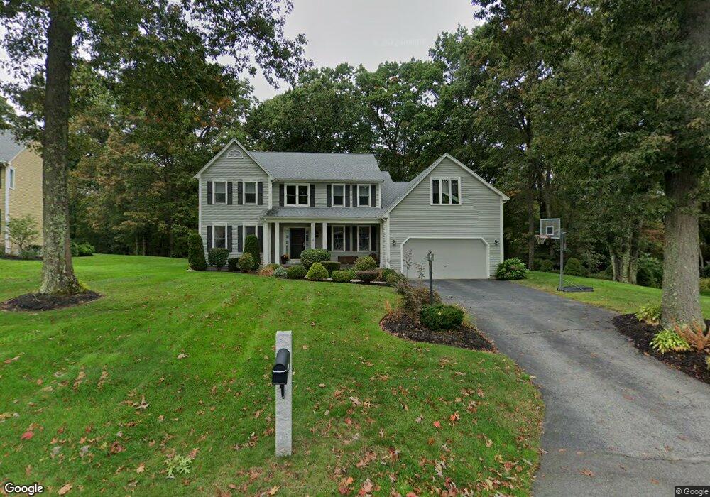
8 Southridge Cir Andover, MA 01810
Shawsheen Heights NeighborhoodEstimated Value: $1,184,140 - $1,642,000
4
Beds
4
Baths
3,417
Sq Ft
$388/Sq Ft
Est. Value
About This Home
This home is located at 8 Southridge Cir, Andover, MA 01810 and is currently estimated at $1,324,535, approximately $387 per square foot. 8 Southridge Cir is a home located in Essex County with nearby schools including West Elementary School, Wood Hill Middle School, and Willow River Secondary School.
Ownership History
Date
Name
Owned For
Owner Type
Purchase Details
Closed on
Aug 24, 2012
Sold by
Levis Donald B and Levis Tobi K
Bought by
Donald B Levis Ret and Levis
Current Estimated Value
Purchase Details
Closed on
May 15, 1998
Sold by
Mummey James R
Bought by
Levis Donald B
Home Financials for this Owner
Home Financials are based on the most recent Mortgage that was taken out on this home.
Original Mortgage
$200,000
Interest Rate
7.08%
Mortgage Type
Purchase Money Mortgage
Purchase Details
Closed on
Jan 17, 1992
Sold by
Jil-Mic Rt
Bought by
Mummey James R
Purchase Details
Closed on
Aug 29, 1991
Sold by
Irongate Park Rt
Bought by
Jil Mic Rt
Create a Home Valuation Report for This Property
The Home Valuation Report is an in-depth analysis detailing your home's value as well as a comparison with similar homes in the area
Home Values in the Area
Average Home Value in this Area
Purchase History
| Date | Buyer | Sale Price | Title Company |
|---|---|---|---|
| Donald B Levis Ret | -- | -- | |
| Donald B Levis Ret | -- | -- | |
| Levis Donald B | $425,000 | -- | |
| Levis Donald B | $425,000 | -- | |
| Mummey James R | $319,900 | -- | |
| Mummey James R | $319,900 | -- | |
| Jil Mic Rt | $120,000 | -- | |
| Jil Mic Rt | $120,000 | -- |
Source: Public Records
Mortgage History
| Date | Status | Borrower | Loan Amount |
|---|---|---|---|
| Previous Owner | Jil Mic Rt | $200,000 | |
| Previous Owner | Jil Mic Rt | $182,500 |
Source: Public Records
Tax History Compared to Growth
Tax History
| Year | Tax Paid | Tax Assessment Tax Assessment Total Assessment is a certain percentage of the fair market value that is determined by local assessors to be the total taxable value of land and additions on the property. | Land | Improvement |
|---|---|---|---|---|
| 2024 | $12,778 | $992,100 | $395,100 | $597,000 |
| 2023 | $12,033 | $880,900 | $337,800 | $543,100 |
| 2022 | $11,549 | $791,000 | $304,500 | $486,500 |
| 2021 | $11,113 | $726,800 | $276,900 | $449,900 |
| 2020 | $10,819 | $720,800 | $276,900 | $443,900 |
| 2019 | $10,901 | $713,900 | $276,900 | $437,000 |
| 2018 | $10,535 | $673,600 | $268,900 | $404,700 |
| 2017 | $10,133 | $667,500 | $263,500 | $404,000 |
| 2016 | $9,928 | $669,900 | $263,500 | $406,400 |
| 2015 | $9,731 | $650,000 | $263,500 | $386,500 |
Source: Public Records
Map
Nearby Homes
- 29 Glenwood Dr
- 0
- 96 Beacon St
- 11 Devonshire St
- 25 Clubview Dr Unit 25
- 13 Clubview Dr Unit 13
- 5 Marc Ln
- 21 Clubview Dr Unit 21
- 42 Beresford St
- 750 Brookside Dr Unit G
- 54 Amherst St
- 37 Crenshaw Ln Unit 37
- 15 Beaconsfield St
- 33 Jefferson St
- 37 Tewksbury St Unit 39
- 11 W Hawley St
- 8 Packard St
- 102 Weare St
- 34 Leeds Terrace
- 5 W Kenneth St
- 6 Southridge Cir
- 7 Southridge Cir
- 10 Southridge Cir
- 4 Southridge Cir
- 5 Southridge Cir
- 9 Southridge Cir
- 3 Southridge Cir
- 6 Pauline Dr
- 14 Southridge Cir
- 19 Pauline Dr
- 4 Pauline Dr
- 6 Iron Gate Dr
- 11 Southridge Cir
- 17 Pauline Dr Unit AR
- 17 Pauline Dr
- 7 North St
- 15 Pauline Dr
- 11 Pauline Dr
- 8 Iron Gate Dr
- 9 Pauline Dr