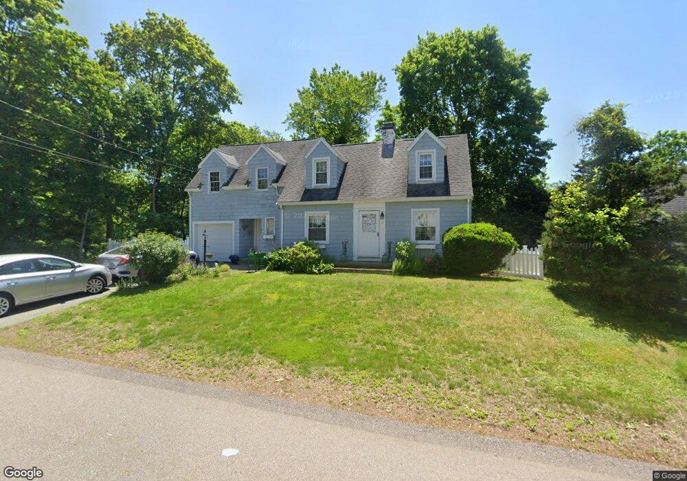
8 Sutcliffe Ave Canton, MA 02021
Estimated Value: $665,000 - $909,000
2
Beds
3
Baths
1,780
Sq Ft
$438/Sq Ft
Est. Value
About This Home
This home is located at 8 Sutcliffe Ave, Canton, MA 02021 and is currently estimated at $780,027, approximately $438 per square foot. 8 Sutcliffe Ave is a home located in Norfolk County with nearby schools including Canton High School, Thacher Montessori School, and St. John the Evangelist School.
Ownership History
Date
Name
Owned For
Owner Type
Purchase Details
Closed on
Aug 14, 2000
Sold by
Vanhorn Tr Alma L
Bought by
Bartlett John and Bartlett Theresa
Current Estimated Value
Home Financials for this Owner
Home Financials are based on the most recent Mortgage that was taken out on this home.
Original Mortgage
$196,200
Interest Rate
8.21%
Mortgage Type
Purchase Money Mortgage
Create a Home Valuation Report for This Property
The Home Valuation Report is an in-depth analysis detailing your home's value as well as a comparison with similar homes in the area
Home Values in the Area
Average Home Value in this Area
Purchase History
| Date | Buyer | Sale Price | Title Company |
|---|---|---|---|
| Bartlett John | $218,000 | -- |
Source: Public Records
Mortgage History
| Date | Status | Borrower | Loan Amount |
|---|---|---|---|
| Open | Bartlett John | $260,000 | |
| Closed | Bartlett John | $250,000 | |
| Closed | Bartlett John | $196,200 |
Source: Public Records
Tax History
| Year | Tax Paid | Tax Assessment Tax Assessment Total Assessment is a certain percentage of the fair market value that is determined by local assessors to be the total taxable value of land and additions on the property. | Land | Improvement |
|---|---|---|---|---|
| 2025 | $6,831 | $690,700 | $349,700 | $341,000 |
| 2024 | $6,623 | $664,300 | $336,300 | $328,000 |
| 2023 | $6,502 | $615,100 | $336,300 | $278,800 |
| 2022 | $6,305 | $555,500 | $320,300 | $235,200 |
| 2021 | $6,144 | $503,600 | $291,200 | $212,400 |
| 2020 | $5,867 | $479,700 | $277,300 | $202,400 |
| 2019 | $5,700 | $459,700 | $252,000 | $207,700 |
| 2018 | $5,573 | $448,700 | $242,400 | $206,300 |
| 2017 | $5,376 | $420,300 | $217,800 | $202,500 |
| 2016 | $4,989 | $390,100 | $212,500 | $177,600 |
| 2015 | $4,837 | $377,300 | $206,300 | $171,000 |
Source: Public Records
Map
Nearby Homes
- 12 Sassamon St
- 35 Turnpike St
- 2253 Washington St Unit 2
- 59 Turnpike St
- 30 Green Lodge St
- 1904 Washington St
- 26 Wentworth Rd
- 1649 Washington St
- 2204 Davenport Ave Unit 2204
- 22 Elm St
- 140 York St
- 33 Kelly Way Unit 33
- 42 Oakdale Rd
- 78 Cedarcrest Rd
- 130 University Ave Unit 1405
- 36 Cedarcrest Rd
- 360 Blue Hill Dr
- 300 Chapman St
- 69 Wolcott Woods Ln Unit 69
- 902 Irving Rd Unit 902
- 10 Sutcliffe Ave
- 9 Sutcliffe Ave
- 5 Hubbard St
- 11 Sutcliffe Ave
- 7 Sutcliffe Ave
- 7 Hubbard St
- 3 Hubbard St
- 13 Sutcliffe Ave
- 2082 Washington St
- 14 Ponkapoag Way
- 16 Ponkapoag Way
- 2080 Washington St
- 18 Ponkapoag Way
- 12 Ponkapoag Way
- 2084 Washington St
- 15 Sutcliffe Ave
- 2076 Washington St
- 10 Ponkapoag Way
- 20 Ponkapoag Way
- 2086 Washington St