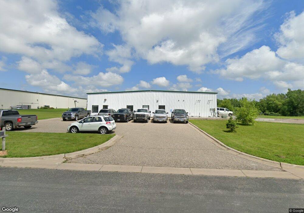
80 3rd St S Montrose, MN 55363
Estimated Value: $471,609
--
Bed
--
Bath
4,960
Sq Ft
$95/Sq Ft
Est. Value
About This Home
This home is located at 80 3rd St S, Montrose, MN 55363 and is currently estimated at $471,609, approximately $95 per square foot. 80 3rd St S is a home located in Wright County with nearby schools including Montrose Elementary School, Buffalo Community Middle School, and Buffalo Senior High School.
Ownership History
Date
Name
Owned For
Owner Type
Purchase Details
Closed on
Aug 11, 2017
Sold by
The Sterner Crew Inc
Bought by
Dal Properties Llc
Current Estimated Value
Purchase Details
Closed on
Oct 5, 2015
Purchase Details
Closed on
Dec 20, 2004
Sold by
Conroy & Sterner Enterprises Llc
Bought by
Colombo Lp
Purchase Details
Closed on
May 16, 2001
Sold by
Property Enhanced Specialist Inc
Bought by
Conroy And Sterner Enterprises Llc
Create a Home Valuation Report for This Property
The Home Valuation Report is an in-depth analysis detailing your home's value as well as a comparison with similar homes in the area
Home Values in the Area
Average Home Value in this Area
Purchase History
| Date | Buyer | Sale Price | Title Company |
|---|---|---|---|
| Dal Properties Llc | $300,000 | Home Title | |
| -- | $185,000 | -- | |
| Colombo Lp | $500,000 | -- | |
| Conroy And Sterner Enterprises Llc | $93,000 | -- |
Source: Public Records
Tax History Compared to Growth
Tax History
| Year | Tax Paid | Tax Assessment Tax Assessment Total Assessment is a certain percentage of the fair market value that is determined by local assessors to be the total taxable value of land and additions on the property. | Land | Improvement |
|---|---|---|---|---|
| 2025 | $11,928 | $476,000 | $213,500 | $262,500 |
| 2024 | $8,602 | $451,300 | $188,800 | $262,500 |
| 2023 | $8,602 | $438,800 | $188,800 | $250,000 |
| 2022 | $9,704 | $346,800 | $136,900 | $209,900 |
| 2021 | $9,818 | $335,100 | $142,600 | $192,500 |
| 2020 | $9,220 | $335,100 | $142,600 | $192,500 |
| 2019 | $9,212 | $310,000 | $0 | $0 |
| 2018 | $9,160 | $305,000 | $0 | $0 |
| 2017 | $9,772 | $305,000 | $0 | $0 |
| 2016 | $9,942 | $0 | $0 | $0 |
| 2015 | $10,256 | $0 | $0 | $0 |
| 2014 | -- | $0 | $0 | $0 |
Source: Public Records
Map
Nearby Homes
- 150 Pheasant Ridge Dr
- 137 Pheasant Ridge Dr
- 301 Center Ave S
- 426 Dillon Ave N
- 161 Mindy Ln Unit 9
- 149 Mindy Ln
- 517 2nd St S
- 610 Emerson Ave N
- 305 Garfield Ave S
- 703 7th St N
- 726 7th St N
- 140 Garner Cir
- 1766 US Highway 12 SW
- 684 Aspen Ln
- 683 Aspen Ln
- 151 Garner Cir
- 643 Fieldcrest Ave N
- 685 Aspen Ln
- 690 Aspen Ln
- 645 Fieldcrest Ave N
- XXXX Zephyr Ave
- XXX Zephyr Ave
- 300 Zephyr Ave
- 115 Nelson Blvd
- 125 Nelson Blvd
- 446 Us Highway 12 SW
- 184 Pheasant Ridge Dr
- 178 Pheasant Ridge Dr
- 154 Grouse Cir
- 174 Pheasant Ridge Dr
- 190 Pheasant Ridge Dr
- 192 Pheasant Ridge Dr
- 188 Pheasant Ridge Dr
- 186 Pheasant Ridge Dr
- 194 Pheasant Ridge Dr
- 180 Pheasant Ridge Dr
- 156 Grouse Cir
- 176 Pheasant Ridge Dr
- 172 Pheasant Ridge Dr
- 170 Pheasant Ridge Dr