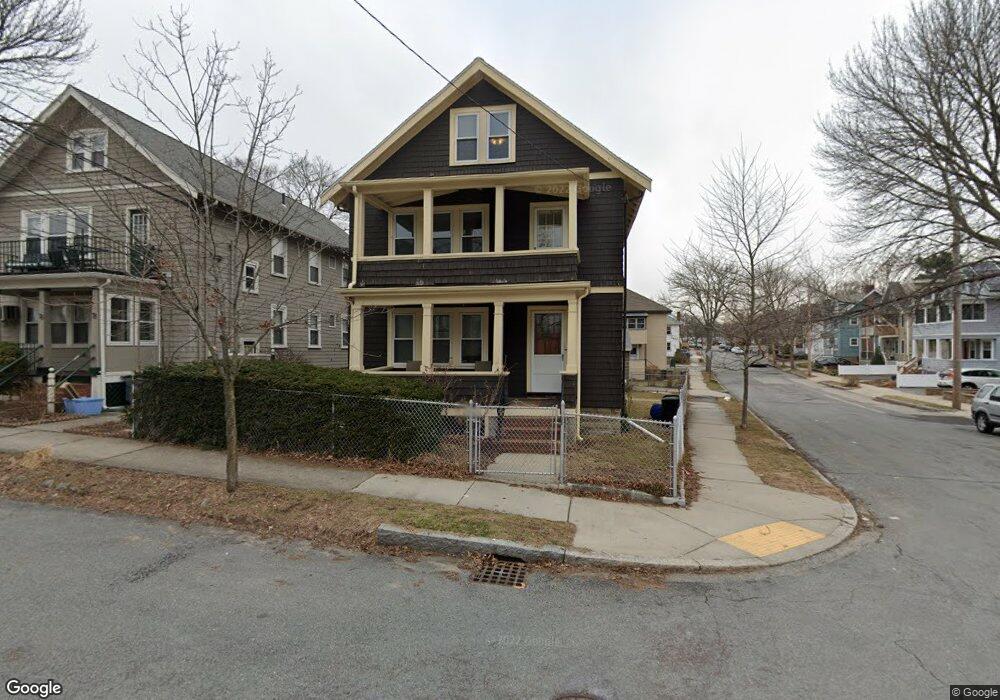
80-82 Amsden St Unit 80 Arlington, MA 02474
East Arlington NeighborhoodEstimated Value: $1,211,000 - $1,423,000
4
Beds
3
Baths
2,096
Sq Ft
$608/Sq Ft
Est. Value
About This Home
This home is located at 80-82 Amsden St Unit 80, Arlington, MA 02474 and is currently estimated at $1,273,865, approximately $607 per square foot. 80-82 Amsden St Unit 80 is a home located in Middlesex County with nearby schools including Hardy Elementary School, Thompson School, and Ottoson Middle School.
Ownership History
Date
Name
Owned For
Owner Type
Purchase Details
Closed on
Apr 8, 2025
Sold by
Woolkalis Brandon and Bolesky Kara E
Bought by
Estrella Christopher and Bromberg Gabrielle K
Current Estimated Value
Purchase Details
Closed on
May 19, 2023
Sold by
Sandra J Mcmullen T J and Sandra Mcmullen
Bought by
Woolkalisand Brandon and Bolesky Kara E
Home Financials for this Owner
Home Financials are based on the most recent Mortgage that was taken out on this home.
Original Mortgage
$495,000
Interest Rate
6.28%
Mortgage Type
Purchase Money Mortgage
Purchase Details
Closed on
Feb 24, 2023
Sold by
Richard Mcmullen T and Richard Mcmullen
Bought by
Sandra J Mcmullen T J and Sandra Mcmullen
Purchase Details
Closed on
Apr 21, 2021
Sold by
Mcmullen Family Funding T and Mcmullen
Bought by
Richard Mcmullen T and Richard Mcmullen
Create a Home Valuation Report for This Property
The Home Valuation Report is an in-depth analysis detailing your home's value as well as a comparison with similar homes in the area
Home Values in the Area
Average Home Value in this Area
Purchase History
| Date | Buyer | Sale Price | Title Company |
|---|---|---|---|
| Estrella Christopher | $1,205,000 | None Available | |
| Estrella Christopher | $1,205,000 | None Available | |
| Woolkalisand Brandon | $1,150,000 | None Available | |
| Woolkalisand Brandon | $1,150,000 | None Available | |
| Sandra J Mcmullen T J | -- | None Available | |
| Sandra J Mcmullen T J | -- | None Available | |
| Richard Mcmullen T | -- | None Available | |
| Richard Mcmullen T | -- | None Available |
Source: Public Records
Mortgage History
| Date | Status | Borrower | Loan Amount |
|---|---|---|---|
| Previous Owner | Woolkalisand Brandon | $495,000 |
Source: Public Records
Tax History Compared to Growth
Tax History
| Year | Tax Paid | Tax Assessment Tax Assessment Total Assessment is a certain percentage of the fair market value that is determined by local assessors to be the total taxable value of land and additions on the property. | Land | Improvement |
|---|---|---|---|---|
| 2025 | $15,304 | $1,421,000 | $573,100 | $847,900 |
| 2024 | $11,032 | $1,041,700 | $545,600 | $496,100 |
| 2023 | $10,148 | $905,300 | $457,400 | $447,900 |
| 2022 | $10,104 | $884,800 | $440,900 | $443,900 |
| 2021 | $9,808 | $864,900 | $440,900 | $424,000 |
| 2020 | $9,568 | $865,100 | $440,900 | $424,200 |
| 2019 | $9,009 | $800,100 | $468,400 | $331,700 |
| 2018 | $8,168 | $673,400 | $341,700 | $331,700 |
| 2017 | $7,630 | $607,500 | $297,600 | $309,900 |
| 2016 | $7,212 | $563,400 | $253,500 | $309,900 |
| 2015 | $7,107 | $524,500 | $248,000 | $276,500 |
Source: Public Records
Map
Nearby Homes
- 57 Garrison Ave
- 215 Massachusetts Ave Unit 19 (34)
- 6 Hamilton Rd Unit 6
- 34 Belknap St
- 230 Massachusetts Ave Unit 6
- 3 Seagrave Rd
- 235 Powder House Blvd
- 23 Brookford St
- 23 Brookford St Unit 2
- 23 Brookford St Unit 1
- 11 Watson St Unit 1
- 11 Watson St Unit 2
- 69 Clarendon Ave Unit A
- 202 Powder House Blvd Unit 2
- 19 Cottage Park Ave
- 128 Thorndike St Unit 2
- 16 High St Unit 2
- 24 Washburn Ave Unit 1
- 97 Elmwood St Unit 313
- 97 Elmwood St Unit 110
- 76 Amsden St Unit 78
- 78 Amsden St Unit B
- 74 Amsden St Unit 2
- 72 Amsden St Unit 1
- 72 Amsden St Unit 74
- 72 Amsden St
- 74 Amsden St Unit 74
- 54 Waldo Rd Unit 56
- 75 Windsor St Unit 1
- 75 Windsor St
- 75 Windsor St Unit 2
- 73 Amsden St
- 71 Amsden St
- 58 Waldo Rd Unit 60
- 71 Windsor St Unit 73
- 71 Windsor St Unit 1
- 71 Windsor St Unit 71
- 73 Windsor St Unit 73
- 50 Waldo Rd Unit 52
- 70 Amsden St