
Seller's Agent in 2026
Cynthia Layton
Century 21 Frank Frye
(740) 403-4470
7 in this area
68 Total Sales
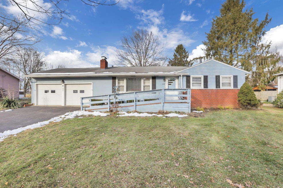
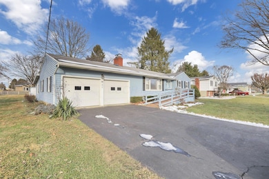
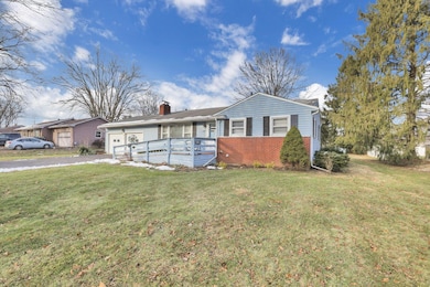
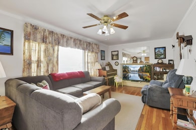

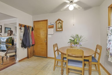
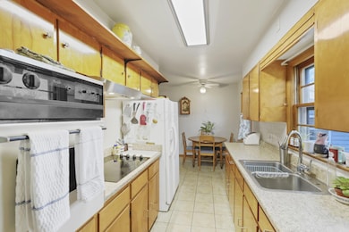
Great Location in Heath! Comfy ranch home offers 2 Bedrooms, 2 Full Baths and spacious backyard (with shed) situated on .459 acres. Entry level master ensuite has spacious closet and laundry room. The home boasts hardwood floors, a galley kitchen with open pantry, dining area, spacious living room and a separate heated office/den/potential bedroom off of the 2 car garage.
Full unfinished basement ready to finish out and ideal for adding another bedroom. Updated house electrical panel. Appliances convey with exception of 1st floor washer and dryer and microwave. Shelving and cabinets located in basement convey. Handicap Accessible Ramp. See Accessibility Form.
Centrally located near shopping, dining, schools, and hospital and bike path.
Last Agent to Sell the Property
Century 21 Frank Frye License #2016005667 Listed on: 12/10/2025
| Date | Type | Sale Price | Title Company |
|---|---|---|---|
| Warranty Deed | $226,900 | None Listed On Document | |
| Deed | -- | None Listed On Document | |
| Survivorship Deed | $93,000 | Bxkent Title |
| Date | Status | Loan Amount | Loan Type |
|---|---|---|---|
| Open | $211,900 | New Conventional | |
| Previous Owner | $88,200 | Adjustable Rate Mortgage/ARM |
| Date | Event | Price | List to Sale | Price per Sq Ft |
|---|---|---|---|---|
| 01/16/2026 01/16/26 | Sold | $226,900 | 0.0% | $170 / Sq Ft |
| 12/10/2025 12/10/25 | For Sale | $226,900 | -- | $170 / Sq Ft |
| Year | Tax Paid | Tax Assessment Tax Assessment Total Assessment is a certain percentage of the fair market value that is determined by local assessors to be the total taxable value of land and additions on the property. | Land | Improvement |
|---|---|---|---|---|
| 2024 | $2,970 | $78,830 | $19,430 | $59,400 |
| 2023 | $3,317 | $78,830 | $19,430 | $59,400 |
| 2022 | $2,227 | $49,810 | $14,000 | $35,810 |
| 2021 | $2,272 | $49,810 | $14,000 | $35,810 |
| 2020 | $2,286 | $49,810 | $14,000 | $35,810 |
| 2019 | $1,688 | $39,590 | $14,000 | $25,590 |
| 2018 | $1,706 | $0 | $0 | $0 |
| 2017 | $1,705 | $0 | $0 | $0 |
| 2016 | $1,449 | $0 | $0 | $0 |
| 2015 | $1,474 | $0 | $0 | $0 |
| 2014 | $2,774 | $0 | $0 | $0 |
| 2013 | $1,363 | $0 | $0 | $0 |
Seller's Agent in 2026
Cynthia Layton
Century 21 Frank Frye
(740) 403-4470
7 in this area
68 Total Sales
Buyer's Agent in 2026
CHASE CONNOR
Howard Hanna Real Estate Services
(740) 641-8305
1 in this area
23 Total Sales
Source: Columbus and Central Ohio Regional MLS
MLS Number: 225045223
APN: 030-090948-00.000
Disclaimer: Certain information contained herein is derived from information provided by parties other than Homes.com. All information provided is deemed reliable, but is not guaranteed to be accurate and should be independently verified.
![]() IDX information is provided exclusively for personal, non-commercial use, and may not be used for any purpose other than to identify prospective properties consumers may be interested in purchasing.
IDX information is provided exclusively for personal, non-commercial use, and may not be used for any purpose other than to identify prospective properties consumers may be interested in purchasing.
Information is deemed reliable but not guaranteed.
Ask me questions while you tour the home.