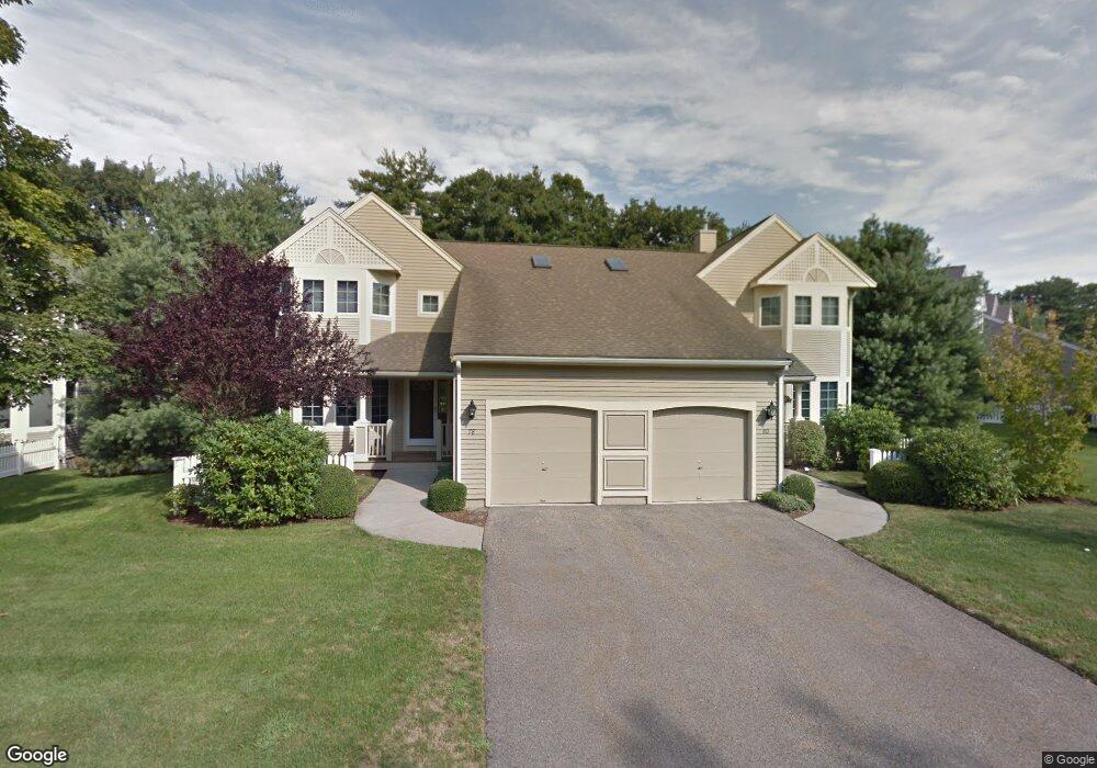
80 Cannon Forge Dr Foxboro, MA 02035
Estimated Value: $574,000 - $589,000
2
Beds
3
Baths
1,698
Sq Ft
$343/Sq Ft
Est. Value
About This Home
This home is located at 80 Cannon Forge Dr, Foxboro, MA 02035 and is currently estimated at $582,337, approximately $342 per square foot. 80 Cannon Forge Dr is a home located in Norfolk County with nearby schools including Foxborough High School, Foxborough Regional Charter School, and The Sage School.
Ownership History
Date
Name
Owned For
Owner Type
Purchase Details
Closed on
Sep 23, 1996
Sold by
Skanko Shar-Foxb Dev
Bought by
Harris John L and Harris Betsy M
Current Estimated Value
Home Financials for this Owner
Home Financials are based on the most recent Mortgage that was taken out on this home.
Original Mortgage
$187,200
Outstanding Balance
$15,635
Interest Rate
7.89%
Mortgage Type
Purchase Money Mortgage
Estimated Equity
$566,702
Create a Home Valuation Report for This Property
The Home Valuation Report is an in-depth analysis detailing your home's value as well as a comparison with similar homes in the area
Home Values in the Area
Average Home Value in this Area
Purchase History
| Date | Buyer | Sale Price | Title Company |
|---|---|---|---|
| Harris John L | $210,134 | -- |
Source: Public Records
Mortgage History
| Date | Status | Borrower | Loan Amount |
|---|---|---|---|
| Closed | Harris John L | $25,000 | |
| Open | Harris John L | $99,568 | |
| Open | Harris John L | $187,200 |
Source: Public Records
Tax History
| Year | Tax Paid | Tax Assessment Tax Assessment Total Assessment is a certain percentage of the fair market value that is determined by local assessors to be the total taxable value of land and additions on the property. | Land | Improvement |
|---|---|---|---|---|
| 2025 | $6,888 | $521,000 | $0 | $521,000 |
| 2024 | $6,924 | $512,500 | $0 | $512,500 |
| 2023 | $5,835 | $410,600 | $0 | $410,600 |
| 2022 | $6,181 | $425,700 | $0 | $425,700 |
| 2021 | $6,089 | $413,100 | $0 | $413,100 |
| 2020 | $5,334 | $366,100 | $0 | $366,100 |
| 2019 | $5,217 | $354,900 | $0 | $354,900 |
| 2018 | $4,949 | $339,700 | $0 | $339,700 |
| 2017 | $5,470 | $363,700 | $0 | $363,700 |
| 2016 | $5,156 | $347,900 | $0 | $347,900 |
| 2015 | $4,802 | $316,100 | $0 | $316,100 |
| 2014 | $4,518 | $301,400 | $0 | $301,400 |
Source: Public Records
Map
Nearby Homes
- 9 Independence Dr Unit 9
- 165 Chestnut St Unit 2
- 147 Chestnut St Unit A
- 147 Chestnut St Unit B
- 1 Maura Elizabeth Ln
- 261 East St
- 13 Summerville Rd Unit 13
- 26 Fuller Rd Unit 6
- 3 Willow St
- 3 Wampanoag Rd
- 233 Central St
- 157 Central St
- 2 Foxfire Dr
- 619 N Main St
- 67 Carpenter St
- 668 S Main St
- 14 Baker St
- 73 Ridge Rd
- 54 Main St Unit A
- 356 Central St
- 58 Cannon Forge Dr
- 82 Cannon Forge Dr
- 84 Cannon Forge Dr
- 60 Cannon Forge Dr
- 52 Cannon Forge Dr
- 46 Cannon Forge Dr
- 50 Cannon Forge Dr
- 54 Cannon Forge Dr
- 78 Cannon Forge Dr
- 86 Cannon Forge Dr
- 68 Cannon Forge Dr
- 66 Cannon Forge Dr
- 64 Cannon Forge Dr
- 62 Cannon Forge Dr
- 56 Cannon Forge Dr
- 76 Cannon Forge Dr
- 74 Cannon Forge Dr
- 76 Cannon Forge Dr Unit 76 B
- 64 Cannon Forge Dr Unit B64
- 66 Cannon Forge Dr Unit B-66
Your Personal Tour Guide
Ask me questions while you tour the home.