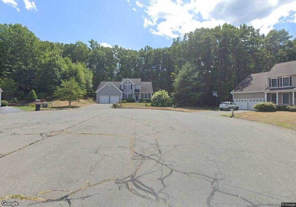
80 Dartmouth Dr Canton, CT 06019
Estimated Value: $751,000 - $934,000
4
Beds
4
Baths
3,115
Sq Ft
$260/Sq Ft
Est. Value
About This Home
This home is located at 80 Dartmouth Dr, Canton, CT 06019 and is currently estimated at $809,663, approximately $259 per square foot. 80 Dartmouth Dr is a home located in Hartford County with nearby schools including Cherry Brook Primary School, Canton Intermediate School, and Canton Middle School.
Ownership History
Date
Name
Owned For
Owner Type
Purchase Details
Closed on
Mar 29, 2010
Sold by
Webb Jonathan W and Webb Elizabeth
Bought by
Payne Carosn R and Payne Elizabeth G
Current Estimated Value
Home Financials for this Owner
Home Financials are based on the most recent Mortgage that was taken out on this home.
Original Mortgage
$235,000
Outstanding Balance
$156,673
Interest Rate
5.02%
Estimated Equity
$652,990
Purchase Details
Closed on
Nov 24, 2003
Sold by
Baker Res Lp
Bought by
Webb Jonathan W and Webb Elizabeth
Home Financials for this Owner
Home Financials are based on the most recent Mortgage that was taken out on this home.
Original Mortgage
$250,000
Interest Rate
5.98%
Create a Home Valuation Report for This Property
The Home Valuation Report is an in-depth analysis detailing your home's value as well as a comparison with similar homes in the area
Home Values in the Area
Average Home Value in this Area
Purchase History
| Date | Buyer | Sale Price | Title Company |
|---|---|---|---|
| Payne Carosn R | $485,000 | -- | |
| Payne Carosn R | $485,000 | -- | |
| Webb Jonathan W | $422,750 | -- | |
| Webb Jonathan W | $422,750 | -- |
Source: Public Records
Mortgage History
| Date | Status | Borrower | Loan Amount |
|---|---|---|---|
| Open | Webb Jonathan W | $235,000 | |
| Closed | Webb Jonathan W | $235,000 | |
| Previous Owner | Webb Jonathan W | $244,200 | |
| Previous Owner | Webb Jonathan W | $250,000 |
Source: Public Records
Tax History Compared to Growth
Tax History
| Year | Tax Paid | Tax Assessment Tax Assessment Total Assessment is a certain percentage of the fair market value that is determined by local assessors to be the total taxable value of land and additions on the property. | Land | Improvement |
|---|---|---|---|---|
| 2025 | $13,724 | $409,660 | $85,970 | $323,690 |
| 2024 | $13,990 | $409,660 | $85,970 | $323,690 |
| 2023 | $10,869 | $307,300 | $83,700 | $223,600 |
| 2022 | $10,353 | $307,300 | $83,700 | $223,600 |
| 2021 | $10,209 | $307,300 | $83,700 | $223,600 |
| 2020 | $10,015 | $307,300 | $83,700 | $223,600 |
| 2019 | $9,843 | $307,300 | $83,700 | $223,600 |
| 2018 | $10,433 | $339,850 | $87,500 | $252,350 |
| 2017 | $10,362 | $339,850 | $87,500 | $252,350 |
| 2016 | $10,114 | $339,850 | $87,500 | $252,350 |
| 2015 | $9,920 | $339,850 | $87,500 | $252,350 |
| 2014 | $9,706 | $339,850 | $87,500 | $252,350 |
Source: Public Records
Map
Nearby Homes
- 141 Dowd Ave
- 455 Dowd Ave Unit 455
- 25 Maple Ave
- 48 Weatherstone
- 58 Weatherstone
- 61 Weatherstone
- 40 E Hill Rd
- 50 E Hill Rd Unit 3B
- 41 Applegate Ln
- 49 Applegate Ln Unit 49
- 64 Bridge St
- 12 Verville Rd
- 114 Cold Spring Rd
- 123 Bridgewater Dr
- 30 Cliff Dr
- 8 Town Bridge Rd
- 152 E Hill Rd
- 132 Morgan Rd
- 7 Woodmont Rd
- 370A W Mountain Rd
- 75 Dartmouth Dr
- 76 Dartmouth Dr
- 70 Dartmouth Dr
- 71 Dartmouth Dr
- 19 Livingston Rd
- 23 Livingston Rd
- 60 Bart Dr
- 62 Dartmouth Dr Unit 64
- 63 Dartmouth Dr
- 27 Livingston Rd
- 84 Ellsworth Ln
- 10 Cobb Rd
- 15 Livingston Rd
- 11 Livingston Rd
- 55 Dartmouth Dr Unit 57
- 79 Ellsworth Ln
- 6 Cobb Rd
- 78 Ellsworth Ln
- 54 Dartmouth Dr
- 18 Livingston Rd