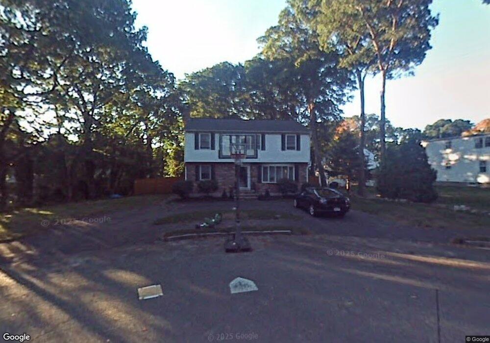
80 Dean Rd Milton, MA 02186
Estimated Value: $1,038,680 - $1,252,000
4
Beds
2
Baths
1,836
Sq Ft
$624/Sq Ft
Est. Value
About This Home
This home is located at 80 Dean Rd, Milton, MA 02186 and is currently estimated at $1,145,170, approximately $623 per square foot. 80 Dean Rd is a home located in Norfolk County with nearby schools including Milton High School, St. Agatha School, and Milton Academy.
Ownership History
Date
Name
Owned For
Owner Type
Purchase Details
Closed on
Jun 16, 2004
Sold by
Shaughnessy Barbera D and Shaughnessy Mark W
Bought by
Turner Mary E and Turner Scott D
Current Estimated Value
Home Financials for this Owner
Home Financials are based on the most recent Mortgage that was taken out on this home.
Original Mortgage
$325,000
Interest Rate
6.12%
Mortgage Type
Purchase Money Mortgage
Purchase Details
Closed on
Nov 26, 1996
Sold by
Flaherty Dorothy L
Bought by
Shaughnessy Mark W and Shaughnessy Barbara D
Create a Home Valuation Report for This Property
The Home Valuation Report is an in-depth analysis detailing your home's value as well as a comparison with similar homes in the area
Purchase History
We collect this data history from publicly available records. To have your information removed, we recommend requesting removal directly through your county’s website.
| Date | Buyer | Sale Price | Title Company |
|---|---|---|---|
| Turner Mary E | $538,000 | -- | |
| Shaughnessy Mark W | $228,000 | -- |
Source: Public Records
Mortgage History
We collect this data history from publicly available records. To have your information removed, we recommend requesting removal directly through your county’s website.
| Date | Status | Borrower | Loan Amount |
|---|---|---|---|
| Open | Shaughnessy Mark W | $318,000 | |
| Closed | Turner Mary E | $325,000 | |
| Previous Owner | Shaughnessy Mark W | $191,000 | |
| Previous Owner | Shaughnessy Mark W | $205,000 |
Source: Public Records
Tax History
| Year | Tax Paid | Tax Assessment Tax Assessment Total Assessment is a certain percentage of the fair market value that is determined by local assessors to be the total taxable value of land and additions on the property. | Land | Improvement |
|---|---|---|---|---|
| 2025 | $9,790 | $882,800 | $488,600 | $394,200 |
| 2024 | $9,489 | $869,000 | $465,300 | $403,700 |
| 2023 | $9,332 | $818,600 | $443,200 | $375,400 |
| 2022 | $9,185 | $736,600 | $443,200 | $293,400 |
| 2021 | $8,386 | $638,700 | $356,200 | $282,500 |
| 2020 | $8,129 | $619,600 | $341,300 | $278,300 |
| 2019 | $7,929 | $601,600 | $331,400 | $270,200 |
| 2018 | $7,764 | $562,200 | $292,600 | $269,600 |
| 2017 | $7,263 | $535,600 | $278,700 | $256,900 |
| 2016 | $6,812 | $504,600 | $252,200 | $252,400 |
| 2015 | $6,734 | $483,100 | $232,300 | $250,800 |
Source: Public Records
Map
Nearby Homes
- 7 Phyllis Ln
- 98 Pleasant St
- 403405 Reedsdale Rd
- 268 Highland St
- 341 Highland St
- 901 Randolph Ave
- 76 Shawmut St
- 141 Gardiner Rd
- 650 Canton Ave
- 25 Waldeck Rd
- 94 Grafton Ave
- 213 School St
- 440 Granite Ave Unit 201
- 625 Canton Ave
- 85 Old Farm Rd
- 196 Canton Ave
- 159 Willard St Unit 7
- 580 Quarry St Unit 18
- 10 Magnolia Rd
- 40 Elm St
Your Personal Tour Guide
Ask me questions while you tour the home.