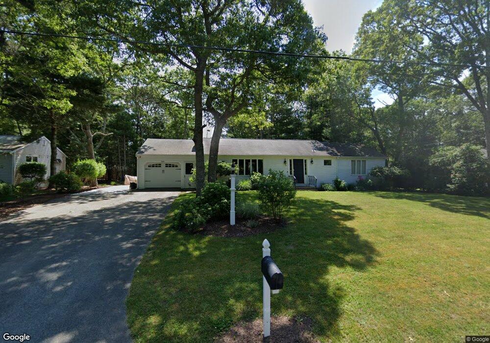
80 Guildford Rd Centerville, MA 02632
Centerville NeighborhoodEstimated Value: $605,894 - $639,000
3
Beds
2
Baths
1,501
Sq Ft
$417/Sq Ft
Est. Value
About This Home
This home is located at 80 Guildford Rd, Centerville, MA 02632 and is currently estimated at $626,474, approximately $417 per square foot. 80 Guildford Rd is a home located in Barnstable County with nearby schools including West Villages Elementary School, Barnstable United Elementary School, and Barnstable Intermediate School.
Ownership History
Date
Name
Owned For
Owner Type
Purchase Details
Closed on
Feb 27, 2009
Sold by
Marx Beverly and United Methodist Chrch
Bought by
Morrisey Allen W
Current Estimated Value
Home Financials for this Owner
Home Financials are based on the most recent Mortgage that was taken out on this home.
Original Mortgage
$220,924
Interest Rate
5%
Mortgage Type
FHA
Purchase Details
Closed on
Aug 31, 1993
Sold by
Wilson Lillian M and Anderson Genevieve
Bought by
Pratt Faye E
Home Financials for this Owner
Home Financials are based on the most recent Mortgage that was taken out on this home.
Original Mortgage
$69,000
Interest Rate
7.06%
Mortgage Type
Purchase Money Mortgage
Create a Home Valuation Report for This Property
The Home Valuation Report is an in-depth analysis detailing your home's value as well as a comparison with similar homes in the area
Home Values in the Area
Average Home Value in this Area
Purchase History
| Date | Buyer | Sale Price | Title Company |
|---|---|---|---|
| Morrisey Allen W | $225,000 | -- | |
| Pratt Faye E | $79,200 | -- | |
| Pratt Faye E | $19,800 | -- |
Source: Public Records
Mortgage History
| Date | Status | Borrower | Loan Amount |
|---|---|---|---|
| Open | Pratt Faye E | $209,778 | |
| Closed | Morrisey Allen W | $220,924 | |
| Previous Owner | Pratt Faye E | $69,000 |
Source: Public Records
Tax History
| Year | Tax Paid | Tax Assessment Tax Assessment Total Assessment is a certain percentage of the fair market value that is determined by local assessors to be the total taxable value of land and additions on the property. | Land | Improvement |
|---|---|---|---|---|
| 2025 | $4,543 | $561,600 | $152,200 | $409,400 |
| 2024 | $4,359 | $558,100 | $152,200 | $405,900 |
| 2023 | $4,105 | $492,200 | $138,400 | $353,800 |
| 2022 | $3,933 | $408,000 | $102,500 | $305,500 |
| 2021 | $3,713 | $354,000 | $102,500 | $251,500 |
| 2020 | $3,775 | $344,400 | $102,500 | $241,900 |
| 2019 | $3,586 | $317,900 | $102,500 | $215,400 |
| 2018 | $2,776 | $288,600 | $107,900 | $180,700 |
| 2017 | $2,693 | $280,100 | $107,900 | $172,200 |
| 2016 | $3,062 | $280,900 | $108,700 | $172,200 |
| 2015 | $2,926 | $269,700 | $105,400 | $164,300 |
Source: Public Records
Map
Nearby Homes
- 87 Foxglove Rd
- 169 Cedric Rd
- 315 Prince Hinckley Rd
- 900 Old Stage Rd
- 352 Nye Rd
- 296 Buckskin Path
- 324 Patriot Way
- 74 Saddler Ln
- 29 Appaloosa Way
- 80 Branch Terrace
- 585 Old Falmouth Rd
- 7 Ebenezer
- 73 Tern Ln
- 66 Tern Ln
- 1115 Shootflying Hill Rd
- 97 Yacht Club Rd
- 51 Larch Ln
- 82 Yacht Club Rd
- 1309 Shootflying Hill Rd
- 1309 Shootflying Hill Rd
- 70 Guildford Rd
- 70 Guildford Rd
- 79 Sheaffer Rd
- 69 Sheaffer Rd
- 89 Sheaffer Rd
- 60 Guildford Rd
- 100 Guildford Rd
- 19 Lester Cir
- 59 Sheaffer Rd
- 99 Sheaffer Rd
- 20 Lester Cir
- 10 Cyrus Dr
- 110 Guildford Rd
- 49 Sheaffer Rd
- 109 Sheaffer Rd
- 76 Sheaffer Rd
- 86 Sheaffer Rd
- 49 Guildford Rd
- 0 Sheaffer Rd
- 50 Guildford Rd
Your Personal Tour Guide
Ask me questions while you tour the home.