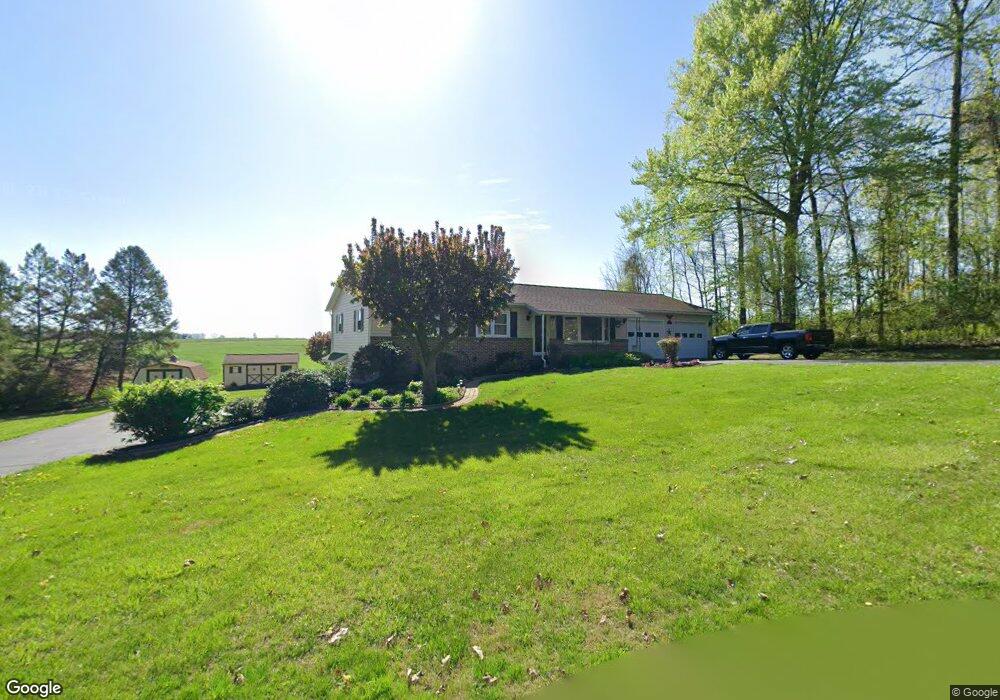
80 Johns Way Honey Brook, PA 19344
Estimated Value: $405,000 - $463,000
2
Beds
1
Bath
1,232
Sq Ft
$354/Sq Ft
Est. Value
About This Home
This home is located at 80 Johns Way, Honey Brook, PA 19344 and is currently estimated at $436,000, approximately $353 per square foot. 80 Johns Way is a home located in Chester County with nearby schools including Honey Brook Elementary Center, Twin Valley Middle School, and Twin Valley High School.
Ownership History
Date
Name
Owned For
Owner Type
Purchase Details
Closed on
May 24, 2018
Sold by
Lawrence Developers Lp
Bought by
Natural Lands Trust Inc
Current Estimated Value
Home Financials for this Owner
Home Financials are based on the most recent Mortgage that was taken out on this home.
Original Mortgage
$829,750
Outstanding Balance
$714,442
Interest Rate
4.4%
Mortgage Type
Commercial
Estimated Equity
-$278,442
Create a Home Valuation Report for This Property
The Home Valuation Report is an in-depth analysis detailing your home's value as well as a comparison with similar homes in the area
Home Values in the Area
Average Home Value in this Area
Purchase History
| Date | Buyer | Sale Price | Title Company |
|---|---|---|---|
| Natural Lands Trust Inc | $1,659,500 | None Available |
Source: Public Records
Mortgage History
| Date | Status | Borrower | Loan Amount |
|---|---|---|---|
| Open | Natural Lands Trust Inc | $829,750 |
Source: Public Records
Tax History Compared to Growth
Tax History
| Year | Tax Paid | Tax Assessment Tax Assessment Total Assessment is a certain percentage of the fair market value that is determined by local assessors to be the total taxable value of land and additions on the property. | Land | Improvement |
|---|---|---|---|---|
| 2025 | $4,877 | $127,010 | $45,010 | $82,000 |
| 2024 | $4,877 | $127,010 | $45,010 | $82,000 |
| 2023 | $4,765 | $127,010 | $45,010 | $82,000 |
| 2022 | $4,713 | $127,010 | $45,010 | $82,000 |
| 2021 | $4,575 | $127,010 | $45,010 | $82,000 |
| 2020 | $4,552 | $127,010 | $45,010 | $82,000 |
| 2019 | $4,417 | $127,010 | $45,010 | $82,000 |
| 2018 | $4,417 | $127,010 | $45,010 | $82,000 |
| 2017 | $4,312 | $127,010 | $45,010 | $82,000 |
| 2016 | $3,404 | $127,010 | $45,010 | $82,000 |
| 2015 | $3,404 | $127,010 | $45,010 | $82,000 |
| 2014 | $3,404 | $127,010 | $45,010 | $82,000 |
Source: Public Records
Map
Nearby Homes
- 14 Blue Spruce Dr
- 211 Michael Rd
- 407 Cahill Cir Unit 4
- 650 Broad St
- 110 Petrelia Dr
- 339 Churchtown Rd
- 241 Dove Dr
- 116 Cornwall Place
- 114 Jacobs Dr
- 158 Leary Rd
- 0 Westbrook Dr
- 0 Westbrook Dr
- 0 Westbrook Dr
- 0 Westbrook Dr
- 607 Buchland Rd
- 40 Cupola Rd
- 105 Cambridge Rd
- 151 S Sandy Hill Rd
- 221 Creamery Rd
- 490 Red Hill Rd
- 190 September Rd
- 60 Johns Way
- 150 September Rd
- 243 September Rd
- 120 September Rd
- 220 September Rd
- 2281 Compass Rd
- 2261 Compass Rd
- 51 King Rd
- 2162 Compass Rd
- 70 King Rd
- 98 Seldomridge Ln
- 1715 Beaver Dam Rd
- 40 King Rd
- 1689 Beaver Dam Rd
- 1669 Beaver Dam Rd
- 1635 Beaver Dam Rd
- 157 King Rd
- 1688 Beaver Dam Rd
- 1650 Beaver Dam Rd